Summary for Tuesday, May 22, 2007 chase in NW Kansas
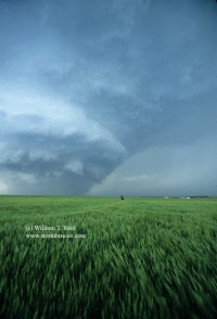
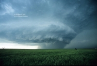
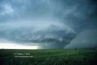
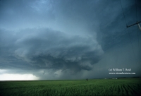
Short version—-observed a fabulous tornadic storm in Graham County, KS….many more good structure photos will be forthcoming once the slides are scanned!
Long version:
May 22 was Day 8 (out of 10) for the Tour 2 guests. The tour up to this point had seen plenty of thunderstorms, from the Rio Grande to Montana, but had not yet witnessed a decent supercell (or tornado). On May 21 we had expected a chance of supercells in SW South Dakota, but a line of cells fired early in the afternoon and there were too many storms, none very strong. We drove through the Badlands and had some cool scenery to photograph beneath the dark skies. We continued until almost midnight to Valentine, NE, as we knew that Tuesday the 22nd could be big, perhaps well down into SW Kansas. I asked the guests to be ready to roll by 7:30 a.m.
I was anxious to blast south into Kansas on Tuesday morning. I knew that if I needed to be near the KS/OK border and if storms formed a little earlier than usual, then we might be late. That would not be acceptable. My morning briefing was short and sweet: “The shear and instability forecast for western Kansas this afternoon are more than adequate for tornadoes and supercells……let’s go.”
It took close to four hours to reach the NE/KS border on U.S. 83. Fortunately, it appeared that the target area was close to U.S. 83 in western KS, and probably north of a Garden City-Dodge City line. Warm air aloft was likely to cap the atmosphere south of this line. A surface low pressure center was located around extreme SW KS and SE CO, and it was going to send a punch of dry and hot air into SW KS during the afternoon. This dry punch would smack up against the moist air east of U.S. 83 in WC and NW KS and trigger convection, we hoped. The SPC tornado risk forecast bullseyed a small area around Wakeeney, KS, on I-70 between Colby and Hays. Some chasers were targeting the Garden City area, a few counties south of I-70. Some were waiting in Hays. I wasn’t quite sure yet where I wanted to be when we reached Kansas.
Fortunately, by noon, it appeared that we were not too far from a decent position. We stopped in Hoxie, KS (west of Hill City) for lunch, at a nice café with a decent salad bar/buffet. We had stopped there last spring for lunch, I think, but I could not recall what happened later on on that particular day. I was hoping that this place was good luck. The pork chops were excellent….all you could eat with the salad bar and potatoes and other veggies and rolls for six bucks!
After lunch we stopped on a hill just south of Hoxie and checked data. None of the data that we looked at suggested that we needed to go anywhere. The skies were partly cloudy with some strato-cu morphing a little into flat cu. Winds were SSE with dew points around 60. Dews were a few degrees higher towards Hays, to the east. It was time to just watch the skies and wait for that first storm tower to go up. Finally, around 4:30 p.m., we had a storm tower—-several of them! We were between Hill City and Hoxie, with a couple of tall towers just to our west, and another one about a county away to our southwest. It would be wise to play the tail-end (southern) storm on this day…but would the cell just south of Interstate 70, south of Collyer, hold together? We drifted east to Hill City to keep our options open as the storm cells developed and drifted northeast. At Hill City, around 5 p.m., it was apparent that the southern storm was the real thing. We went south about 20 miles to a spot (a few miles north of Wakeeney) with a good view of the developing storm to our WSW. The storm had a very strong updraft, made obvious by the tremendous anvil that it was producing. The updraft appeared to split at least once. Jay Antle was at the same location, and I told him that I had had very good luck on days with splitting storms. He responded that the opposite seemed to be the rule for him.
Our group patiently waited here for a good 30-40 minutes as the cell slowly came NE towards us. We had a good view of the flanged updraft and occasional glimpses of the updraft tower.
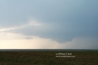
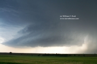
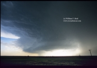
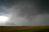
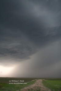
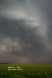
By 6 p.m. there were two updrafts—a north one and south one. Though the south cell/updraft was much stronger and larger, the north one (near St. Peter, KS) had a lower base and some suspicious stuff happening beneath it. It became tornado warned, and a funnel cloud became apparent. I elected to try to get a little closer in case it decided to produce. The two cells were only ten miles or so apart, so we weren’t in danger of losing sight of the stronger southern cell. We went north about 8 miles, and turned west on a dirt road, about two miles north of a little spot called “Togo”. When we stopped two miles farther west, the northern cell was just to our WNW. It seemed to weaken quickly and any tornado threat had vanished. Meanwhile, the big beast to our southwest was cranking big-time. It had a tremendous vault region and plenty of lightning way up in the greenish storm tower. The sculpted look of the low levels improved by the minute, and we were ecstatic! Finally, we had a real storm for the Tour 2 guests! Marble-to-penny-size hail and some light rain smacked us on the strong ESE winds from time to time. The road was more dirt than gravel, and it would not be wise to linger here if the rain became heavy. The storm continued to our west and southwest and did not appear to be moving much at all. A couple of occlusions failed to create much of a tornado threat. Still, the storm structure and the ominous look to this beast was incredible!
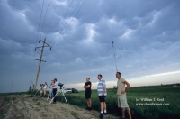
I decided to head back east to the Hill City-Wakeeney road and to drift south several miles, as a new low-level “action area” appeared to be developing to our southwest. This put us a couple of miles south of Togo, immediately east of the storm by about five or six miles. It wasn’t raining here, so we went west again on a dirt road (two or three miles) to get closer. When we reached this point, the inflow winds from the E-to-ESE were very strong, and the storm’s updraft area filled the western sky completely! Thunder rumbled almost constantly, though there were very few CGs. I set up my camcorder on the tripod, but could not fit the entire thing into the viewfinder. Later, after taking some stills, I found the stupid camcorder strap blowing right in front of the camcorder lens. I’m afraid to even look at that video——I fear that I got more strap video than storm video for at least five minutes. The camcorder was set to infinity focus, so the strap won’t even be in focus! How is the market for blurry blowing strap video?
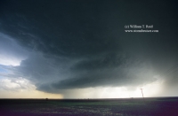
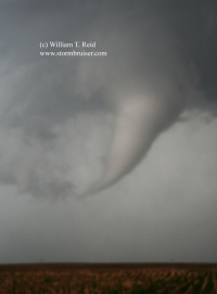
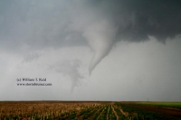
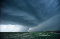
Okay, this is when things got really fun, sometime around 7 p.m. The storm was just to our WNW, and an obvious lowering and tightening and rotating area was beneath the beast, just a few miles away to our NW. It was going to do it, I was certain! (And, I yelled out something to that effect.) I screamed for everyone to get in the vehicles so we could blast north to be closer. With a developing tornado to our northwest, and moving slowly northeast or ENE, we should be okay safety-wise. Of course, there is always the threat of strong winds and big hail in this area, but I disregarded these……or forgot about that. Chris took us north on the dirt road as a nice slender funnel cloud loomed to our northwest. Brian and the guests in the minvan were a little slower and followed about half mile behind.
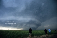
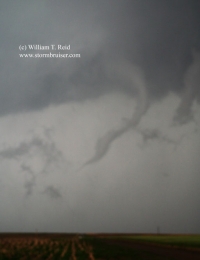
I saw a small whirl of debris beneath the funnel, so we had a legitimate tornado! The road dipped down into a low area with some trees along the road, and our view was lost for a bit. However, even worse, the road was getting wetter, and muddier, and slicker with every second as we continued north. It wasn’t raining now, but the earlier rain from our storm in this area had been a bit much. I radioed Brian that the road was getting soft and muddy. The funnel cloud was well formed and at least halfway to the ground, maybe two miles or so to our NNW. It would be awesome to get a tad closer! That was not going to happen! “I have NO control!” said Chris! We were on muddy road and may have well been on ice —– the van was just sliding forward at about 20 mph. Thank God that the sides of the road were not deep. I don’t recall seeing any tracks in the road—–we were the first vehicle to try this road since the rain. The van moved forward and gently to the left, and Chris could do little to keep it in the center of the road. We wound up on the left side of the road and came to a halt, dead in the water, with a tornado looking quite, um, nice, in our windshield. I radioed Brian: “We are stuck in the mud.” Everyone jumped out of the van with their camera equipment and started sliding around in the mud. We set up tripods and snapped pics as the tornado passed left-to-right to our due north, maybe a mile away, maybe a little more. There was not a lot happening at ground level beneath the funnel, but the funnel was beautiful. It roped out quickly after a few minutes. The wind wasn’t too bad where we were, and I think that I avoided the dreaded strap video. It was difficult to get the tripod level on the muddy field, though.
As the funnel disappeared, a new action area with a decent lowering quickly developed to our northeast. I thought that another tornado was imminent! But, the van was now a giant paperweight. By the time that the tornado had ended, a line of about ten vehicles had stopped just behind us. Most of these chasers had stopped to photograph the tornado. Now, they wanted to continue the chase! Fortunately, we were all of the way over on the left and weren’t blocking the narrow dirt road too much. The other chase vehicles were able to pass by slowly on Mud Lane, and Brian remained about a half mile behind with his happy guests!
Chris asked, I mean he “told” me to get in the driver’s seat. When the final chase vehicle had crept by, the six other guys in our group started pushing the van. I pushed down on the accelerator. Not much happened. Hmmm, big nasty monster mothership to our west still. Yep…….we are in deep doo-doo. But wait! The van is advancing! We nudged forward a little, then a little more, and now I was moving along at a good clip (6 mph) in the road’s left ditch! The guys continued to push, and I somehow was able to maneuver the van to the middle of the road. It was still as nasty and muddy as ever, but I managed to keep it straight, sort of. I didn’t want to stop to let the guys in. I had to make it to the top of a little hill at least, just before the road east which would take me two miles east back to the main N-S road ( U.S. 183). I must have gone about a quarter mile at about 10 mph with the guys running after me on the muddy road. It was quite a sight in my rear view mirror. Meanwhile, the circulation not too far to the NE was looking ready to produce. I stopped on the little high point and the guys scrambled in with their very muddy shoes, laughing and huffing and puffing and gasping for breath and whooping it up! They had never been so glad to get stuck on a muddy road before.
I had to navigate two more miles of muddy and slick road until pavement. This road had deep ditches, and if I slid into those not only would I never get out, the van might tip over. Ugh. There was one point where I had little or no control and the van was starting to slide sideways. For some reason I seem to know instinctively how to steer and brake (or not brake) in order to stay out of the ditches. We made it onto U.S. 183 unscathed, except for muddy van carpeting. It was time to blast—–where? That second tight and suspicious area had kind of flaked out, and it was moving into an area with only dirt/mud roads. We couldn’t go north into Hill City as the core of the storm was sitting on the road between here and there. I decided to try to get south and east of the cell again, but it was a good 10 or 12 miles south to Wakeeney in order to get east. Daylight was in short supply now, as it was a little past 7:30 p.m. On the way south to Wakeeney we began to get some medium-sized hail again, almost quarter size perhaps. This put some fresh little dings in the rental minivan, but we paid the daily damage waiver, so no biggie. I hope.
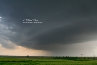
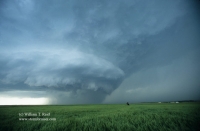
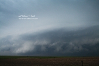
For the remainder of daylight we had continued spectacular views of this supercell between Wakeeney and Ellis. It looked like it tried hard to tornado again with nice RFD cuts and barrel-shaped updrafts to our north. We were a tad too far away to get a good look at what might be underneath. As dusk fell and the core neared, we dashed south a few miles to Ellis to avoid more hail.
I had made reservations for rooms in Wakeeney, just a county away to the west. But, a wall of heavy precip stretched across I-70 and was inching eastward. We made a half-hearted attempt to go through the heavy core, and got scared and turned back to Ellis. New mesos and tornado warnings were rippling northward along the leading edge of this line, and there no doubt was a lot of wind and unpleasantness inside of that. We went back east to Ellis, still ahead of the line. It was dark, and we were hungry. We could eat here while the line goes by, I figured.
We stopped at a Subway or Dairy Queen mega-convenience fast-food joint along the Interstate at the Ellis exit, and something was weird. They were not serving. There was a tornado warning for the county and town, so everyone was hunkered down or watching nervously out the window. One of the guests (Vicki) wanted to use the restroom, so I said okay. A minute later the town’s sirens are wailing, and we decide that it would be prudent to get the heck out of the town. Vicki was quick, and we blasted south through some wind and rain, with the town’s sirens still going and a cop car going by us at breakneck speed. It was eerie. About 5 miles south of town we can see a distinct and wide bowl-shaped lowering, possibly the tornadic area responsible for the warning. As we got east of it, it weakened a bit and cool air started blowing out towards us. This was a sign that the cell had little or no tornado potential, and we were safe, relatively speaking. We went back towards Ellis, and were greeted by more hail right away—mostly small change size. There were some stones on the road that were at least 1.5 inches in diameter. Martin stopped to wait out the hail and got hammered for several minutes. We decided to continue, and drove out of it in 10 seconds!
Back in Ellis, the streets were flooding! The road into Ellis went downhill, and the flowing water was at least five inches deep. It got even deeper, and I had to turn off of the main road to avoid that. We went back to the same fast-food place, and even more people were in there for shelter, looking very concerned. The manager said that if we went inside we would have to go inside the restrooms or something due to the tornado threat. Well, we figured that the threat had past, so we just stood outside for a while and watched more rain and wind and hail and lightning. I think that the folks inside thought we were nuts. It’s very weird having a bunch of troubled people around you when you know that there is (practically) zero tornado threat.
I checked my digital pics of the tornado, and they are all rather blurry as I must have had the focus wrong—–dagnabbit. Hopefully the video is okay. I was a bit frazzled since the van was stuck in the mud and trying to take pics and decent video at the same time.

Leave a Reply
You must be logged in to post a comment.