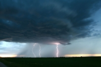
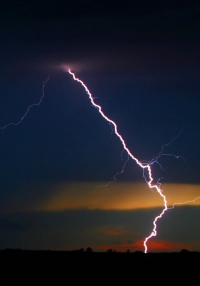
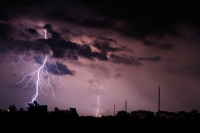
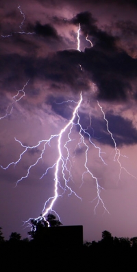
Brian and I wandered north and west from Minot towards Kenmare and vicinity. Shear was great, CAPE was so-so, and a front was in the area. Unfortunately, the cold front severely undercut some weak LP-like updrafts west of Kenmare. We forayed briefly into Saskatchewan, thinking that maybe conditions were better to the northeast. But, it was rainy and miserable across the border, so we came back into North Dakota through Antler and then along U.S. 83 well north of Minot. Near sunset, a cell developed west of U.S. 83 with some CG activity, and then other electrified cells popped up a little farther south, around Lansford. The tripods and mosquitoes were out in force and the digital cameras were open for business.
long version:
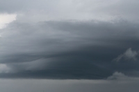
When we woke up in Mandan there were two areas to consider for convective activity in North Dakota: one in the southeast corner of the state and the other in the northwest. We went with the northwest target since it was closer and tornado potential was minimal either way. However, there was a disturbingly large area of mid and high-level cloudiness invading western ND, right over our cold front, which was to be our focus area for storm development. So much for pretty updrafts in the sunshine. We headed to Minot and then WNW to Kenmare to meet the cold front. The scenery along the way was quite enjoyable, despite the somewhat depressing overcast. Radar showed some shower activity west and north of Kenmare. As we drifted west of Kenmare we observed a few laminar-sided, bell-shaped lowerings which were protruding beneath the dense mid-level overcast. These were rotating updraft bases…but they were behind the cold front, above cool (62F) northwesterly winds! Radar showed a couple of cells about 75 miles to our NNE that might be a little east of the front across the border in Canada, so we headed north through Bowbells to Northgate.


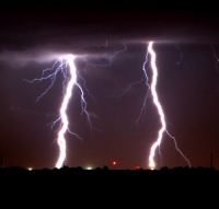
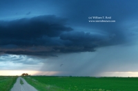 We wouldn’t be able to intercept those, but we could intercept a storm that might form a little farther south ahead of the front. We were well behind the cold front by the time we reached the border crossing and had to wait at least 20 minutes before we were granted access into the foreign country. We traveled north about 15 miles, then east another 30 or so miles through Oxbow and Carnduff in order to get east of the stratiform rain. A few new thunderstorms had developed in the meantime back down towards Kenmare (still behind the cold front, unfortunately), so it was time to head back to the good-ol’ USA. We enjoyed the close lightning and thunder crashes as we crossed the border, and thankfully the wait was much shorter this time. We stopped to film a pretty scene near sunset (which was at 9:55 p.m. CDT) about 20 miles north of Minot as new storms began to develop just to our west. We could see new rain shafts forming just down the dirt road…would we get a light show to photograph against the sunset colors? Yes, but the dreaded mosquito population was eagerly waiting to eat us alive! Eventually the winds picked up and the mosquito threat diminished enough to allow us to get a few decent CG photos in the fading light. We repositioned farther south for one more CG photo-op before calling it a night in Minot.




Leave a Reply
You must be logged in to post a comment.