
 short version:
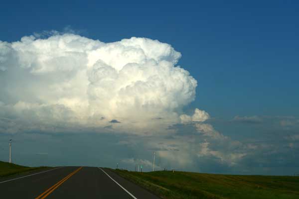
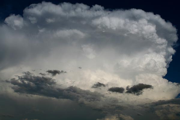
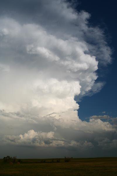
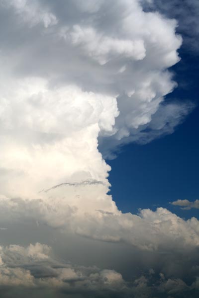
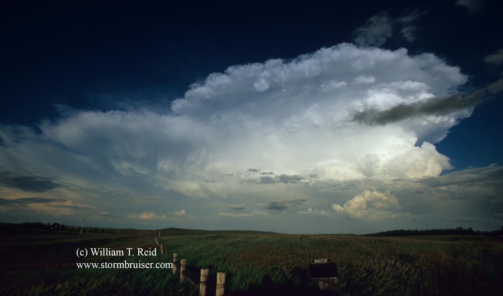
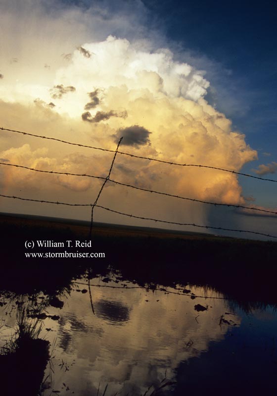
Brian and I were almost ready to blow off the day, chase-wise, from SW ND, when a cell developed to our SSE in SD. It led us to south of Pierre, and we never could get in front of it. These views are from the north and west of the cumulonimbus.
extended version:
Brian and I began the day in Minot. Our cold front from the previous evening was well down into central South Dakota, where a slight risk of severe wx was forecast. We weren’t keen on any particular target area along the front. Tornado prospects were again near zero, so we also were not too excited about chasing. Adding to the general malaise was the thick deck of mid-level clouds which plagued us most of the day.
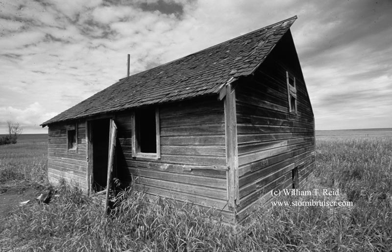
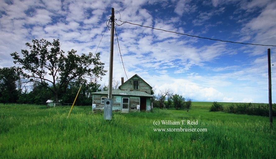
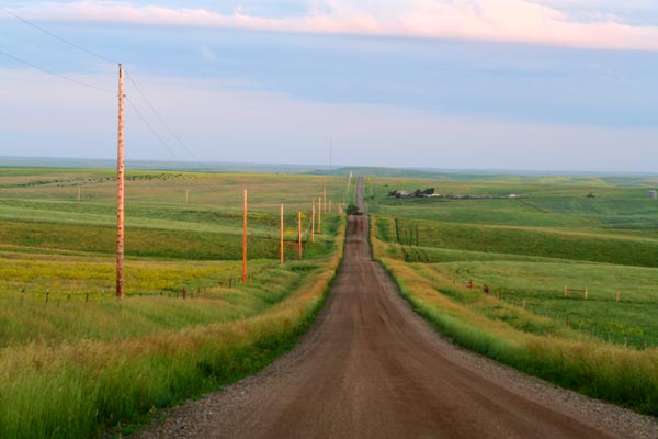
We had lunch in Bismarck and then decided to go west on I-94. This decision was made more with the Day 2 chase in mind (somewhere in the eastern half of Montana), while thinking that perhaps we could find some lightning to photograph towards sunset in extreme western SD. In our minds it was more of a positioning/scenery day than a chase day. Near Mott, ND, we stopped to photograph a couple of old places.
We went south through Hettinger and entered NW SD (north of Bison) around 5 p.m. It was about this time that we saw some weak echoes on the Threatnet radar along the front in SD to our distant SE. The closest one was exactly 100 miles away to our SE, west of Pierre. There was plenty of daylight left, so we began heading east and south and east again (through Faith and Howes) to get closer in case something got really strong. The storm was puny for quite a while, but it persisted, so we kept on driving towards it.
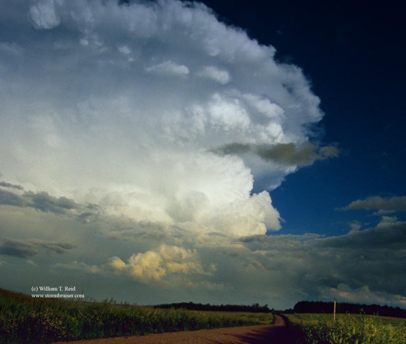
The storm looked pretty pathetic for the first 2 hours or so that we had it in sight. It was moving ESE at about 20 mph, and since we did not have a direct route to the southeast, it took about 3 hours to get close to the back side of the cell. We closed in quickly on the cell as it moved SW of Pierre, and it was about this time when the updraft appeared most powerful and dramatic with a full compliment of sunshine reflecting off of it. We stopped a couple of times to snap pics. Near sunset we were just south of Pierre and heading south, and the darn cell was starting to accelerate eastward and weaken. We never did get in front of it, but we had a good show in the bright light (and eventually soft light) behind it. What was most surprising was that no warnings were issued by the NWS for this seemingly intense updraft. We aren’t even sure whether the cell was a supercell or not.


 digital stills above, slides below


Leave a Reply
You must be logged in to post a comment.