June 23 was a Saturday, the first full day of chasing for Tour 6—-a day which was doomed from the start. This was the day after Tour 6 began in Denver, when we chased some marginally severe and marginally interesting storms in the vicinity of Fort Morgan and Sterling, CO. Some of the cells here were severe-warned, and there was even a tornado-warned cell near I-70. This was also the day of an F5 tornado west of Winnipeg, Manitoba. The town of Elie, MB, was the unfortunate town in that tornado’s path. This was Tempest’s lecture tour, and Chuck Doswell and I knew that the potential for supercells would be decent the next afternoon up close to the U.S./Canada border, perhaps near or north of Minot, ND. Of course, we didn’t know on that Friday when we were watching some marginal storms in a marginal severe-storm environment just how good the next day would be. In retrospect, we should have blown off everything on June 22 and blasted north. We could have easliy made it to the Rapid City area before midnight. As it turned out, we reached our motel in Scottsbluff, NE, shortly before midnight. I looked at the model data that night and knew that we were in trouble. The new model data suggested that the target would be quite close to the MT/ND/SK/MB border areas, and possibly 50-100 miles north of the international border. That was a good ten hours north of Scottsbluff…ugh.
At Tempest we are required to get at least a good 6-7 hours sleep in the interest of safety, so I had the crew ready to go by 7:30 a.m. All night long my head was swirling with the calculations as to where we might be around 6 p.m. CDT on Saturday. Could we be near the border by then, and would the storms already be up and running? Will the storms be north or south of the border? We had the briefest pit stops and lunch possible as we headed north through Belle Fourche, Buffalo, Bowman, and Belfield on U.S. 85 on Saturday. There was one excruciatingly long delay near Lusk, WY, due to road construction. It had us stopped for about 25 minutes. This was only an hour or so after we had left Scottsbluff. In my mind, I knew that we were going to need some big-time things go in our favor in order for the day to work out. We needed any activity to develop on the south end of the target area, near or south of the U.S./Canada border…and/or…we needed storm development to be fairly late in the afternoon or early evening…and/or…we needed slow-moving storms moving in a favorable direction relative to our position. We knew the chances for tornadoes looked pretty good. We needed some luck in order to have a chance if a nice tornadic supercell formed. A very, very nice tornadic supercell did indeed form…and we didn’t have any luck. We didn’t have a chance. The crucial mistake had been made the day before, when we decided to watch the Colorado storms.
Chuck and I spotted a very nice build-up of cumulus congestus from about Belfield, ND. It was slightly west of due north, and was in southeastern Saskatchewan. It was going up big-time. It was barely after 3 p.m. It was about 200 miles away! We were doomed, and deep down we knew it. But, there was plenty of daylight, and there could be additional cells later. We pressed on northward. At the border crossing at Northgate, ND, the impressive supercell was marching east-southeastward at about 30 mph near the SK/MB border, about 45 miles to our northeast. Another less-impressive cell was trailing it, to our north. When we reached the border, we had no chance to reach the leading cell. And, as we sat at the border and waited for our identifications to be checked, that leading cell began its crazy tornado-making trek. The wait at the border was an agonizing 25 minutes. The building blocked our view of the cell, and the covering above us blocked our Threatnet signal. When we emerged from the guard station, the rear-end of the tornadic lead cell was still visible, but a good 50 miles distant. We had to look at the Threatnet radar display and groan as the shear-marker “Wheel of Fortune” values hovered around 150 – 168 mph for a good hour or two. We were missing the show.
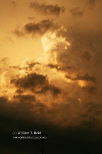
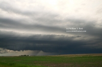
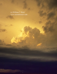
The trailing supercell was sucking on air that was worked over by the leading cell. There was some decent structure with it, but it was fairly benign and unimpressive, at least compared to what we imagined the leading cell might look like. As we neared the trailing cell north of Whitewater near sunset, it appeared like it was trying to make a tornado, but it couldn’t. This trailing supercell was moving over areas that had been impacted by the tornadic supercell, maybe 60 – 75 minutes earlier, from about Pipestone to Baldur. These towns are southwest and southeast of Brandon, respectively. One of the tornadoes was rated F3, and they were quite spectacular, long-lived, and highly visible. What a bummer.


Leave a Reply
You must be logged in to post a comment.