
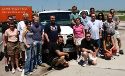
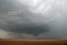
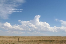
Back to southeastern Kansas again! This was the final chase day for Tour 3, so it was nice that our target wasn’t too far from… [Read More]
Archives for May 2008
May 29, 2008 Kearney, NE Tornadic Supercell
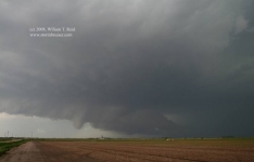
By noon-ish we were heading east along I-80 in central Nebraska, near Kearney. The outlook for significant tornadoes on this day was very good… [Read More]
May 28, 2008 Dorothy’s House and Monument Rocks

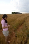
This was a positioning day. We motored north through western Kansas, with stops at Dorothy’s House (in Liberal) and at Monument Rocks (north of Scott… [Read More]
May 27, 2008 Willow, OK Stormus Dissipatus
With hopes at a modest level at best, we scooted west into western OK as thunderstorms developed. A couple of updrafts looked good briefly, but… [Read More]
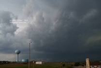
May 26, 2008 More Kansas storms

Thunder the Wonder Dog joined us for lunch in Offerle (west of Kinsley). Like the day prior, today’s storms were less than impressive. The initial… [Read More]
May 26 Update
Crazy, crazy, crazy chase period from May 22 to May 24! I saw five tornadoes on the 22nd in NW KS, two on the 23rd… [Read More]
May 25, 2008 Central Kansas Storms
The big play this day was in Iowa, where the Parkersburg monster tornado formed. We began the day in Salina and played central Kansas. We… [Read More]
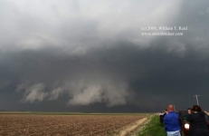
May 24, 2008 Hennessey, OK Tornadic Supercell
A lone, isolated supercell was a prolific tornado producer as it moved slowly through Kingfisher County and Garfield County in Oklahoma on May 24, 2008. … [Read More]
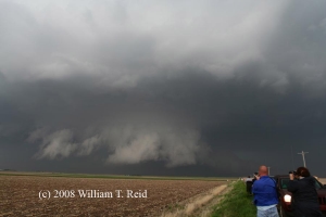
May 23, 2008 Clark County, KS Tornadic supercell
The timing of the switch from Tour 2 to Tour 3 was not good. We had put up with a lousy pattern for five or… [Read More]
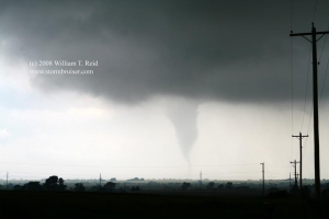
May 22, 2008 Grainfield, KS Cyclic Tornadic Supercell
Gad, I had not seen a good-sized and photogenic tornado for far too long. The last one up until 5-22-08 was on 5-22-07, near Wakeeney,… [Read More]
May 21, 2008 I-80 Wind and Wind
The atmosphere was finally recharging after almost a week of down time for chasers. Surface low pressure was becoming established on the High Plains, and… [Read More]
May 20, 2008 Keota, CO High Plains Gets Shafted
Or, High Plains gets a fun hail shaft. The previous four days were down days. Our group poked around Big Bend on the 16th and… [Read More]
May 19, 2008 Update
Finally —- an update for the SB faithful! The final 5-6 days of Tour 1 were extremely active, as were the first three days for… [Read More]
May 16-17, 2008 Beautiful Big Bend
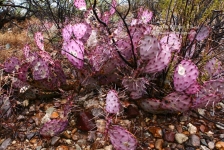
We reached the Big Bend National Park in light rain on the 16th and photographed the purple cactus. Our rooms were in Terlingua, chili capital… [Read More]
May 15, 2008 Eagle Pass, TX Supercell
At our morning briefing in Fredericksburg, we targeted the Rio Grande River area somewhere between about Del Rio and Eagle Pass. Parameters looked good for… [Read More]