
And “Tornado Fredonia”, too, but we could not see it, despite looking at the supercell on its southeast side as it came up to Fredonia, KS. My brief summary, written many moons ago:
—-
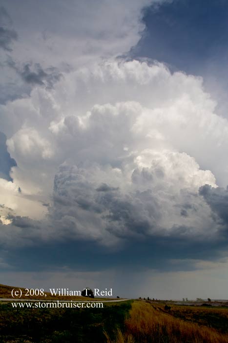
May 1: We spent a lot of time at the library in Blackwell, OK, during the afternoon. Storms developed only 20-30 miles to our east around 4 p.m. We were on the exploding cells early and followed them into southeast Kansas, north of Independence. A cell was tornado-warned for quite a while near Fredonia, but we did not observe a tornado. (There was a report of a brief and weak tornado near Fredonia which we missed, or could not see from our vantage point.) Structure with the storm was good and the guests got a great chase on their first full day. We found food in Neodesha, and drove to Joplin, MO, for the night. A very nice tornado was spawned from a supercell in northeastern Oklahoma, about 80 miles south of our storm, after sunset. That’s the way it goes much of the time in storm chasing.
—-
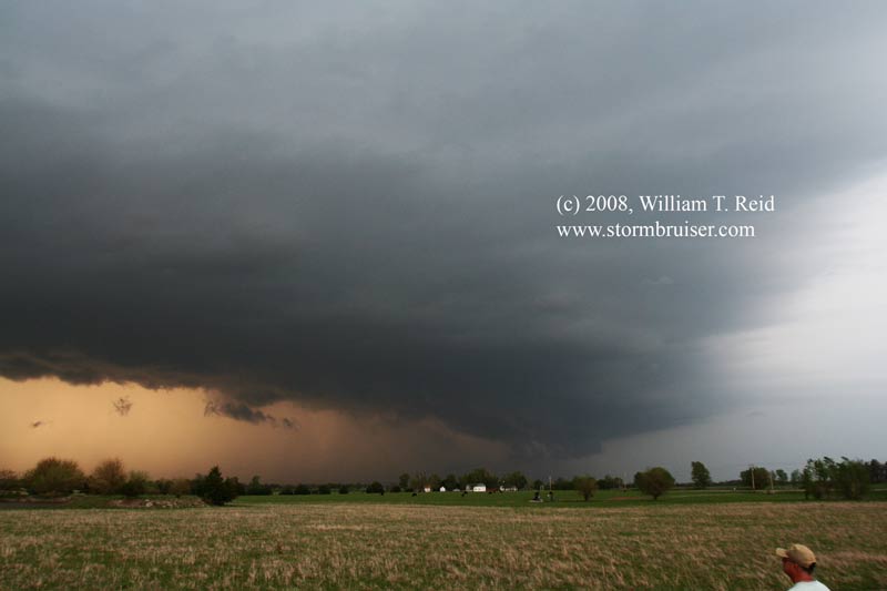
The tornado was spotted not long after this supercell picture was shot. We went north towards Fredonia, where the sirens were sounding and the sky was low and threatening just to the west and north. We scooted east to Altoona, then north, then south, then west halfway to Fredonia again. Another cell neared, it was dark and time to call it a chase.
The next day, May 2, was long and difficult and frustrating. We left Joplin before 9 a.m., but, at Little Rock, found ourselves too far west as tornadic cells developed a little east of Little Rock midday. There was no way to catch up as these moved rapidly ENE. We salvaged some marginally severe storms in northern Louisiana, near Shongaloo. After a dinner of frog legs in Shongaloo, we motored into Shreveport for the night.
Leave a Reply
You must be logged in to post a comment.