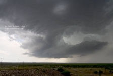
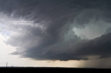
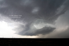
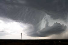
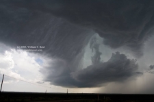
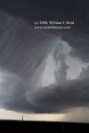
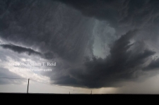
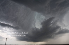
Yet another big day with somewhat high hopes for tornadoes! My forecast target spot was a little west of San Angelo, TX, and that worked out quite nicely. After our lunch in Sweetwater we went south towards San Angelo. A strong storm developed quickly west of San Angelo and moved ESE. After an agonizingly long fuel and pit stop in San Angelo, we blasted a little south of town (halfway to Cristoval) to view a weird, skeletal, cork-screwing updraft. It moved southeast, to our southwest, and dumped some dime-size hail on us as it shriveled. This updraft region was changing shape quickly—the images below were taken over just a five-minute period, from 4:33 to 4:38 p.m. CDT.
Meanwhile, a second updraft was exploding just to our southeast. This was an absolute beast of an updraft, and we really needed to get in position on it. Unfortunately, the road network was sparse and we were forced to drive about 25 miles south-southeast to U.S. 190 in order to get east. And, the darn supercell decided that it was Kentucky Derby day or something and it was moving east at about 45 mph, towards Eden. The (Threatnet) shear markers on this thing reached up to about 126 mph as we got south and finally southeast of it along U.S. 190. Also, to our ESE, was a new and vigorous updraft. This would become the “Llano” supercell. It split and sent a left-mover scurrying north towards the Eden beast. The Eden storm ingested the left-mover as an afternoon snack.
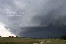
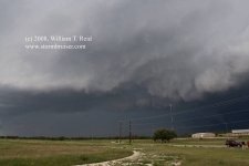
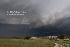
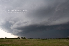
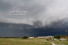
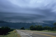
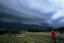
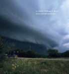
At Brady we were in position in front of the tornado-warned (Eden) cell. The supercell was a massive HP with nice multi-tier structure. We stopped on a residential road and a lady screamed at us that a tornado was coming and we needed to take cover. After about five minutes the thing was nearly upon us and we had to get outta town. There was a wicked green maw descending upon Brady…though any tornadic area must have been mostly precip-wrapped. Our group fled southeast as the edges of the core impacted us. These images of the Brady HP supercell are looking west to northwest from Brady from 6:15 to 6:16 p.m. CDT.
We managed a few quick stops on 71 to Fredonia for views of the structure. The supercell didn’t have quite the nasty look it once had. The core of the Llano storm was now just to our southeast, and 71 took us directly into it. This cell was now tornado-warned, headed towards Llano, and was only moving about 25 mph. We could get in position on it, if we were willing to flirt with the core. So, we pressed onward. Hail size grew to dimes and pennies and persisted, but did not slow us down much. As we neared Llano, the radar was showing a nice “TVS’ (tornado vortex signature) quite close to Llano. A tornado could be in progress only 5 miles away! We couldn’t see, though. It was too dangerous to continue plunging southeastward through the core, and my plan was to wait a little in Llano beneath some protective covering until visibility improved. Well, we didn’t quite make it. Very heavy hail began to pound us as we entered Llano. Some stones were golfball in size, and the sound was deafening. Visibility was a hundred feet and the wind was strong from the north. We pulled in quickly besides a metal building, which provided minimal protection from the hail and a little protection from the wind. The hail and wind let up slightly and the streets began to flood somewhat. Tempest driver and guide Chris Gullikson indicated that we should try to continue south out of town, as radar showed that we were on the southern fringe of the hail core, and any alleged “tornado” would be a few miles southwest of town. We followed Chris for about a block, and then the hail barrage really started to crank. Visibility was only 30 or 40 feet. We could not hear each other speak, nor could we communicate on the radio. I had Rob turn the van around and pointed him towards a strong overhang/covering at a car dealership in Llano. The media vehicle followed, but the minivans remained exposed for the most part a couple of blocks away. I was able to exit the big van with my camcorder, and I videoed the new trucks at the dealership “getting the business.” Rob picked up a bunch of golfball-sized stones, and the barrage continued for several more minutes. Yes, all of the vehicles received plenty of small hail dings and pimples, but somehow all of the windows and other vehicle parts escaped unscathed.
As the hail let up we scooted south through Llano, where hail drifts were a foot deep and the roads were white. The low-level meso, or the “action area”, was not too far to our southeast, and we continued southeast on 71. By this time the Doppler On Wheels truck and the Tornado Intercept Vehicle and its 10-vehicle entourage were right behind us. We let them pass, and eventually we came up on an interesting area with some rotation and lowerings, but it appeared less than well-organized. The storm continued ESE towards Marble Falls as darkness fell. We found ourselves on a high point south of Marble Falls, and saw a wicked “notch” area just north of town with frequent CGs and a rain-wrapping free-for-all. Apparently a good-sized tornado was not able to become established. We saw the wet RFD wall-of-wind approach, and blasted south as small branches were rendered from trees.
We stopped at a nearby convenience store for a much-appreciated pit stop, and then went for our rooms in Fredericksburg. 512 miles.

Leave a Reply
You must be logged in to post a comment.