Stormbruiser.com

William T. Reid

  • About
  • Video Links
  • Climate
  • Categories
    • Astronomy
    • Aurora/Northern Lights
    • Artsy
    • Airports (LAX and VNY)
    • Animal Day
    • Beach
    • BEST and MOST POPULAR
    • Chase Season Summary
    • Chasers and friends
    • Cumulonimbus
    • Death Valley
    • Desert
    • Desert/Mountains
    • Elevated photography
    • Eyesores
    • Fire
    • Flooding
    • Hurricane
    • Landscapes
    • Lightning
    • Local: Conejo Valley/San Fernando Valley
    • Mid and High Clouds
    • Nighttime photography
    • Old Stuff
    • Rainbows/Optical Phenomena
    • San Nicolas Island
    • Storm Video Sales
    • Stormy Skies
    • Stupid Bugs
    • Sunsets and Storms
    • Supercells
    • The City
    • Tornadoes
    • Unusual Clouds
    • Vegetation
    • Wind and Dust
    • Winter Weather
  • Contact
You are here: Home / 2008 / May 15, 2008 Eagle Pass, TX Supercell

May 15, 2008 Eagle Pass, TX Supercell

May 15, 2008 By Bill Leave a Comment

At our morning briefing in Fredericksburg, we targeted the Rio Grande River area somewhere between about Del Rio and Eagle Pass.  Parameters looked good for supercells if storms could develop over the mountains in Mexico west of Del Rio.  If the storms didn’t turn too hard to the right, then they should make it to the international border for our viewing pleasure. 

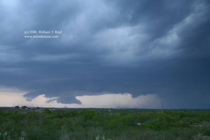
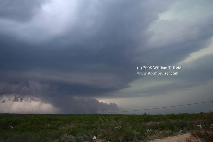
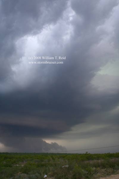
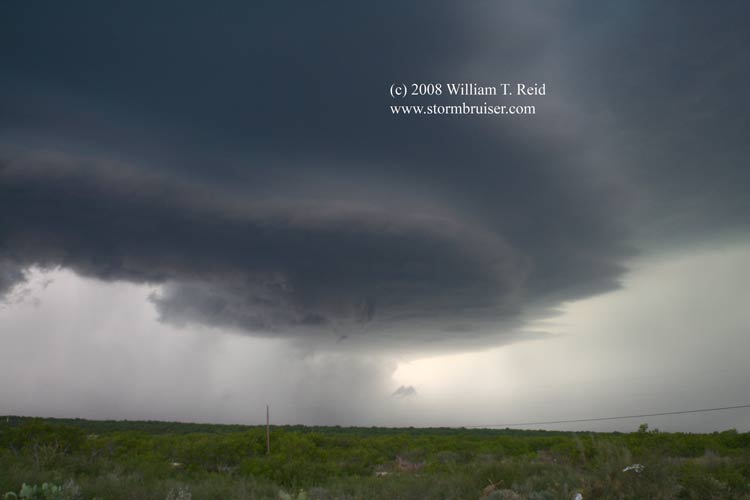
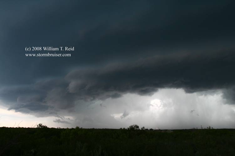
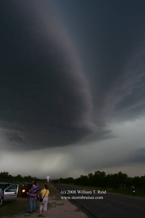
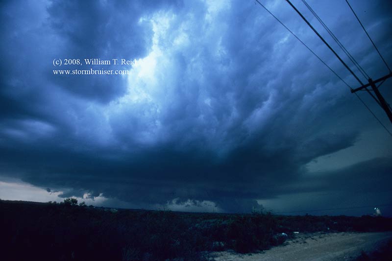
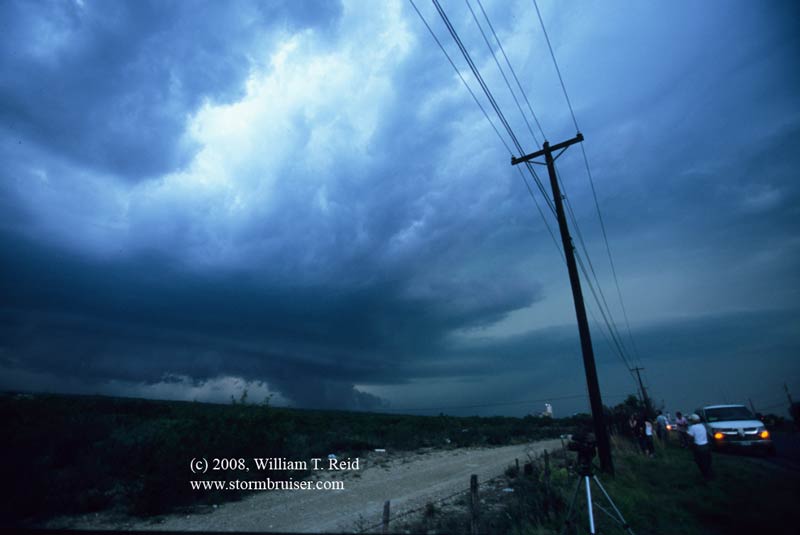
We had a nice Mexican lunch in Rock Springs and continued southwest to Del Rio.  A storm went up in the mountains, west of Del Rio, just as planned!  We had to wait about three hours for it to reach the U.S.  This occurred at Eagle Pass, and the cell was tornado-warned.  The base was a little on the high side and there was plenty of precip involved with the updraft, but the structure was impressive nonetheless.  The core neared and chased us south a few miles, and Eagle Pass was munched by hail up to almost 3 inches in diameter.  We went southeast to El Indio, but the cell elected to move more easterly than east-southeasterly, so we could not view the notch area adequately.  As the storm drifted east we caught the back edge of the updraft and a tight, spinning protrusion, but the storm was not in a tornado mood.

New strong cells blew up in Mexico and gave us a nice lightning show on our wet drive back to Del Rio.  380 miles.

08may15_eagle_pass_tx_sc_0698.jpg08may15_eagle_pass_tx_sc_0700.jpg08may15_eagle_pass_tx_sc_0703.jpg08may15_eagle_pass_tx_sc_0705.jpg08may15_eagle_pass_tx_sc_0707.jpg08may15_eagle_pass_tx_sc_0711.jpg08may15_eagle_pass_tx_sc_0714.jpg08may15_eagle_pass_tx_sc_0717.jpg08may15_eagle_pass_tx_sc_0718.jpg08may15_eagle_pass_tx_sc_0719.jpg08may15_eagle_pass_tx_sc_0723.jpg08may14_eagle_pass_tx_sc_08db31.jpg08may14_eagle_pass_tx_sc_08db34.jpg

Filed Under: 2008, Supercells

Leave a Reply

You must be logged in to post a comment.

Search

May 2008
S M T W T F S
 123
45678910
11121314151617
18192021222324
25262728293031
« Apr   Jun »

Categories

Archives

Copyright © 2025 stormbruiser.com · Log in