Stormbruiser.com

William T. Reid

  • About
  • Video Links
  • Climate
  • Categories
    • Astronomy
    • Aurora/Northern Lights
    • Artsy
    • Airports (LAX and VNY)
    • Animal Day
    • Beach
    • BEST and MOST POPULAR
    • Chase Season Summary
    • Chasers and friends
    • Cumulonimbus
    • Death Valley
    • Desert
    • Desert/Mountains
    • Elevated photography
    • Eyesores
    • Fire
    • Flooding
    • Hurricane
    • Landscapes
    • Lightning
    • Local: Conejo Valley/San Fernando Valley
    • Mid and High Clouds
    • Nighttime photography
    • Old Stuff
    • Rainbows/Optical Phenomena
    • San Nicolas Island
    • Storm Video Sales
    • Stormy Skies
    • Stupid Bugs
    • Sunsets and Storms
    • Supercells
    • The City
    • Tornadoes
    • Unusual Clouds
    • Vegetation
    • Wind and Dust
    • Winter Weather
  • Contact
You are here: Home / 2008 / May 20, 2008 Keota, CO High Plains Gets Shafted

May 20, 2008 Keota, CO High Plains Gets Shafted

May 20, 2008 By Bill Leave a Comment

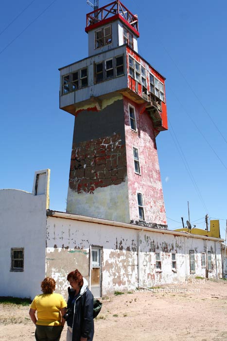
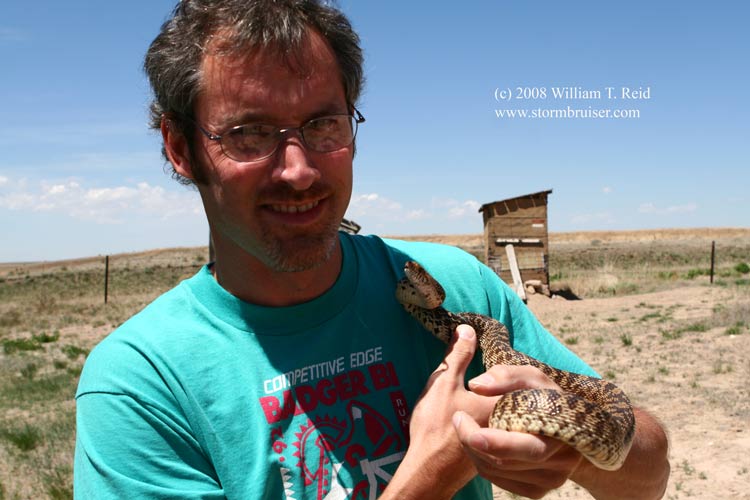
Or, High Plains gets a fun hail shaft.  The previous four days were down days.  Our group poked around Big Bend on the 16th and 17th, and drove north to Santa Rosa, NM, on the 19th, without incident.  On Monday, the 19th, we were privy to some virga bombs in the vicinity of Limon, CO.  Low-level moisture and upper flow improved the next day, and we targeted northeast Colorado.  Some time was spent at the Genoa WonderTower, where Chris found a slithery friend.

08may20_genoa_co_tower_5117.jpg08may20_genoa_co_chris_5111.jpg08may20_genoa_co_snake_5109.jpg

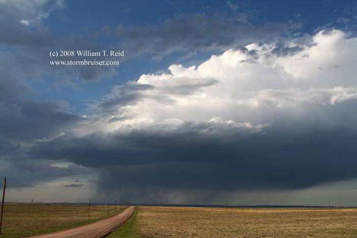
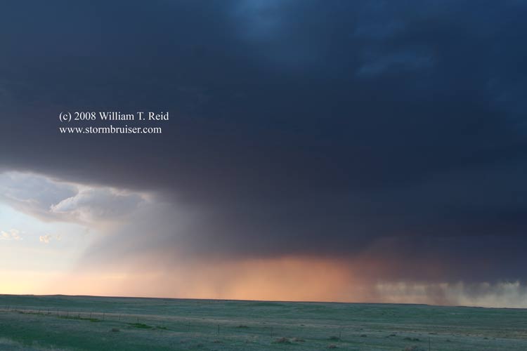
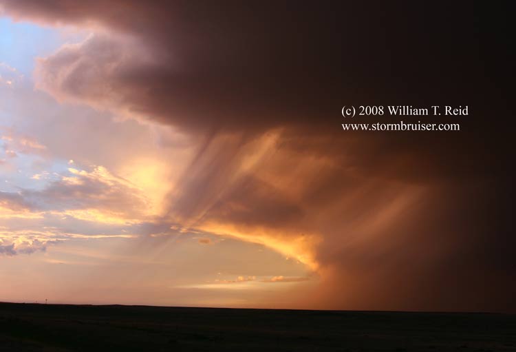
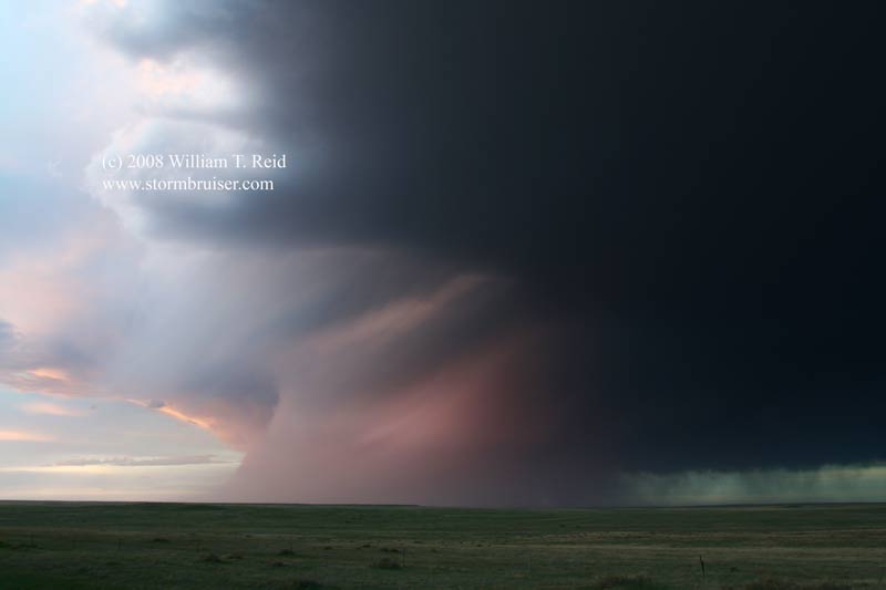
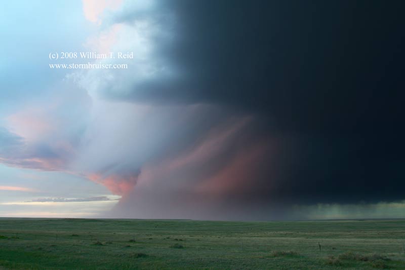
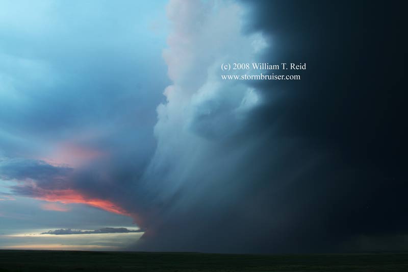
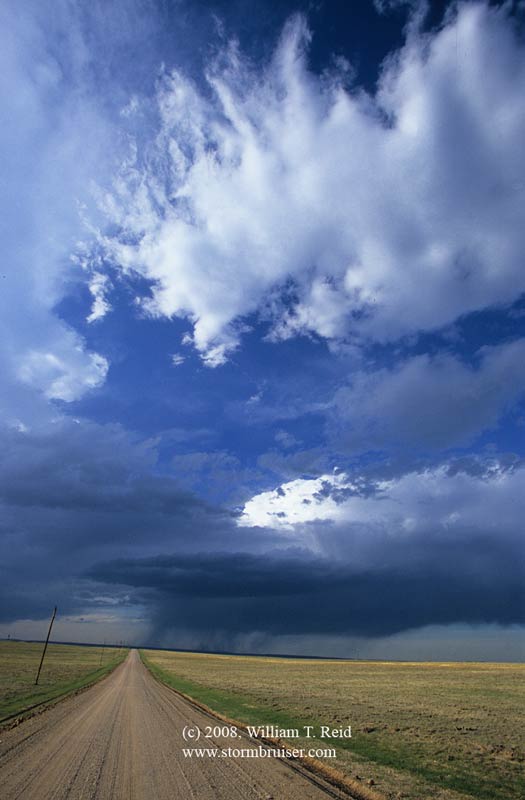
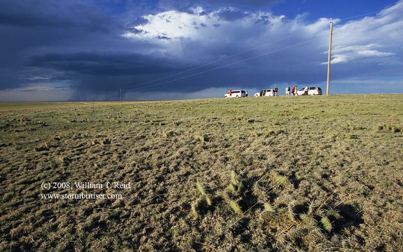
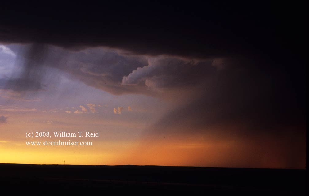
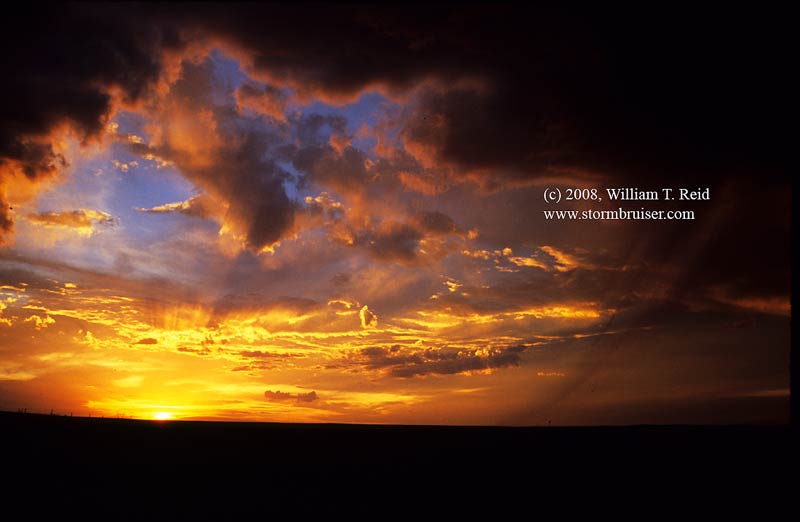
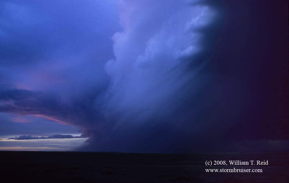
We were drawn north towards the Pawnee National Grassland in Weld County, and observed an isolated storm at sunset.  It was drifting ESE, north of Briggsdale, and seemed to assume supercellular characteristics at least briefly.  The updraft base even sported a funnel cloud for a minute of two.  The last rays of direst sunlight on the hail-filled precip shaft was nice.  These views are generally northwest to north, a couple of miles southeast of Keota.

08may20_keota_co_sc_5118.jpg

08may20_keota_co_sc_0481.jpg08may20_keota_co_sc_0497.jpg08may20_keota_co_sc_0500.jpg08may20_keota_co_sc_0519.jpg08may20_keota_co_sc_0529.jpg08may20_keota_co_sc_0542.jpg08may20_keota_co_sc_0550.jpg08may20_keota_co_sc_0568.jpg08may20_keota_co_sc_0578.jpg08may20_keota_co_sc_0592.jpg08may20_keota_co_sc_0601.jpg

digital images above, slides below…click at your own risk

08may20_weldco_co_08eb29.jpg08may20_weldco_co_08eb30.jpg08may20_weldco_co_funnel_08fa02.jpg08may20_weldco_co_sunset_08fa03.jpg08may20_weldco_co_sunset_08fa09.jpg08may20_weldco_co_cb_08fa10.jpg

Filed Under: 2008, Cumulonimbus, Stormy Skies, Sunsets and Storms

Leave a Reply

You must be logged in to post a comment.

Search

May 2008
S M T W T F S
 123
45678910
11121314151617
18192021222324
25262728293031
« Apr   Jun »

Categories

Archives

Copyright © 2025 stormbruiser.com · Log in