Gad, I had not seen a good-sized and photogenic tornado for far too long. The last one up until 5-22-08 was on 5-22-07, near Wakeeney, KS. It was now exactly a year later, and the prospects for tornadoes looked pretty good, again in NW Kansas! A strong surface low in Colorado and great energy aloft was going to make it a fun May day for a lot of chasers, it seemed. My target area was along a warm front running E-W close to I-70 in NW KS. Winds north of the front were easterly, so tornado development might be favored near and just north of the front, where low-level turning of the winds with height was maximized. By early afternoon our 4-vehicle chase-tour caravan was halfway south from Ogallala to Colby. We were north of the warm front and beneath a low overcast. Our radar display showed a large storm well to our west, near Greeley, CO. This cell trekked northwestward and produced a very large and violent tornado near Windsor. How can you forecast that?! Video of the event was on the web within an hour, and we felt kind of numb and empty when we saw how tremendous that tornado was. Anyway, there was little we could do, as I had decided to play the better odds of the moderate risk. Thunder and rain greeted us as we stopped in Colby. The show was beginning in Kansas.
Small storm cells were developing along a dry line in western Kansas and moving northward into Thomas County and surrounding counties. And, they were moving quickly. This was lame, but it was still early. We went south of Colby and east to Oakley. The cells approaching from the south in Logan and Gove counties were strengthening. I needed to be patient and to allow nature to take its course. I did not want to blast too far south of Oakley towards these storms, as tornado potential should be much better up north here near I-70. We stopped in Oakley, and our media team discovered a bolt or foreign object in one of their tires. Not good. The tire was still functioning, though….should we repair it or put on the dinky spare? It was crunch-time as far as the chase day was concerned, and we elected to leave the tire as it was and hope for the best. A good-sized cell was aiming at Oakley, and deserved our attention.
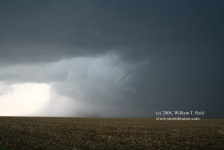
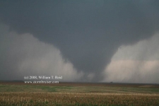
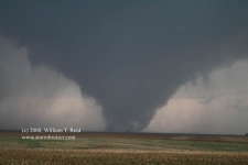
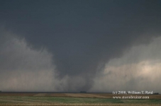
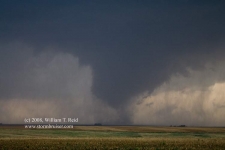
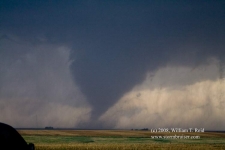
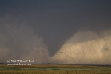
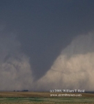
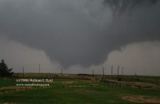
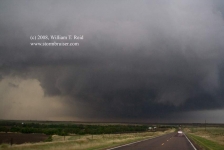
If memory serves me correctly, we took a look at the cell coming up on the west side of Oakley and were not impressed. We jumped east on I-70 and exited at Grinnell to intercept the next storm. We drove maybe eight miles south and found ourselves in front of a mature supercell. It was moving north rather quickly, and the action area to our south meant business, with plenty of precipitation obscuring the goods. Rain was overspreading the dirt road network we were utilizing, and then small hail. I didn’t like being in the path of this beast, so we went back north a couple of miles and then east a couple to give us some breathing room. The four images below were taken perhaps 8-10 miles or so southeast of Grinnell and looking west, as the updraft and wall cloud moved from left to right. Time frame is about 4:20 to 4:30 p.m. CDT.
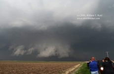

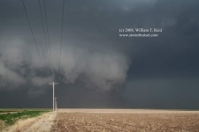
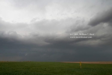
The images above depict a well-organized and a mature supercell, and there may have been intermittent weak tornadic activity with the storm as it moved northward towards Grinnell. Our group jumped onto Hwy 23 to Grainfield. The cell, to our west and then northwest, appeared to weaken and we let it go. Another strong storm was moving northward in our direction through Gove County, and I decided to head back south along 23 towards Gove. This “Gove” cell looked pretty good on radar, but (prior to getting close to it) a smaller, newer updraft caught my attention some 6 to 8 miles south of Grainfield. This updraft was only a couple of miles west of 23, and it started to spit out some close CGs. We stopped alongside to give it a chance, and I mentioned out loud that these “CG” lightning spurts occasionally precede tornado development. As the updraft base moved to our northwest, a prominent lowering developed beneath the base. It didn’t appear to be rotating much at all, if any, and I wasn’t really expecting a tornado anytime soon, but we needed to stay with it. Back north on 23! This time my van was bringing up the rear of our 4-vehicle caravan, and the dreaded radio call by the girls of a blown tire came over the radio. The timing was horrid—-our little cell was looking better and better as the lowering loomed very near to the ground. My drivers (Chris and Kinney) quickly elected to stop to help the girls change their tire. They had plenty of capable males with them in their vans to help them make the tire change, and I figured there was little I could do to help. So, I pressed on with the chase, feeling a little guilty and feeling really lousy for the tour guests in the two minivans. Marcia and Jenna pleaded with Chris and Kinney to continue with the chase, but they were real troupers and came to their rescue! Naturally, on this, the tenth and final day of the tour, a tour which had to endure a terrible Death Ridge for five or six days, a tornado emerged from our little supercell while more than half of the group was standing in the rain and dealing with a flat tire! UGH!!
Well, our tour was now split. Chris and Kinney and company were working on the flat south of Grainfield, and I was trying to stay close to the cell. Rob and I and our six guests reached Grainfield, and we had a whitish, slender funnel cloud about ready to touch down not too far to our north-northwest. Unfortunately, Hwy 23 jogs here, and we had to go east two miles on I-70 before continuing north. This took us farther away from the storm. As we turned north I finally was able to see what was going on. A tornado was in progress to our northwest, but the contrast was very poor, there was light rain falling, and the tornado was skinny and did not look like it would last too long. Regardless, we pressed northward and managed to get closer. After about three miles the contrast was much better, and we stopped to watch the long tornado rope out and dissipate! The photos of the “Grainfield tornado” below were taken from about 5:44 to 5:48 p.m. CDT. The view is to the WNW for the most part, from Hwy 23 in extreme southern Sheridan County.
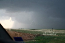

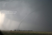
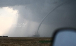
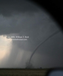
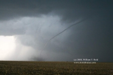
Our supercell was still cranking and chugging north at a decent clip — maybe 30 mph — so we stayed with it on 23. It was going into cyclic tornado-making mode! The base of the new meso was larger and meaner-looking than the Grainfield version. A large wall cloud was in the works, and we needed to get to Hoxie! We made the 12 miles north to Hoxie quickly, and as we peered to the west down Hwy 24 in Hoxie, we could see very good rotation in the broad wall cloud with occasional “fingers” touching down. This tornado was starting out in multi-vortex fashion, no more than a few miles west of Hoxie. Again, we were in light rain, and I wanted to get northeast of the tornado for the best contrast and to give us some time to exit the van and set up the camcorder. This was accomplished some five miles or so north of Hoxie. We watched the tornado move to our west and northwest with good contrast, and the rain let up some, too. The tornado transformed in shape quite a bit and became long and narrow as it neared its demise. At one point, an obvious, skinny horizontal funnel appeared to stick out of the side of the cone-shaped funnel. The images of the “Hoxie tornado” below were taken from about 6:02 to 6:15 p.m. CDT.


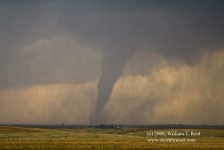


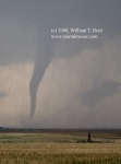
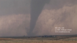

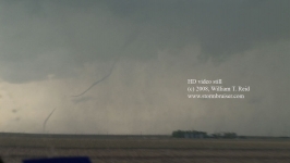
In one of the final images above you can see the prominent, new lowered storm base to the right of the Hoxie tornado. The next cycle was developing. We continued north on 23 towards the Soloman River, and the supercell now sported an extremely dynamic, mean-looking, and very dark base. The first two digital still images (below, at about 6:20 p.m.) were at ISO 800, f2.8, and 1/100 second. I managed one still of a tornado with this new cycle, and concentrated on video thereafter (HD video stills below are from 6:19 to 6:26 p.m. CDT). The drive north towards Dresden on 23 was quite spectacular, with perhaps four or five separate tornado touchdowns to our north from two or three separate tornadic circulations, on both sides of the highway. The tornadoes tended to be short-lived, with very fast swirling motion at both cloud base and along the ground, with two in progress at least once. We followed from a mile or two behind in the rain. The road came to a “T” four south of Dresden, and we jogged east a mile and north again into town (on 123). It appeared that the town escaped serious harm! The supercell was still continuing north, but our paved road option out of Dresden was not. We went northeast on 383 and effectively lost contact with the active storm base. In hindsight it may have been worthwhile to try the dirt road north out of Dresden, but conditions were somewhat wet and very dark.
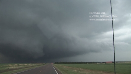
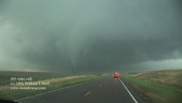


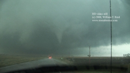
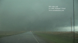

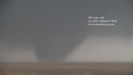

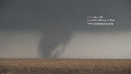
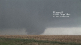
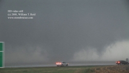
We made a pit stop west of Norton, and then waited along U.S. 36 for the next tornado-warned cell to come to us. The cell had a good look to it, but we could not see a tornado. The cell was HP-ish and a tornado could have been rain-wrapped.
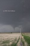
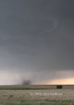
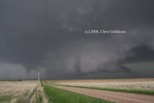
As darkness fell, I contacted the other part of the tour. I was cringing —- had they seen nothing or next to nothing, and would I have to share our tornado glory in their tornadoless despair? Nope! Chris and Kinney did a tremendous job, had quickly put a spare on the girls’ SUV, and had intercepted a tornadic supercell near I-70, close to Ellis! Yes! They witnessed about four tornadoes (see Chris Gullikson’s images below). The last chase day was a great success for all involved!





Leave a Reply
You must be logged in to post a comment.