The timing of the switch from Tour 2 to Tour 3 was not good. We had put up with a lousy pattern for five or six days during the middle of Tour Two, and now the pattern was great! We were feeling good following a fantastic tornado day on the 22nd, but now it was time to drive back to base camp (Oklahoma City). This stinks. Much of western Kansas was again under the gun with excellent tornado prospects. We got up on the early side in Salina, and got the tour guests back to OKC around noon. Usually, on these turnaround days between tours (Tour 3 would begin at noon the following day), my tour guides and I clean out the vans and get the oil changed and do a myriad of other tasks. Forget that noise.
Chris Gullikson and I and four of the Tour Two guests quickly checked into the Wingate Inn in OKC and placed ourselves back inside of the big white van. The greatest threat of tornadoes (and the chaser hordes) was again in northwest Kansas near Interstate 70. We had to be back at the OKC hotel this night, so I targetted extreme northwest Oklahoma and adjacent parts of Kansas and the eastern Oklahoma Panhandle. Supercells and tornadoes seemed to be a good bet in this area, so we took the Northwest Passage route to Woodward and Laverne. All we needed was for storms to hold off a bit until we arrived. They did —- perfectly.
A very healthy updraft exploded in eastern Beaver County, OK, as we neared Rosston, near the Beaver/Harper county line. The cell was to our southwest and was moving NNE. Why can’t all chases be this easy? The cell quickly became severe-warned and we were in position to view the updraft and its base. A large wall cloud developed just west of U.S. 283 as the storm moved into Kansas. The views below are looking mostly west to southwest, near 6:10 p.m. for the CB shots, and near 6:35 p.m. for the wall cloud shots.
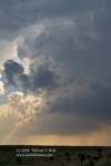
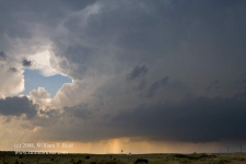
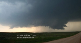

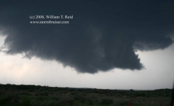
The storm did not waste much time getting its act together, near Englewood in southwest Clark County. The eastern edge of the supercell’s updraft base was hugging Hwy 283, and we soon found ourselves being chased northward by a rapidly rotating wall cloud. It was obvious that a tornado was imminent as we reached Hwy 160, and if we stayed here at 283 and 160 for more than a minute, we were in trouble. As Chris turned east on 160, rain curtains blasted us from the south, and a big rig blasted past us on the two lane road…going the same direction as we were. Chris said that the truck driver was scared for his life! The truck driver obviously knew that he or she needed to somewhere else NOW! I looked back over my right shoulder and up and behind us a tad—a good-sized funnel cloud was RIGHT there—about as close as I’ve ever been to one. Go Chris!
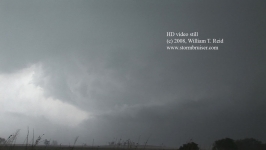
A few minutes later and a few miles east of 283 we stopped to look back. A whitish, slender, but fairly beefy funnel cloud was dangling just above the earth to our WNW. It persisted for a good minute or two, but seemed reluctant to make solid condensation contact with the ground. It was close enough to definitely be a tornado, though. It developed a kink and lifted up a bit. We were in rain and I tried to get some decent video. The stills below are from video, looking west to WNW, at 6:52 for the wall cloud and from 6:57 to 6:59 p.m. CDT for the tornado, about five miles west of Ashland, KS.
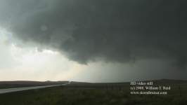
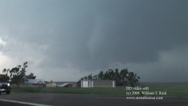


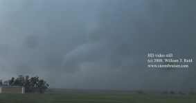
The road network is not good in sparsely-populated Clark County. The cell was moving to the northeast at about 25 mph. We drove about 12 miles east to Sitka and Route 34, and headed north to intercept the cell again. It was torture to drive farther away from the tornadic supercell and to be unable to see what it was doing. About nine miles north of 160 we found a very nice high spot. This was north of a “peak” called Mt. Jesus on the Kansas Gazetteer, and it afforded an excellent view of the approaching storm. Inflow winds from the east were absolutely tremendous, with gusts of perhaps 50 mph. I set up the camcorder and tripod low to the ground and took the stills (below) as the storm approached. The road in the images below heads west, the storm is maybe four or five miles distant and moving northeast at 25-30 mph, and the time frame is 7:27 to 7:31 p.m. CDT.
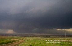
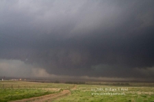


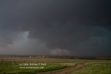
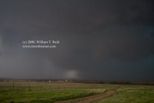
In the third photo above, the old, initial tornadic meso with a wall cloud or funnel cloud is obvious towards the left edge. The brighter area of the RFD/clear slot can be seen just in front of it. (We are looking more to the southwest here.) Meanwhile, a new meso and prominent, very low updraft base is a little closer and beginning to wrap up (the right half of the same image). The three images which follow show the RFD/clear slot prominently cut into the new meso, with a good-sized wall cloud (or large funnel cloud and developing tornado) looming inside of the cut.
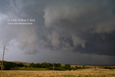
This was one of the nastiest-looking storms I have ever seen that did not have an obvious tornado in progress. It was dark and green and blue and it had a rain core from you-know-where, which may well have been harboring a tornado. The business end of the newer, closer mesocyclone was headed right for us, and we bailed southward quickly to avoid getting creamed. Only a minute or two south of our high point and we were okay, with an impressive view to the north.
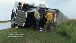
We briefly went north to come up on the tail-end of the meso, but then had to turn around to get out of the way of the older meso. After a few miles southbound we were getting hammered, unable to clear the meso completely. Chris pointed the van towards the WSW, into the wind. The rain wasn’t too bad, and I don’t recall any hail, but the winds were fierce and the trees around us were losing leaves. This was RFD wind, I suspect, on the south side of the action area just to our north. It was possible that a tornado was passing by to our north, but we could not see it due to wind and rain and cloud and spray. Perhaps we were on the southern fringe of a tornadic cuirculation. The wind barrage was bad for about a minute. I never felt that we were in danger, but it was borderline close! We sat for a few more minutes here (near Mount Jesus) to allow the storm to pass, and then headed back north. We soon came upon broken poles and trees and debris —– a tornado had definitely just moved through here! And, less than two miles north of our high point (where we watched the cell approach), three big rigs of empty cattle trailers were turned over on their sides on the road! The drivers were a bit dazed but unhurt. Wow—what a mess this would have been if the trailers had been filled with animals. This occurred where 34 jogs slightly, halfway between Sitka and Bucklin, and I think it is likely that the “lead” meso blew the rigs over. The cell continued to the northeast towards Greensburg (where funnel clouds and tornadoes were sighted), and we let it go as we made sure that the truck drivers were okay. Law enforcement was on the scene quickly. Later, we met up with the media gals (see May 22, 2008 summary) in Bucklin and played tag with new supercells around Greensburg and Medicine Lodge after sunset. From there it was a long four hours or so back to OKC. May 23rd had been a very long day and a very exciting day—-another great chase day in Kansas!
The “Mount Jesus” storm moves off to the northeast.

Leave a Reply
You must be logged in to post a comment.