A lone, isolated supercell was a prolific tornado producer as it moved slowly through Kingfisher County and Garfield County in Oklahoma on May 24, 2008. The tornadoes were not exceptionally large and long-lived, fortunately, but it was a bonanza tornado day for storm chasers who managed to reach the storm by 3 p.m.
Time lapse/music video montage here!
*****
Here we were in Oklahoma, minding our own business and trying to get to Kansas, when a bunch of tornadoes got in our way! This was a wild and crazy and entirely unexpected chase day. It was a Saturday, the first day of Tour 3 out of OKC. The two days prior had been quite fruitful for me in Kansas, and I was somewhat beat. We didn’t get back to OKC until 3 a.m. Saturday morning after chasing a tornadic supercell through Clark County, Kansas, on the 23rd. At 9 a.m. I and my Tour 3 drivers were up and getting the three vans cleaned and the oil changed. We met the guests for the tour orientation at about 12:50 p.m., and I spent about 25 minutes going through the routine of the safety guidelines and what to expect on a stormchase tour. I wanted to get on the road as soon as possible, as I figured that severe weather was again likely in Kansas, or perhaps Nebraska. I had not looked at any weather data yet. Chris G., free from the tour group now, called me just after orientation. He said that a tornado watch was already in place for north-central Oklahoma, and a storm was developing near Enid, just 65 miles north of OKC! Apparently an outflow boundary from the nighttime convection in south-central Kansas had sagged south into Oklahoma, and was hung-up east-west in the Enid vicinity. Low-level convergence on the boundary was helping to initiate storms. The boundary would serve as a locus for increased low-level vorticity…and the tornado threat could be high for a storm that could ride the boundary. The storm referenced by Chris became a prolific tornado producer, and we managed to be there for most of them!
I learned of the first tornado at about 2:30 p.m. as we were grabbing goodies and doing the “pit-stop” stuff at a convenience store on I-35 and Route 51. This location is about 30 miles due east of Hennessey and 40 miles east of Lacey. Our 15-20 minute stop was unfortunate, as we missed what may have been the most photogenic, approachable, and long-lived tornado of the day. This tornado was caught by an Oklahoma City TV news helicopter, and broadcast live on cable news channels nation-wide. The tornado struck a pig farm near Lacey, OK (in Kingfisher County). The SPC tornado log indicates a time frame of 2:27 p.m. to 2:39 p.m., tracking from two miles west of Lacey and lifting at Lacey. My video log shows that our tour group was still about 25 miles east of Hennesey (and 35 miles east of Lacey) at 2:43 p.m. So, even if we had not stopped it is doubtful that we would have observed the Lacey tornado.
Chris called to say that he could see the Lacey tornado as he approached from the north and east. Another friend of mine was phoning me as we pressed westward towards Hennessey. He was giving me the play-by-play of the Lacey tornado as he watched it on TV. Great—we are under 30 minutes away from a destructive tornado and we have nothing yet. Is this thing going to hang in there, or is the storm going to fall apart as we arrive? We had the perfect intercept route to the storm and would be right there in no time. But no time takes forever when a tornado is on the ground. Would we wind up disappointed, a day late and a dollar short?
We were seven miles east of Hennessey at 2:57 p.m. and closing fast, close enough to see a wall cloud with the supercell. According to the SPC log, a second tornado tracked from two miles northeast of Lacey to five miles northeast of Lacey from 2:45 to 2:56 p.m. (So, based on these storm reports, we missed a second tornado, or a reincarnation of the first Lacey tornado.) At 3:01 p.m., from three miles east of Hennessey, I observed a tornado in a roping-out stage, perhaps ten miles to my west-northwest. And, as we came into Hennessey at 3:05 p.m., we had an excellent look at the storm structure to our northwest.

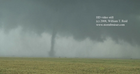
Finally—we were in Hennessey and on the storm. The cell was poised to cross U.S. 81 north of Hennessey, and law enforcement had the route closed. They permitted our group to proceed when I told an officer that we were a chase tour group. At 3:08 p.m. and a mile north of town, a tornado was fully developed to our west-northwest. It was already “lifting” fifteen seconds later:
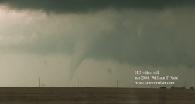
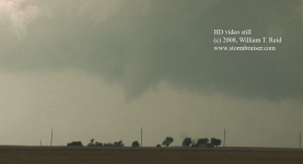
Was this still the original “Lacey” tornadic circulation? I would say “fairly likely,” though I don’t know for certain. This old (occluded) circulation was near the west edge of the supercell’s updraft base. Meanwhile, a larger and lower base that was associated with the next phase of the cyclic supercell was looming to our north, close to Bison. The original mesocyclone produced again, however, and we stopped a little west of U.S. 81, a mile and a half south of Bison. This, again, was (probably) the latest version of the intermittent “Lacey” tornado. We viewed a nice slender, ghostly, “cone-shaped” tornado several miles to the west, and this time it stayed on the ground for few minutes. Contrast was rather poor against the hazy skies behind it, as the sun was still high in the sky.
The stills above are from 3:11 p.m. to 3:15 p.m. The SPC log indicates that this tornado was in Kingfisher County, four miles southwest of Bison from 3:07 to 3:16 p.m. It was very close to the (east-west) Kingfisher/Garfield county line by 3:15 p.m.
The next move — get thee in position for the possible big show with the new meso! From the looks of the broad and black lowered area to our north, I was concerned that a very large tornado was possible. I wanted to be east of the updraft base, and elected to head back south to Hennessey and to take 51 east. After eleven miles we turned north on section road N2980 (if I am recalling correctly!). The storm was moving slowly eastward, giving us plenty of time to get back into position on its east side. At 3:45 p.m. we were four or five miles north of Route 51, and a new tornado was again in progress, to our west-northwest.

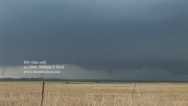
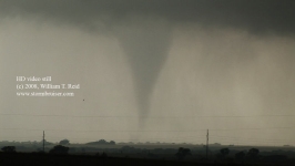
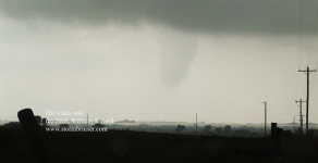
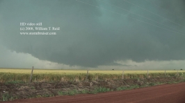
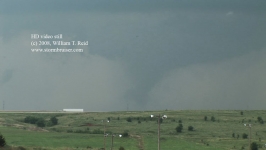
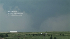
Somewhat true to form for this storm, the tornado was brief. The condensation funnel had disappeared by the time I had the camcorder on the tripod at 3:47 p.m. (image on right side above). The SPC log has this tornado in Garfield County, eight miles southwest of Douglas (or seven east of Bison), from 3:45 to 3:48 p.m. As I write this summary (September 2008), this is the fourth and final tornado report in the SPC log for this storm.
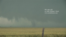
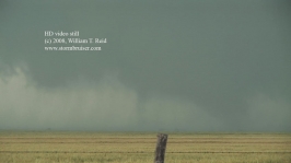
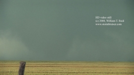
We got back into the van and moved another few miles north, stopping some nine miles north of 51 on Rd N2980 (just a mile or two southwest of Douglas). We were here from about 3:52 to 4:06 p.m. CDT, during which time the “action area” neared, first to our west-southwest, and eventually to our south-southwest. We were finally set up, in position, with good contrast, relatively close…and the storm refused to produce a tornado. Well, maybe not. Low-level rotation in the updraft base was persistent and strong, and a shallow wall cloud with stubby funnel clouds may have been stirring the earth below on occasion. The first four images below are structure shots looking southwest about 3:53 p.m. CDT. The funnel cloud was to our southwest at 3:57 p.m.
Our best route east was a mile or so to our south, so at 4:08 p.m. we dropped down to E0540 Rd., turned left, and went east a little. The lower right image above is looking just south of due west along our east-west section road in Garfield County, south of Douglas by two miles, at 4:12 p.m. A prominent, grayish, lowered area is near the center of the image, and I believe it is this area which would soon produce the next tornado. Note the nearby swath of precipitation. Up until this point, today’s tornadoes had been relatively well-removed from any precipitation cores. Now, a prominent “hook” was developing, and the mesocyclone was beginning to wrap moderate to heavy precipitation curtains around the west and south sides of the “tornado cyclone”. The supercell was transitioning to HP—high precipitation. Lightning activity increased to the immediate west, too. Someone in our group radioed, saying that there was a better high point just up the road to the east, so we went another mile or so east on the dirt road.
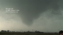
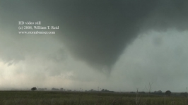
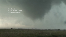
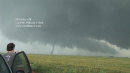
When we stopped and looked west again, a large funnel cloud dominated the sky. The seven video still images above were taken from 4:16 to 4:20 p.m., along E0450 Rd, about two miles south or south-southeast of Douglas. The tornado is about a mile distant to the west-southwest. Here are some higher quality digital stills:
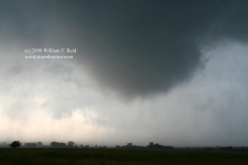

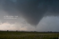
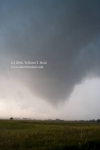
The tornado was a multi-vortex type in its initial stages, and was reluctant to exhibit a full condensation funnel. As it grew near, wraparound rain curtains began to impact our location. I could not risk loitering on an unpaved road that was getting wet with a tornado at close range, so we quickly jumped back into the vans and moved east another mile or two. Strong winds carrying heavy rain smacked us from the south. I looked behind me and briefly videoed the tornado through the wet window. It figured—the condensation funnel was fully developed now. I was unable to get quality video or stills despite being so close!
At 4:22 p.m. we stopped again to take a look behind us. The tornado was skinnier now, and a little north of our east-west road. The two stills below were along E0540 Rd, near Rd N3020, southeast of Douglas.
We moved another mile or so east to escape more hook-echo precipitation. It was fairly dry at N3030 Rd (one mile west of paved Route 74), and I had time to set the camcorder onto the tripod. The tornadic circulation was to our west-northwest. Precipitation curtains were moving at fast-forward speeds, and funnel clouds quickly touched down and then dissipated. After a couple of minutes, a larger, nearly wedge-shaped tornado funnel was obvious (fifth image below), but the contrast was poor and it did not last more than a few seconds. This storm featured a large, very low, and strongly rotating base: tornadic or near-tornadic winds must have been impacting a large area. The six images below are from 4:27 to 4:29 p.m., and the tornado was about two miles east-southeast of Douglas and moving north to northeast.
This “Douglas” tornado cyclone continued for at least another 15 minutes, east of Douglas and west of Highway 74 in Garfield County. Contrast was very poor from our perspective along Highway 74, but the video stills (below) show a pronounced lowering and condensation funnels hard against the land. The first two below are at 4:36 p.m., east-southeast of Douglas on 74 and looking west to west-northwest. We went a couple of miles north, hoping for improved contrast on the tornado. We stopped two miles south of Covington and had a good look at the storm structure, but it was still difficult to confirm a tornado. The lower two images below are looking west-southwest to west at 4:42 p.m.


At this point the supercell was fully high-precipitation in character, and seeing a tornado safely was difficult if not impossible. We needed to get out of the way again after several minutes, to the east option, two miles to the north. We went north and soon had hailstones near tennis-ball size slamming our vicinity. Fortunately, the big ones missed the vehicles! I took a short cut around the south side of Covington and emerged on Route 164 eastbound, which took us through Hayward and Lucien. Heavy rain and hail forced us farther east, much farther east than I would have liked, all of the way to U.S. 77 (12 miles east of Covington). There was no way that I was going to use an unpaved road south in the wet weather, and U.S. 77 was the next paved option.
As we repositioned to the east in the rain, it was not possible to see if a tornado was still in progress or not. This tornado near Douglas does not appear in the Storm Prediction Center’s reports log for May 24th. Based on my video and recollection of the roads we utilized on the chase, I would say that the tornado track was roughly from 2S Douglas to 2E of Douglas from 4:15 to 4:42 p.m., and quite possibly beyond 4:42 p.m. while it was rain-wrapped. Though full condensation funnels tended to be transient with the tornado cyclone, I surmise that tornadic winds were impacting the Oklahoma landscape for much, if not all, of this 27-minute time frame.
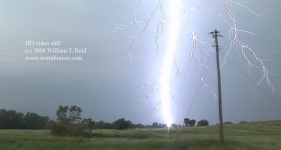
By 5:10 p.m. CDT we had reached U.S. 77 (at Route 164) between Lucien and Perry. We dropped a mile or two south and were free from precipitation, with a decent view of the storm structure to our west-southwest. If there was a tornado with the cell, it was not visible from our perspective. Heavy precipitation was not too far to our north and northwest, and we soon found ourselves in the midst of a CG barrage (that’s cloud-to-ground lighting bolts!). I had everyone quickly get back into the vehicles, and a few more strikes hit very close to us. The thunder blasts were so loud that my ears were actually hurting slightly for the next few hours. One of the strikes must have hit a telephone pole no more than 30 yards away. On the closest strike, I heard a loud SNAP just prior to the boom. The camcorder’s audio can never do justice to the volume of these thunder crashes!
The supercell continued its slow eastward movement through Garfield County, and the “action area” persisted about halfway between east-west routes 51 and 164. We dropped back down to Hwy 51 between Orlando and Mulhall, and became part of the chaser hordes. A lot of the locals had little to do on this Saturday afternoon, and the storm was the best show around. We stopped a mile or two west of U.S. 77 on Route 51, with a view of the storm to our northwest. The cell was very HP. There were some suspicious lowerings and funnel-like clouds near the southern edge of the precip core, but we did not observe any tornadoes with the storm during from this location (from about 5:20 to 5:35 pm.).
Interstate 35 was only three miles to our east, so we drove back to the convenience store that we had visited about four hours earlier for a pit stop. This was a near a nice hilltop with a good view of the storm. At 6:03 p.m., a decent-sized tornado was again visible (though with low contrast) to our west-northwest. It was perhaps six to eight miles distant and dissipated at 6:06 p.m. I would roughly place this tornado about 3-4 miles west-northwest of Orlando, OK. Another tornado (final image below) was a mile or two to the north of the roping-out tornado at 6:06 p.m.
With the storm in HP mode and moving towards Interstate 35, I elected to find another high point near Lake McMurtry, between Perry and Stillwater. The storm exhibited decent structure, wall clouds and RFD cuts as it moved near Perry, but we observed no additional tornadoes. A crazy media chaser was doing a radio play-by-play of chaos and tumult in the vicinity of Perry. We relaxed and watched the storm from our hilltop a few miles away. Sometime later we decided to make a move north to see if there was something to see. There were several cells by this time and none was in a tornado-ing mood. After stopping to watch a nice CG show north of Perry, we continued north to Salina for the night.
This was one of those chase days that make up for the frustrating ones—the ones where you do everything right, but something conspires against you and you miss the show. Today was a day where I didn’t even make a forecast, I didn’t have a clue as to the conditions before getting into the van around 1:20 p.m., and everything wound up falling into my lap just an hour or so later. Also, it is also worth mentioning that the tour-turnaround periods are almost always a big negative. These changeovers have cost me potential big days several times through the years, since I have to be somewhere besides the (presumed) best area for chasing. This time, had there not been this weekend change from Tour 2 to Tour 3 in OKC, I likely would have awakened deep inside Kansas on the 24th. And, like most chasers this day, I may have targeted KS or NE and would have totally busted.
How many tornadoes did we see? It definitely depends on one’s definition of a tornado. If the same wall cloud is occasionally producing tornadoes over say, a 20-30 minute period, does one count each “touchdown” as a different tornado? Or is it really just one “tornadic circulation”, one “tornado”, but with intermittent “touchdowns”? The latter definition is probably more realistic or proper. Using this conservative definition, we observed perhaps five or six tornadoes in Garfield County.
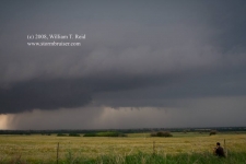
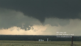
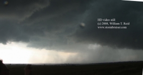
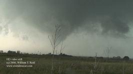
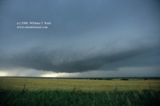
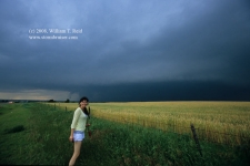
A few slide scans from this day below:
















Bill says
Excellent stuff!