By noon-ish we were heading east along I-80 in central Nebraska, near Kearney. The outlook for significant tornadoes on this day was very good from NC KS northward through NE. The very latest computer forecast models were not in great agreement. One showed the best supercell-and-tornado-making parameters around south-central Nebraska, close to where we were. Another model suggested north-central Nebraska. We lingered close to I-80 during the early afternoon, poised to blast north if we needed to. A storm went up between Holdredge and McCook to our southwest. It was moving towards us and was an easy catch, and we got right in front of it west-southwest of Kearney by maybe 20 miles. Low-level structure improved quite a bit as the cell approached. We had a nice supercell, and it was moving into better dew points and a wind field favorable for tornado development.
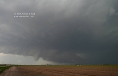
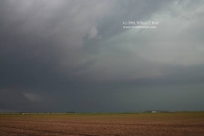
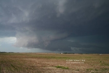
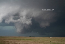
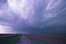
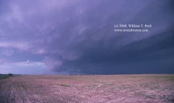
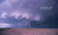
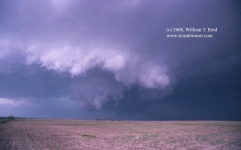
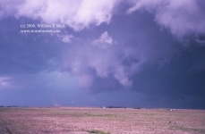
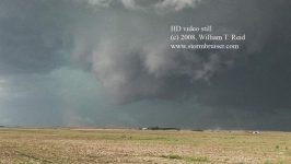
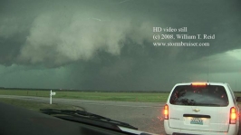
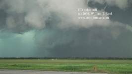
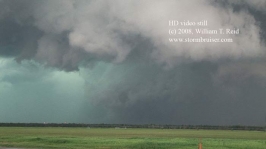
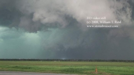
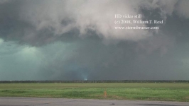
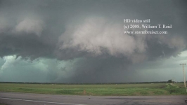
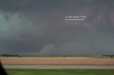
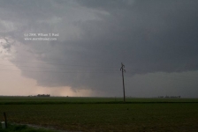
The four images above are from 4:38 to 4:54 p.m. CDT, looking WNW, about seven miles south of Odessa (a bit west of Odessa-Funk Road on County Road 473). There was fast motion in the wall cloud and even a brief dusty spin-up beneath. The image below, at 4:55 p.m., shows some RFD dust and some dust/debris perhaps due to a weak tornado.
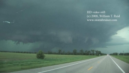
As the updraft base and incipient tornado neared, I had to figure out how we were going to stay with this thing. The storm was moving just north of due east, towards Kearney. One option was to head north towards Elm Creek in order to get to I-80, but it appeared that precipitation and possibly large hail would be part of the equation. Interstate 80 was the only obvious paved option east. I certainly did not want to use a dirt road if a tornado was breathing down our necks. (SPC storm reports indicate that golfball-sized hail was observed at Elm Creek at 4:48 p.m. and at Odessa at 5:05 p.m. At 5:03 p.m., “75 to 80 railroad cars were derailed” by strong winds one mile east of Odessa! Also at this time, a tornado was reported four miles south of Elm Creek. The time given for this tornado report may be a little late.) The best east option was the unpaved section road 742/R Rd. This required a mile jog south. We were followed by a dozen or two chasers eastbound on this little farm road! After nine miles we turned north on state road 44, towards Kearney, and three miles farther north the camcorder had this view:
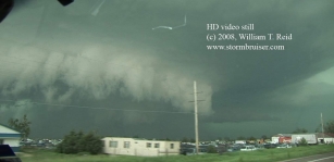
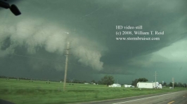
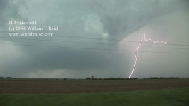
The images above are at 5:19 p.m., about four miles south of Kearney, as the tornado was approaching the west edge of town. We went about two miles east on 50A and stopped. The tornado was impacting Kearney, about four miles to our north-northwest. The tornado did not have a full condensation funnel to the ground. It was somewhat of a broad, rain-wrapped circulation without a classic tornado look to it. Occasional power flashes were observed as the tornado impacted the Kearney power grid. The six video stills below are from 5:24 to 5:26 p.m. The tornadic “action area” is just behind the brighter area (the clear slot).
The storm was moving east or ENE at a decent clip, maybe 40 mph, so we needed to keep moving. We went north on Route 10 to I-80, and eventually east on U.S. 30 to Wood River. We were in decent position here to view the storm to our west and WSW. However, the cell was deep into HP mode, any tornado was heavily rain-wrapped, and we were in light-moderate rain with occasional CGs and could not stop and enjoy the view!
As we hopped back eastbound on I-80 towards Grand Island, one or two of my guides thought that we should consider dropping south to the younger supercells in north-central Kansas. This was a good idea, as our cell’s fast motion and HP character made it a poor chase candidate currently. I was hesitant at the time, though, to abandon a proven tornadic storm. I did decide to drop south into Kansas once we were east of Grand Island, but the south option I chose wound up being slow and ill-advised. We stopped at a convenience store, and ten minutes turned into about twenty, and we basically had missed our opportunity to get on the very nice tornadic supercell near Beloit (due south of Grand Island). As dusk fell, we watched a supercell south of Belleville, Kansas.
This was a very active severe weather day in Nebraska and Kansas, and we made a good forecast and some good and bad chase decisions. Overall I feel somewhat disappointed, as we were in perfect position for the Kearney storm when it was NOT producing, and we were driving and re-positioning and somewhat far away when it WAS producing. I wish I had continued north to I-80, south of Kearney, instead of turning east on 50A. That would have given us a much better look at the Kearney tornado. I also wish I had blasted south out of Grand Island at my earliest opportunity to get into Kansas. Oh well, you can’t be too hard on yourself when you witness something like we saw today!

Leave a Reply
You must be logged in to post a comment.