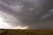
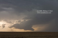
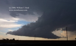
My target area of Clayton and vicinity proved good….to some degree. We began in Las Vegas, NM, and headed east to Clayton. After lunch in Gladstones, a couple of cells developed NW and N of Clayton. The north one was better early on, but we stuck close to Clayton and the southern cell. For about 20 minutes this southern cell (just WNW of town) had a great look, with a wall cloud and perhaps some tornado potential. But, it began to belch much too much precip, and the rain-cooled air spilled southward and undercut the updraft. Game over. We wandered north into SE CO hoping for something else, but the storms that developed remained weak. We should have drifted SE into W TX, towards Muleshoe, where several big hail storms went up. The shots below are looking W to WNW. The first one is prior to the outflow undercutting the updraft base.
William T. Reid


Leave a Reply
You must be logged in to post a comment.