Stormbruiser.com

William T. Reid

  • About
  • Video Links
  • Climate
  • Categories
    • Astronomy
    • Aurora/Northern Lights
    • Artsy
    • Airports (LAX and VNY)
    • Animal Day
    • Beach
    • BEST and MOST POPULAR
    • Chase Season Summary
    • Chasers and friends
    • Cumulonimbus
    • Death Valley
    • Desert
    • Desert/Mountains
    • Elevated photography
    • Eyesores
    • Fire
    • Flooding
    • Hurricane
    • Landscapes
    • Lightning
    • Local: Conejo Valley/San Fernando Valley
    • Mid and High Clouds
    • Nighttime photography
    • Old Stuff
    • Rainbows/Optical Phenomena
    • San Nicolas Island
    • Storm Video Sales
    • Stormy Skies
    • Stupid Bugs
    • Sunsets and Storms
    • Supercells
    • The City
    • Tornadoes
    • Unusual Clouds
    • Vegetation
    • Wind and Dust
    • Winter Weather
  • Contact
You are here: Home / 2008 / June 24, 2008 Isabel, SD Cumulonimbus and mammatus sunset

June 24, 2008 Isabel, SD Cumulonimbus and mammatus sunset

June 24, 2008 By Bill Leave a Comment

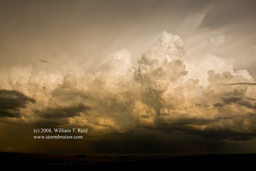
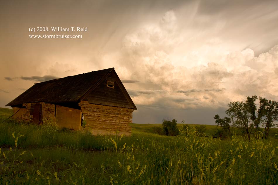
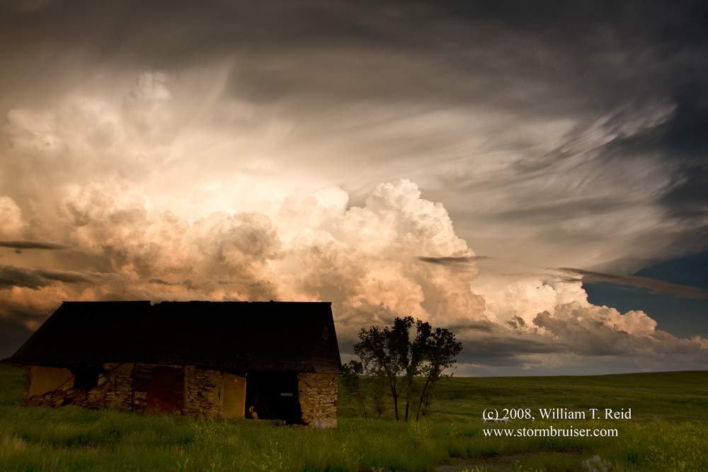
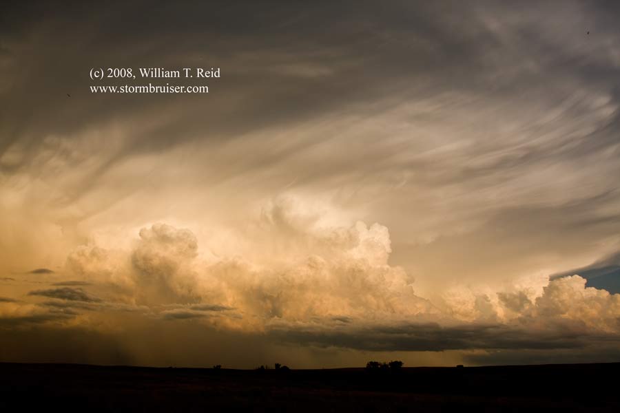
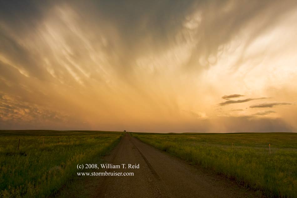
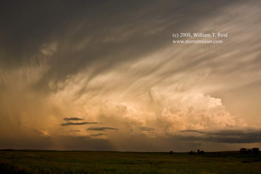
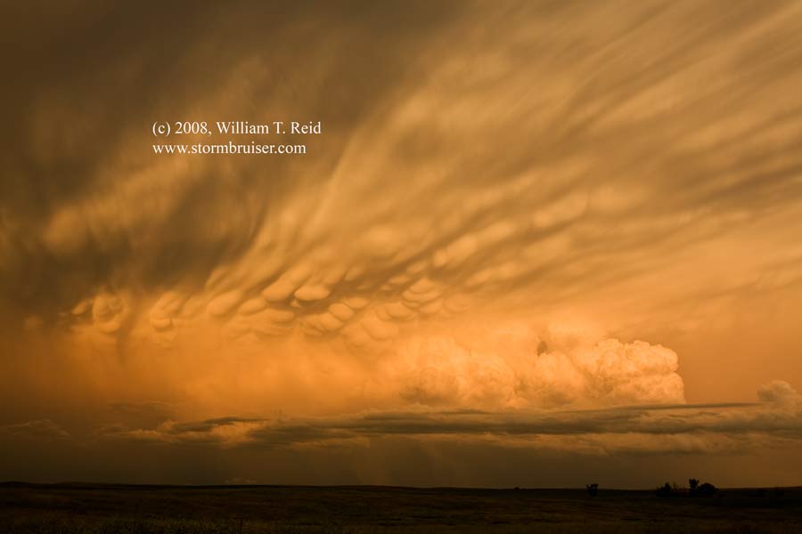
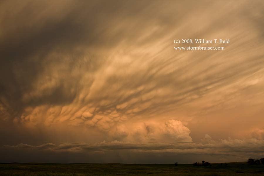
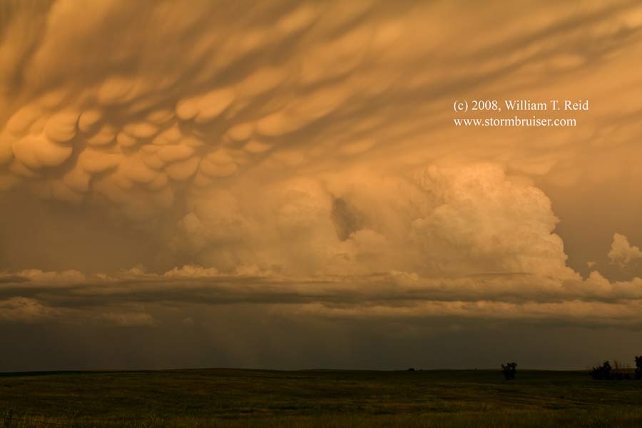
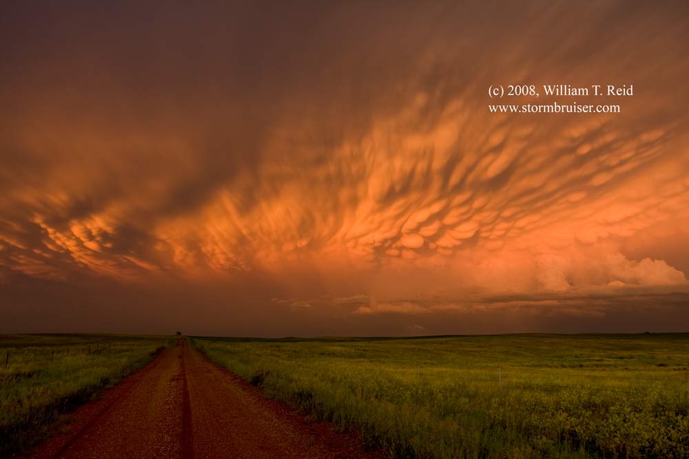
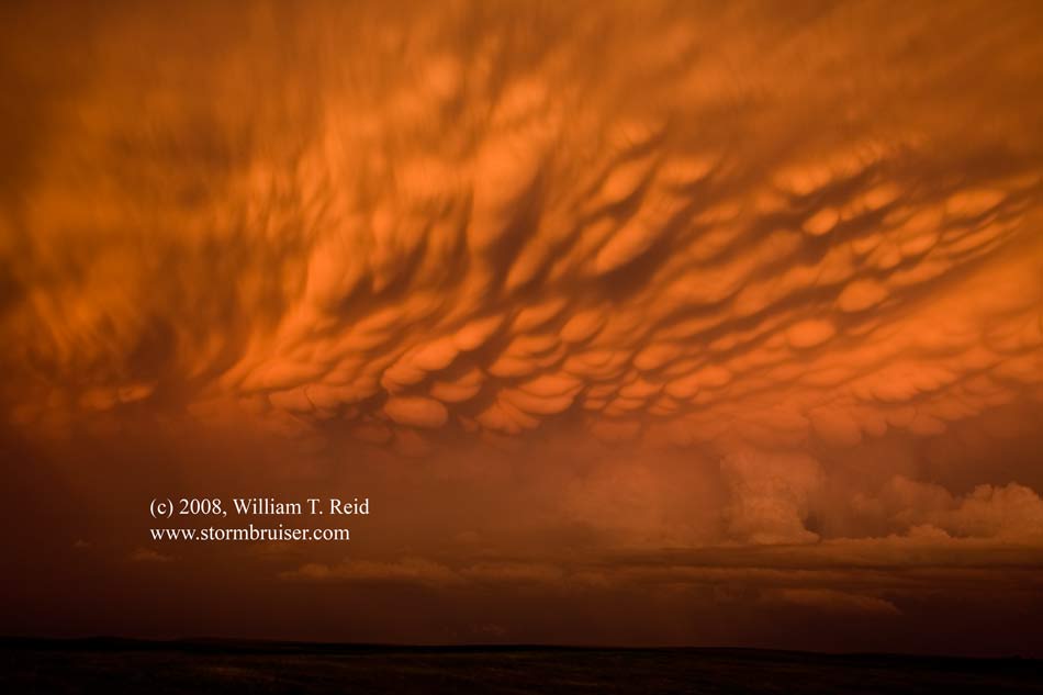
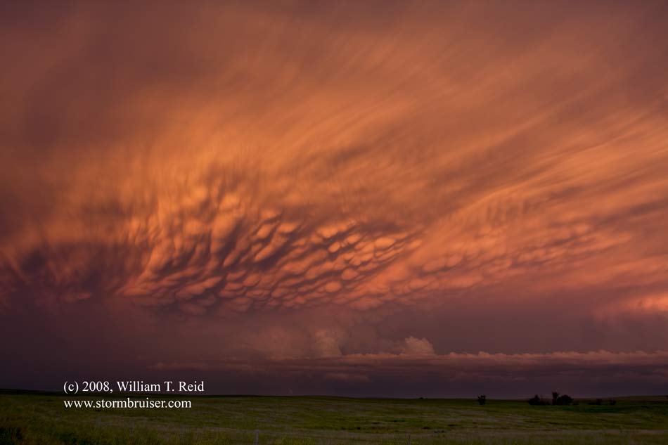
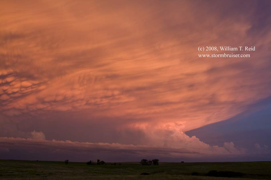
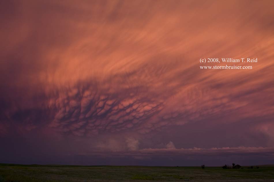
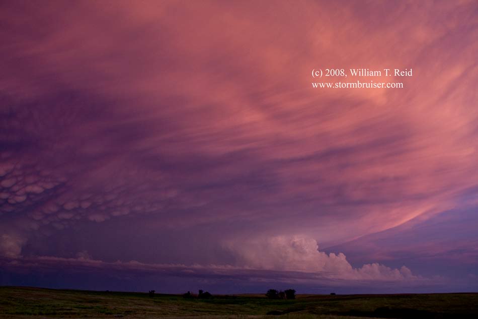
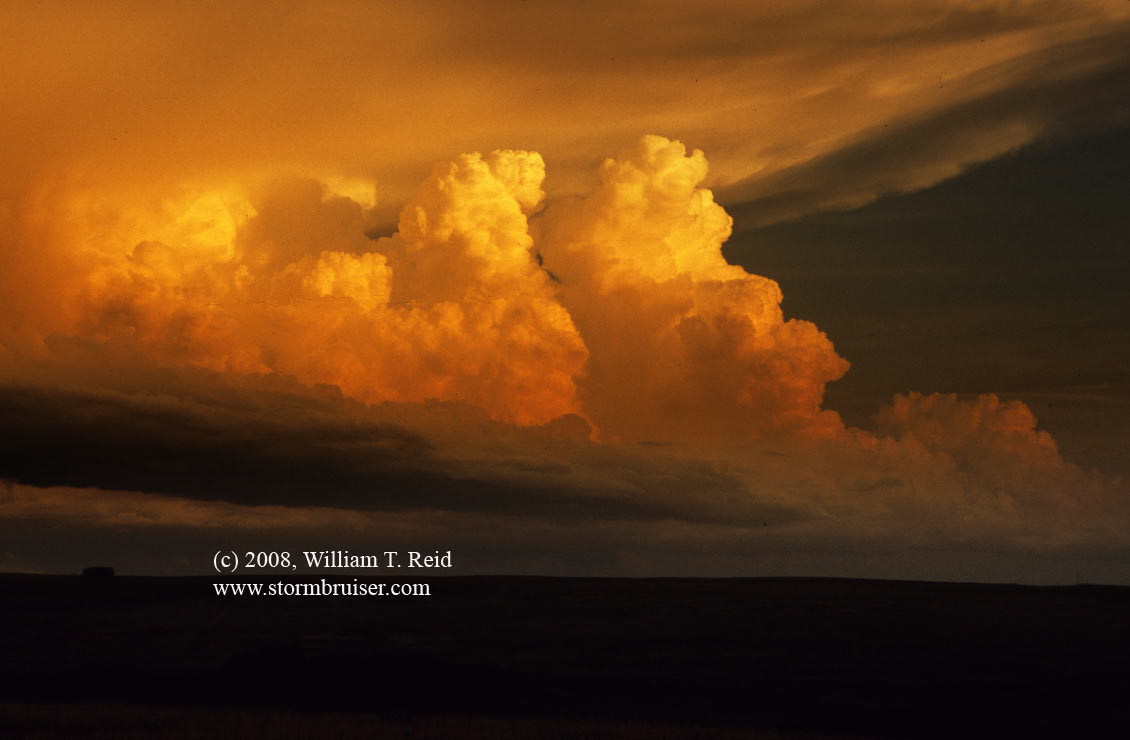
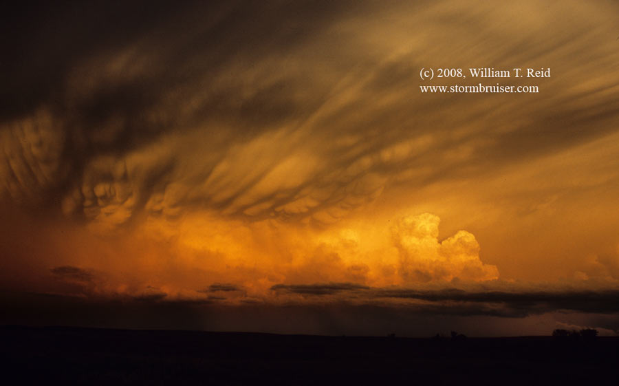
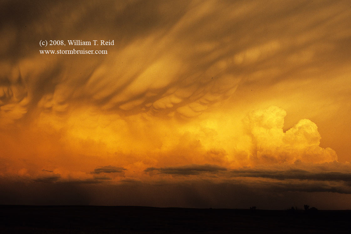
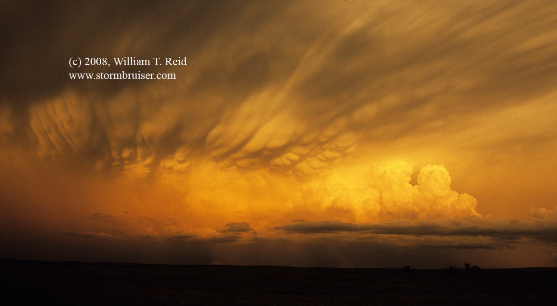
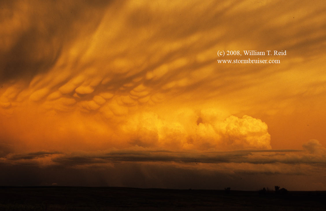
A long and somewhat disappointing day culminates in a spectacular sunset on the back side of severe storms in Corson County, SD.

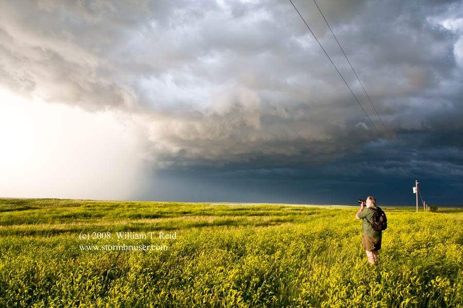
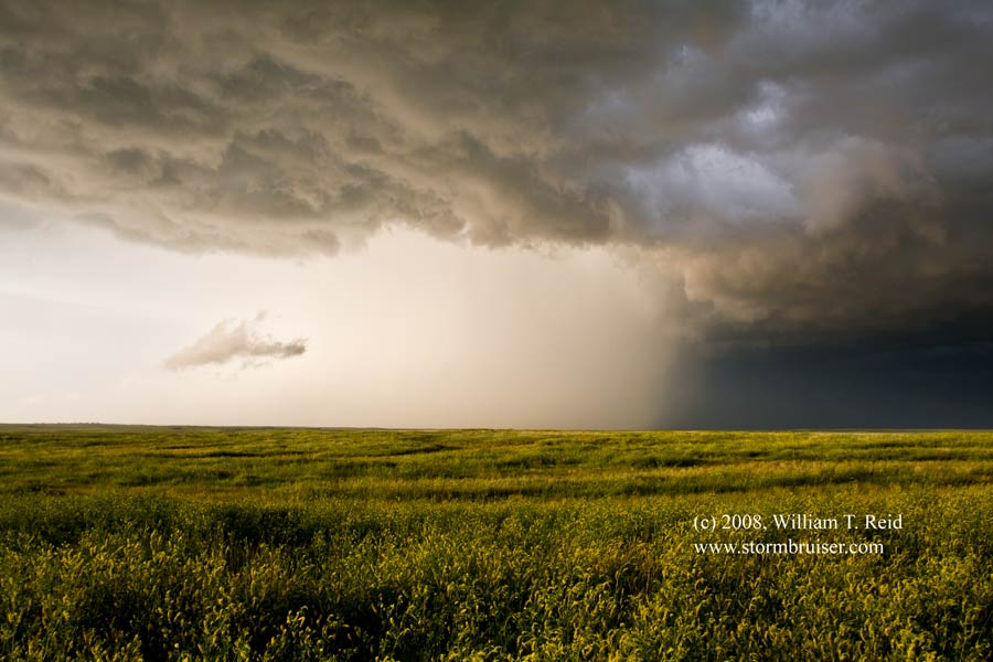
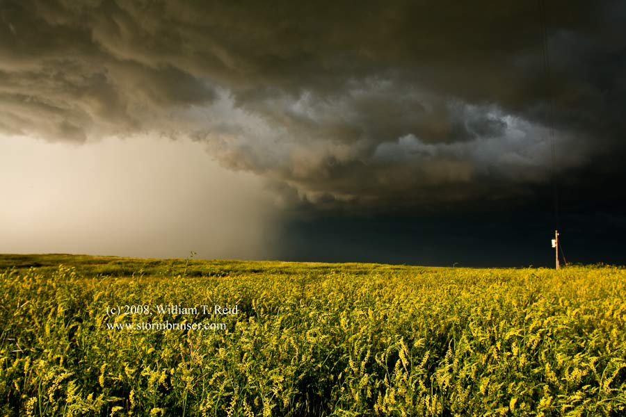
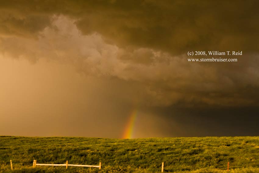
We started out in Valentine, and targeted northwest South Dakota. From Bison, SD, we watched some strong convection go up to our north in SW ND. That activity appeared to be multicell with minimal tornado potential, so we held out hope for something isolated and stronger nearby. A cell did manage to go up west of Mud Butte, and we watched it fizzle to our west from a high point along U.S. 212. In order salvage something today, we went east and north back towards the ND storms, which were edging into Corson County, SD. This convection was somewhat linear, but with a nice look on its tail end. We stopped a little south of the storms at Isabel, where I finally had a cell phone signal (actually, I didn’t — I had to borrow the a cell phone from a guest!). I had a heck of a time booking about 11 rooms for our tour —- Pierre, Eagle Butte, Mobridge, all with no vacancy! I managed to get rooms in Lemmon, SD, on the SD/ND border. Sunset was approaching, and we headed north out of Isabel to get a closer look at the convection. The tail-end cell was a nice hailer, and we came up behind it to find a bunch of one-to-almost-two-inch hailstones littering the green fields. As the storm moved ESE, we stayed put and watched the mammatus display unfold in that direction. Our camera lenses feasted upon the vivid colors while the mosquitoes feasted upon our hemoglobin.

08jun24_isabel_sd_cb_1659.jpg08jun24_isabel_sd_cb_1660.jpg08jun24_isabel_sd_cb_1669.jpg08jun24_isabel_sd_cb_1675.jpg08jun24_isabel_sd_cb_1679.jpg08jun24_isabel_sd_cb_1680.jpg08jun24_isabel_sd_cb_1683.jpg08jun24_isabel_sd_cb_1696.jpg08jun24_isabel_sd_cb_1702.jpg08jun24_isabel_sd_cb_1703.jpg08jun24_isabel_sd_cb_1708.jpg08jun24_isabel_sd_cb_1709.jpg08jun24_isabel_sd_cb_1712.jpg08jun24_isabel_sd_cb_1723.jpg08jun24_isabel_sd_cb_1725.jpg08jun24_isabel_sd_cb_1727.jpg08jun24_isabel_sd_cb_1729.jpg08jun24_isabel_sd_cb_1733.jpg08jun24_isabel_sd_cb_1735.jpg


old-fashioned slide scans below:

08jun24_isabel_sd_cb_08ja20.jpg08jun24_isabel_sd_cb_08jb03.jpg08jun24_isabel_sd_cb_08jb26.jpg08jun24_isabel_sd_cb_08jb29.jpg08jun24_isabel_sd_cb_08jb31.jpg

Filed Under: 2008, Cumulonimbus, Sunsets and Storms, Unusual Clouds

Leave a Reply

You must be logged in to post a comment.

Search

June 2008
S M T W T F S
1234567
891011121314
15161718192021
22232425262728
2930  
« May   Jul »

Categories

Archives

Copyright © 2025 stormbruiser.com ยท Log in