This entry affords a quick look at my chase season. Scroll down through this page to access the chase day entries from late April through June. If a particular image catches your fancy, then you might consider clicking on the date for more of the same, and good luck getting your fancy back.
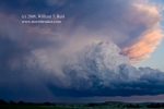
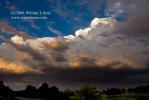
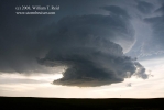
My chase season as a whole in 2008 was a little more active compared to normal, in terms of decent chase days (severe weather, good lightning display or cloud structure, etc.) There was only one really poor stretch with a Death Ridge, from May 16 to 19. There was something worthwhile to chase on the Plains practically every day after that. Tornado-wise, the season was close to normal for me…maybe a little better than normal. I witnessed perhaps 15 tornadoes on the three days from May 22 to 24. There were no other big tornado days for me, only a handful of weak or brief tornadoes. Photography-wise, I am fairly satisfied with my efforts this spring. Forecasting and chase strategy-wise, I made no big bonehead blunders, but naturally I’d like to have a few days back to do over. Give me a holler at
bill@stormbruiser.com
if you would like to say “hello” or comment. And, if you are new to stormbruiser, “Welcome!”, and check back from time to time. The photo “galleries” section remains empty, but I am hoping to get some time to work on that before next spring.
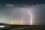
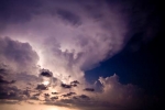
April 26 ^ This San Angelo supercell was quite healthy, and was a great start to the chase season. Nighttime brought excellent CGs for the CCDs.
May 1 ^ HP fun in southeast Kansas, without the tornado muss and fuss.
May 3 ^ Balloon launches at NWS FTW on a down day
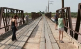
May 4 ^ The Hollis Bridge of Doom almost gets its sandy revenge
May 5 ^ This supercell sent softball-sized hail hurtling earthward upon the citizenry and infrastructure of Garden City, Kansas…no doubt resulting in a negative impact on a garden or two. Bruiser wouldn’t have it any other way.
May 6 ^ The Texas Panhandle finds itself beneath convective bliss
May 7 ^ The Red River of the South is privy to severe storms.
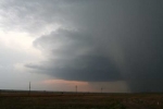
May 8 ^ A beautiful supercell in western Kansas has its way with Jetmore.
May 9 ^ An isolated supercell treks across the central High Plains, but cool outflow greatly minimizes tornado potential, sparing dozens from harmful winds.
May 10 ^ Images of the long-track Picher, OK, tornado obscured by precipitation. Sorry.
May 13 ^ A cell north of Mineral Wells, TX, amused us for an hour.
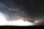
May 14 ^ A strange-looking LP near San Angelo is followed up by a beast, at a town named Brady.
May 15 ^ A nicely-sculpted Mexican HP cell fails to produce proper I.D. and forges into Texas, at Eagle Pass.
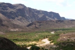
May 17 ^ Death Valley was not convenient for Death Ridge adventures, so we visited Big Bend.
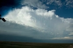
May 20 ^ It’s great to be back on the Cheyenne Ridge! A beautiful, isolated storm put on a colorful display at sunset.
May 21 ^ Who cares about this day? The good stuff is fast approaching.
May 22 ^ Tornadoes at last! A tornado-crazy supercell skirted Grainfield, Hoxie, and Dresden, Kansas.
May 23 ^ In southwest KS, a very strong tornadic supercell bisected Clark County and took aim on Greensburg.
May 24 ^ A plethora of tornadoes was observed with this isolated supercell near Enid and Perry, Oklahoma.
May 25 ^ We fiddled around with some mildly interesting Kansas storms and missed the biggie at Parkersburg, Iowa.
May 26 ^ Storm chaser error: I abandoned the Pratt storm prior to tornado development.
May 27 ^ What makes a storm go mad? Certainly it was not the conditions on this fine day in OK.
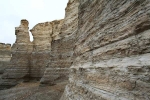
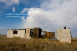
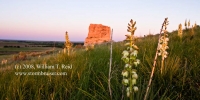
May 28 ^ We deemed this a positioning day into Nebraska for the following day, and visited Monument Rocks in western Kansas.
May 29 ^ Our tour was on the Kearney, Nebraska, tornadic storm like white on rice.
May 30 ^ The atmosphere made chasers in southeast Kansas wait all day before doing what it is supposed to do.
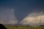
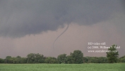
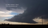
June 7 ^ A very entertaining and photogenic supercell produced a slender tornado near Downs, Kansas.
June 9-10 ^ Junky storms in NE and SD with Dallas Raines and company
June 11 ^ Storms were bunched up in NW Iowa, and we found one near Ashton which looked to be briefly tornadic.
June 12 ^ Severe storms near Emporia, Kansas, were wet and messy.
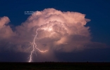
June 13 ^ An electric updraft gave our shutters a workout in southwest Oklahoma on this evening.
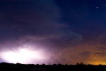
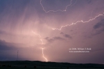
June 14 ^ A supercell trekked southward through the Palo Duro Canyon area, and another storm after sunset sparked enough to make lightning photographers out of us all.
June 15 ^ A healthy and wicked updraft base in Beaver County, Oklahoma, produced some dusty spinups.
June 16 ^ We played upslope and lost in northeast NM, and wandered around Solano.
June 17 ^ New Mexico did a little better than the previous day, but that’s not saying much.
June 18 ^ Tornadoes continued to be in short supply this June. A nicely-sculpted storm north of Kearney called it a day as we approached.
June 19 ^ Numerous cells along I-80 in the Nebraska Panhandle posed for us.
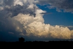
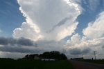
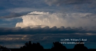
June 20 ^ A pretty CB reaches for the tropopause east of Littleton, CO, on a non-chase day.
June 21 ^ Jailhouse and Courthouse Rocks were emitting some sort of magic atmospheric stabilizer dust, effectively producing fair conditions in the Panhandle.
June 22 ^ This anti-cyclonically rotating updraft near Alliance, Nebraska, might look normal to you Aussie chasers.
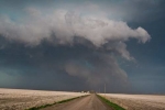
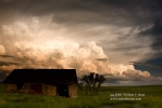
June 23 ^ A Sand Hills supercell that actually closely parallels a paved road! There is a God!
June 24 ^ This amazing sunset in Corson County, South Dakota, was broadcast in living color. Go ahead—click on the “June 24” link—it’s only five bucks.
June 26 ^ Thedford, Nebraska, had the pleasure of our presence on several occasions on this chase day. One cell north of town was a laminar-sided delight.
June 27 ^ Some weak activity in western Kansas was not good enough to aim the camera at…and never end a sentence with a preposition.
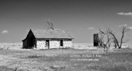
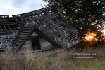
June 28 ^ Back to the Old House
August 15 ^ This doesn’t really count as a chase season event, but I run the show on this web site and can do what I want. Check out this thunderstorm at Los Angeles International Airport!









Leave a Reply
You must be logged in to post a comment.