
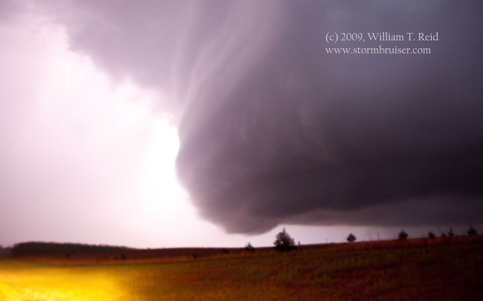
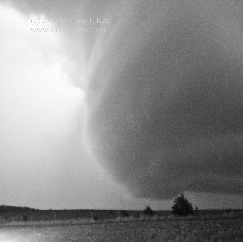
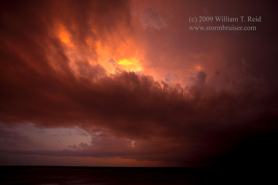
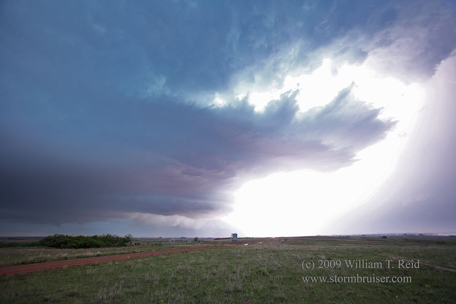
This was the first full chase day for the Tempest Tours guests on Tour One. Bob Conzemius and I started the day in Childress, TX, and targetted southwestern OK. We thought that the chances for a supercell were decent, if a storm could develop. A weak low pressure area in far western OK connected an outflow boundary to its east and a dry line to its south. For much of the afternoon we waited around Elk City, and finally, by 7 p.m., we started to see some decent convection to our north. We drifted north of Clinton, and a storm developed about 20 miles to our west, near Butler (in Custer County). This was an easy catch, and by the time we arrived the cell was well-oganized. Our position just west of Butler was nice, with a close look at a flanged base to the north and another base to the northwest. It began to rain, though, and I thought that it would be a good idea to get farther south and maybe west as the cell should start moving southeast. We rounded Foss Reservoir on its east side and south side as a tornado warning was issued for the storm. The western base became dominant, and when we stopped west of Foss Reservoir there was a nice spaceship look to the updraft, with plenty of lightning in the vault and anvil just to the north (first three images below).
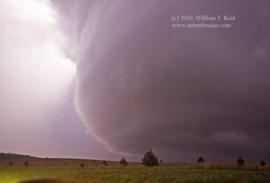
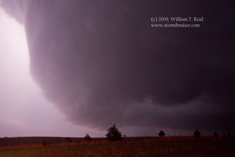
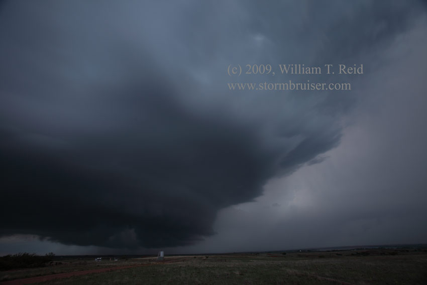
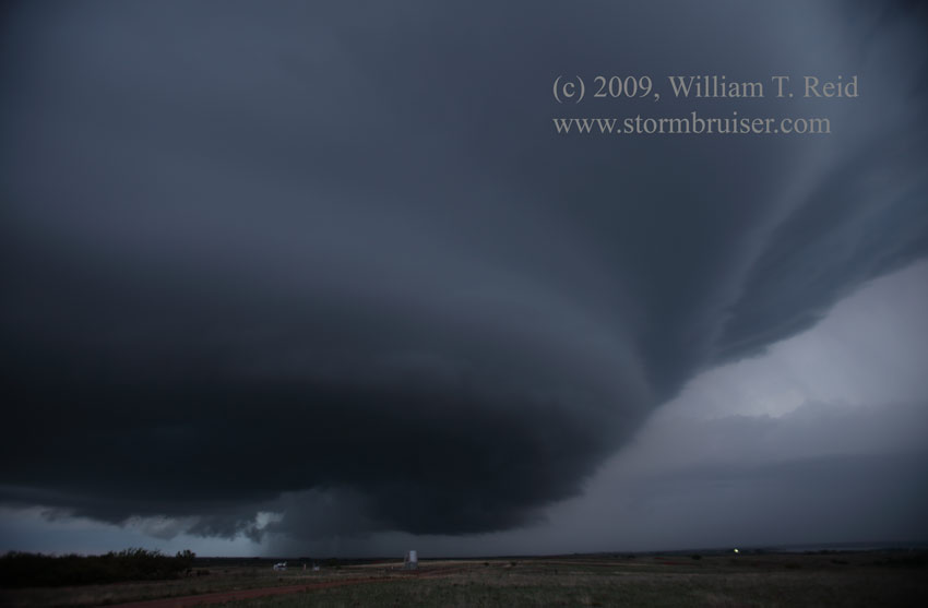
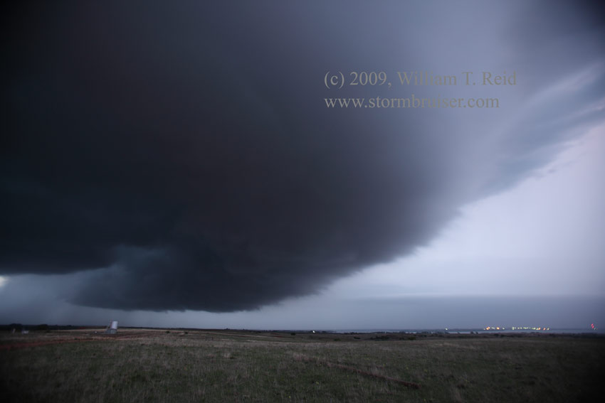
It was nearing 8:30 p.m. at this point, and a sharp RFD cut was making its way into the updraft as the cell drifted towards our location. The storm was now moving sharply to the right, to the SSE. The storm was rotating hard, but never displayed tight low-level rotation. We were greeted by some cool northwest wind and rain and got out of the way to the west by a couple of miles. Looking back to the east, a large “pregnant” base was crossing Hwy 73, near the south end of Foss Reservoir. It was getting dark, but the base was close and easy to see. We elected to try to chase it east and south, but some nearly two-inch hail convinced us to turn back to the west again after only two miles. This was fortuitous, however, as this allowed a great look at the back end of the very impressive rotating updraft to the east-southeast—-see images above and last two photos below. These handheld exposures were 1-2 seconds with the ISO jacked up to 3200, and illuminated by the frequent lightning.
Shortly thereafter the supercell weakened and died near Clinton.


Leave a Reply
You must be logged in to post a comment.