
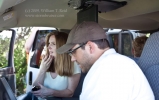
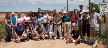
I know, I know, it has been far too long since I have posted. The past two weeks have been very busy, as usual. Tour… [Read More]
Archives for May 2009
May 28, 2009 Sutton County, TX storms
The forecast for severe storms in the Del Rio area persisted for May 28. It looked like the initiation area would be a few counties… [Read More]
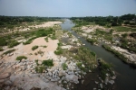
May 27, 2009 Rio Grande Lightning
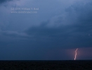
The target area on May 27 was around Fort Stockton, maybe 4-5 hours from Abilene. Well, that is if you don’t get a flat tire…. [Read More]
May 26, 2009 Weatherford, TX Hailstorm
The outlook for May 26th appeared even slightly better, with high CAPE forecast along a boundary between Wichita Falls and Fort Worth. We visited the… [Read More]
May 25, 2009 Northern TX Panhandle
Chase prospects for May 25th looked a little better than previous days, down in the TX Panhandle. We began the day in Fort Morgan, and… [Read More]
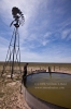
May 24, 2009 Scottsbluff Windbags

The tour 3 guests arrived in OKC on the 23rd, in the midst of a lousy weather pattern. On the 23rd we drove up to… [Read More]
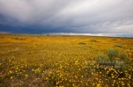
May 20, 2009 Northwest Nebraska storms
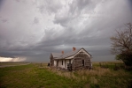
This chase day began in Rapid City, and we targeted the northwest Nebraska Panhandle. A storm went up on schedule and looked somewhat impressive, near… [Read More]
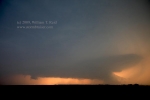
May 19, 2009 Alzada, MT Virga BOMB!
Whoohoo! Our chase team intercepted a very high-based storm cell in extreme southeastern Montana, and photographed precipitation which may or may not have reached the… [Read More]
May 17, 2009 Go northwest, young tour group
Following the chase on the 15th in Missouri, the weather pattern went terribly sour for storm chasers. On the 16th we had a short day… [Read More]
May 15, 2009 Ray and Carroll counties, MO severe storm

We got up somewhat early on the 15th and headed for Kansas City. Storms went up early a little west of Kansas City, and we… [Read More]
May 13, 2009 Western OK Supercell
May 13 was a good day in western OK. This was the day of the Kirkwood, MO, tornado, but that was much too far away… [Read More]
May 12, 2009 SE TX PH severe cells

May 12 wound up rather disappointing, though we wound up on strong storm cells from about Memphis to Childress to Quanah. Prior to initiation, we… [Read More]
May 9, 2009 Llano, TX bust chase
Yesterday was a very long day, a chase from Emporia, KS, to Brownwood, TX. Today we began a lot closer to where we the action… [Read More]
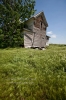
May 8, 2009 Brown County, TX, supercell
Friday, May 8, wound up to be a very entertaining chase day, as our group found itself just east of a beast of a supercell… [Read More]
May 7, 2009 Cameron, MO supercell

Our group departed Edmond, OK, and I was thinking/hoping for thunderstorm development by late afternoon in eastern Kansas. Instability was moderate, shear was excellent, and… [Read More]