 Friday, May 8, wound up to be a very entertaining chase day, as our group found itself just east of a beast of a supercell storm in central Texas. A tornado was reported with the cell in Early, TX (just east of Brownwood), but no tornado was observed by us.
We began the day in Emporia, KS, and I had everyone up and ready to go at the ungodly early hour of 8 a.m. We managed to get to the NE-SW oriented surface boundary near the Red River west of Ardmore, OK, by mid-afternoon. About an hour or two was spent in Saint Jo, TX, in very humid conditions, with dew points near 73F. CAPE values on this day were extreme—over 5000 J/kg. 500 mb flow was west at about 30 knots, and surface winds south of the front were mostly south to SSE around 10 knots. The cap was strong but so was the sunshine, and an area of cumulus developed along the boundary to our west and southwest by about 4:30 p.m. I was concerned that development might be near the hottest air to our southwest, near Breckenridge, which had a temperature of 102F. The reason I was concerned was that if a supercell developed in that direction, it would probably wind up moving away from us.
We elected to start driving SSW towards Jacksboro, and strong storms developed in the Breckenridge area. A couple of cells did indeed become supercellular and started to drift south. We managed to get in position to the southeast of one as it neared I-20 east of Ranger. Its updraft was very impressive upon approach, but it weakened quickly as another cell took control to its southwest. Again we found ourselves on the wrong side of a supercell. Radar indicated that the cloud tops on these things were about 60,000 to 64,000 feet, with hail up to 3 inches reported! We needed to get to the business end of this new southward-moving beast. We dropped south on 16 from I-20 to Comanche, and then WSW on 67 towards Brownwood. East of Blanket, TX, a beautiful and very large and laminar storm base was in view to our northwest! It was spitting out CGs at a good clip, and sported a decent, low-hanging wall cloud. Light rain increased to moderate intensity and forced us south from Blanket towards Zephyr. This road (FM1467) really worked out well, as it allowed us to keep pace with the cell, just a few miles east of the base and wall cloud.
It was during this time frame (while we were near Blanket) that the sun was setting directly behind the storm base, and when a tornado was reported in Early, TX, only 7 to 8 miles to our west-southwest. We did not observe a tornado, and we aren’t really certain if the damage in Early was courtesy of a very strong RFD surge or a low-end tornado. The towns of Early and Brownwood were both creamed by very strong winds nonetheless, with some roofs removed and numerous trees and poles down.
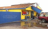
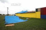
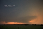
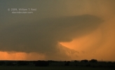
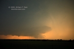
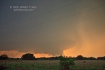
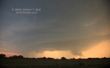
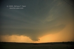
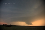
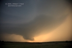
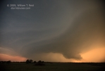
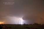
The wall cloud shown in the photos below exhibited rapid upward motions, but not much in the way of rotation. We had one final stop near Zephyr in light rain as the storm drifted off to our southwest. It was dusk, and I tried to get some hand-held shots of the storm structure as lightning flashed. We drifted east of Zephyr a bit to avoid the big hail, and then headed back west to a motel in battered Brownwood. We dodged branches and downed wires on the way. Our motel had power, but no cable TV. Fortunately the Chilis Restaurant had power, and we could eat while watching the Lakers beat Houston in Game 3! On the following day we drove around Brownwood to inspect some of the wind damage.
There were not many chasers on this storm, which is somewhat unusual for an event like this in central Texas in early May. I haven’t found any other chaser pics of the event online, or anything at all from locals in Brownwood or Early. Someone saw a funnel cloud at Lake Brownwood according to this article, and this one contains storm damage information and reports from the NWS. If you have some images of this storm to share, let me know at bill@stormbruiser.com.
Link to web page by chase partner Bob Conzemius for this chase.
Link to KWTX’s severe weather blog for May 8 (includes great radar images and updates on this supercell)
Walker Ashley’s blog shows a nice radar depiction of this storm with a strong couplet over Early at 8:02 p.m.
Near Ranger at 6:40 p.m. A weakening updraft is visible in the middle distance.
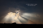
The first three images below were taken from U.S. 67, a few miles ENE of Blanket, from 7:47 to 7:50 p.m. CDT, looking west-northwest. The last image was taken from near Blanket at 7:54 p.m.
The images below were taken a mile or so southwest of Blanket, along U.S. 67 near FM Road 1467. Time frame was 7:58 to 8:00 p.m. CDT, and we are still looking primarily west-northwest (given that the sun sets north of due west on this date). The time for the report of the alleged tornado at Early was 7:57 p.m., but that seems to be a little early (sorry), since Early was to our west-southwest at this point in time. The “east side of Early” received “widespread wind damage” at 8:15 p.m. CDT, according to the storm reports log. This time jives better with the storm’s arrival in Early, according to what we were seeing and when we were seeing it. The storm log has no details for the Early tornado. If the tornado is authentic, perhaps it was a brief and weak tornado which preceded the storm core. We weren’t looking that direction, however, as the main show appeared to be to the WNW. Another possibility is that the time given for the Early tornado is off by about 5 minutes, as suggested by the radar. Unfortunately, we were repositioning around 6:02 p.m., and I shot no video from 6:00 to 6:07 p.m.
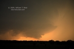
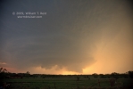
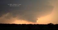

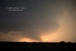
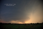
The first image below was at 8:05 p.m., and the remainder were taken from about 8:07 to 8:11 p.m., when we stopped about four miles south of U.S. 67 on FM Road 1467. The town of Early is seven miles to the due west, and the cell is moving south (right to left, from our WNW to west).
These shots at dusk were from the north side of Zephyr, at the intersection of U.S. 84 and FM Road 1467. Time was about 8:25 p.m. CDT, looking west.



Leave a Reply
You must be logged in to post a comment.