Stormbruiser.com

William T. Reid

  • About
  • Video Links
  • Climate
  • Categories
    • Astronomy
    • Aurora/Northern Lights
    • Artsy
    • Airports (LAX and VNY)
    • Animal Day
    • Beach
    • BEST and MOST POPULAR
    • Chase Season Summary
    • Chasers and friends
    • Cumulonimbus
    • Death Valley
    • Desert
    • Desert/Mountains
    • Elevated photography
    • Eyesores
    • Fire
    • Flooding
    • Hurricane
    • Landscapes
    • Lightning
    • Local: Conejo Valley/San Fernando Valley
    • Mid and High Clouds
    • Nighttime photography
    • Old Stuff
    • Rainbows/Optical Phenomena
    • San Nicolas Island
    • Storm Video Sales
    • Stormy Skies
    • Stupid Bugs
    • Sunsets and Storms
    • Supercells
    • The City
    • Tornadoes
    • Unusual Clouds
    • Vegetation
    • Wind and Dust
    • Winter Weather
  • Contact
You are here: Home / 2009 / May 25, 2009 Northern TX Panhandle

May 25, 2009 Northern TX Panhandle

May 25, 2009 By Bill Leave a Comment

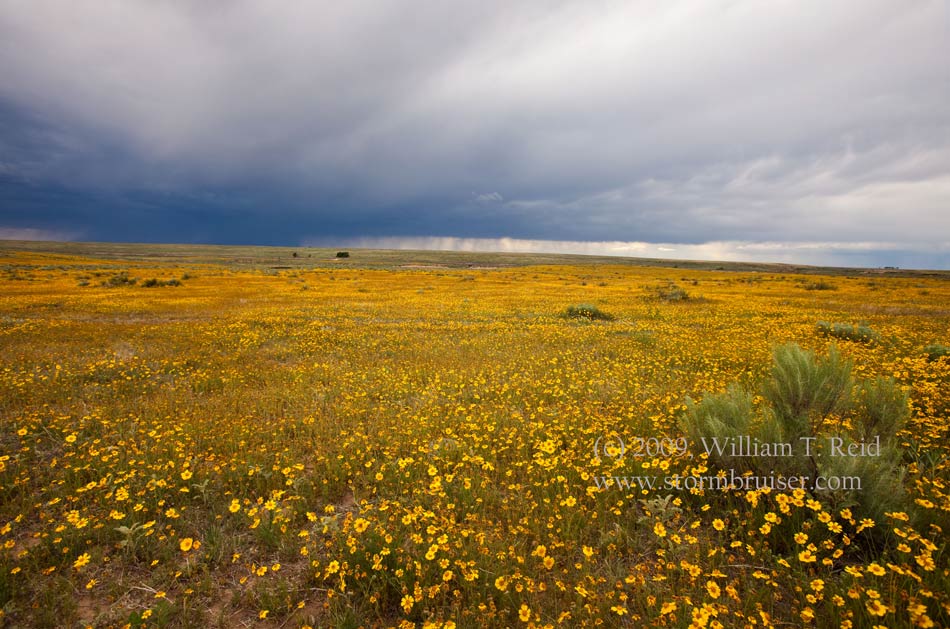
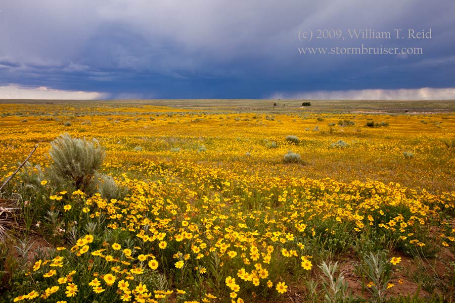
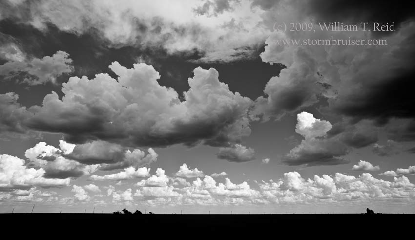
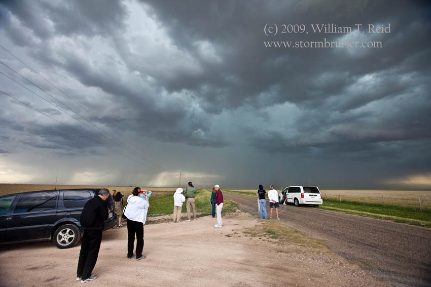
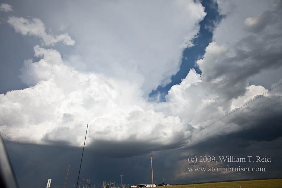
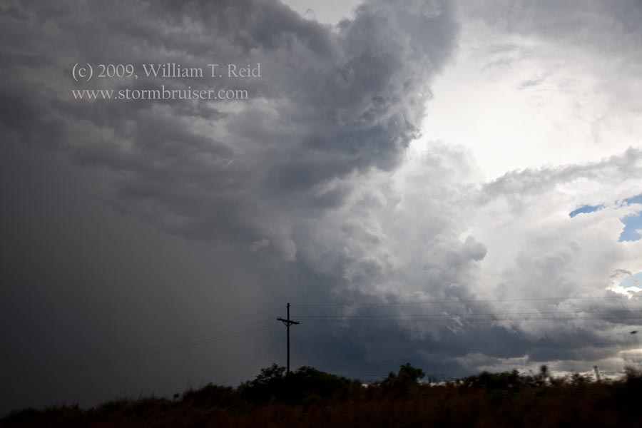
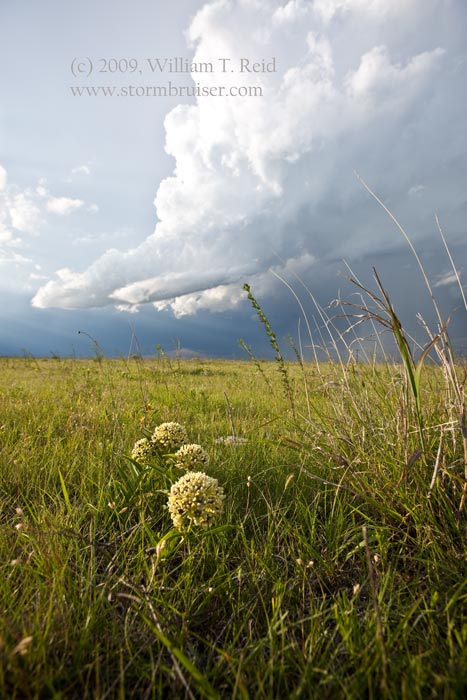
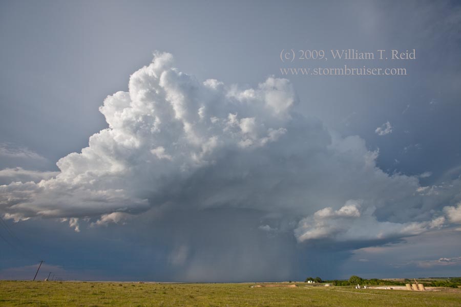
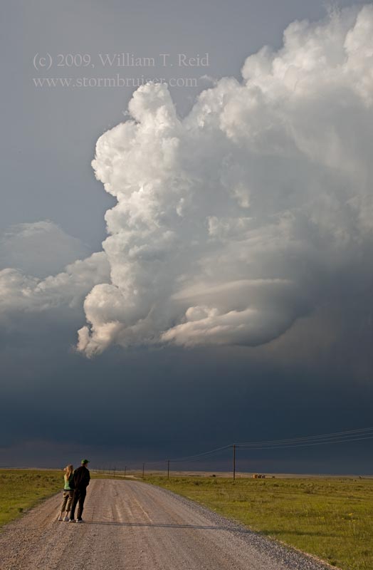
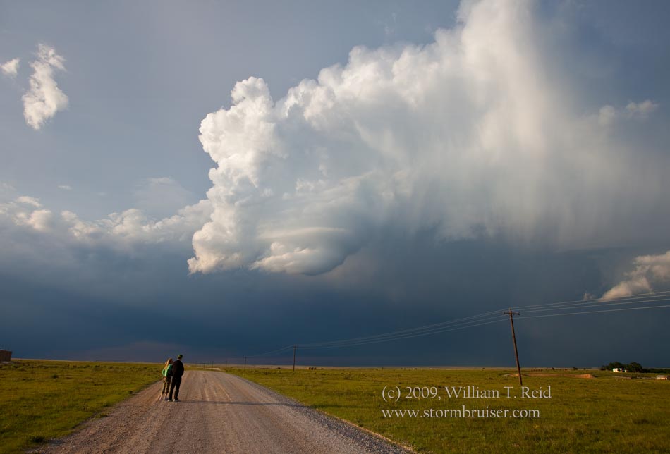
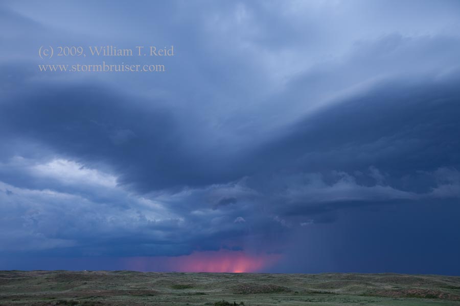
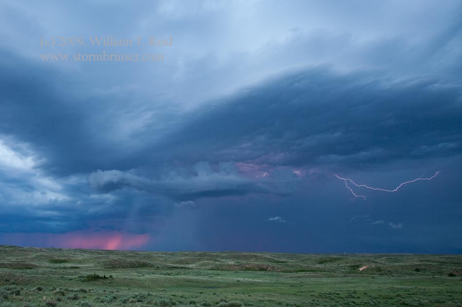
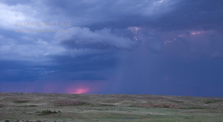
Chase prospects for May 25th looked a little better than previous days, down
in the TX Panhandle.  We began the day in Fort Morgan, and scooted southward.  I was
targeting the eastern TX PH, where CAPE values were expected to exceed 2500 J/kg
--- not bad at all.  Still, the forecast shear was marginal, but maybe enough
for a supercell.  As we neared the NW TX PH near Stratford, we viewed a strong
but high-based storm to the southwest.  It had frequent lightning and looked
quite nice with the sun lighting up the fields of yellow flowers in the
foreground.  But, it was undercut by its own cold outflow and was somewhat
linear.  We could see a new storm updraft to the east, in the target area, so we
headed that way along Road 281.  The cell looked like a supercell on radar and
from behind, with frequent wall clouds and scary lowerings beneath an impressive
updraft tower.  Our road (U.S. 83) southeast to Canadian put us right behind the
cell, and right then and there the storm went into fizzle mode.  The updraft
shriveled as it spun out to our northwest, from a spot northwest of Allison.  At
sunset we found a nice hilltop north of Canadian to watch a storm with laminar
banding and decent lightning, and a little later were on another hilltop south
of town.  The Irish Inn in Shamrock was our home for the night.

090525_stratford_tx_7681090525_stratford_tx_7686090525_stratford_tx_7688090525_stratford_tx_7690090525_canadian_tx_7692090525_canadian_tx_7698090525_canadian_tx_7700090525_canadian_tx_7703090525_canadian_tx_7706090525_canadian_tx_7707090525_canadian_tx_7712090525_canadian_tx_7718090525_canadian_tx_7730

Filed Under: 2009, Cumulonimbus, Landscapes, Sunsets and Storms, Vegetation

Leave a Reply

You must be logged in to post a comment.

Search

May 2009
S M T W T F S
 12
3456789
10111213141516
17181920212223
24252627282930
31  
« Apr   Jun »

Categories

Archives

Copyright © 2025 stormbruiser.com ยท Log in