
I was rather fortunate to witness the beautiful La Grange, Wyoming, tornado of June 5. After Tour 3, on May 30, I flew back home to California to recharge and to catch up on regular life stuff. Fortunately, for the few days that I was not on the Plains, the chase pattern continued less than favorable. A better pattern was developing upon my return on June 4th, however. I had made my flight plans a couple of weeks prior, and it was by chance that I had a stopover in Denver on my way from LAX to OKC. It was also by chance that Brian and the Tour 4 group was chasing on the high terrain of the eastern Colorado Plains on the afternoon of my flights back east. And, it was by chance that several of the guests on Tour 4 had abandoned the tour that morning, leaving plenty of room for an extra body, like mine! It seems that the guests who left were more interested in partying and seeing flying cows than meandering around the Plains and hanging out in Lamar, during a drab pattern. I called Brian upon arrival around 6 p.m. in Denver, and he and the group were already done for the day, in Limon. My sister picked me up at the airport and drove me halfway to Limon, where I met Brian. I was back in chase mode!
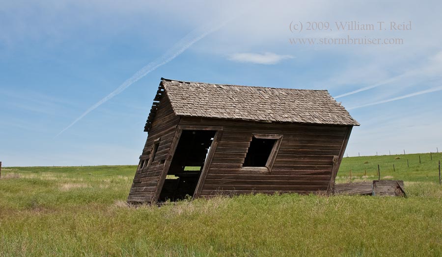
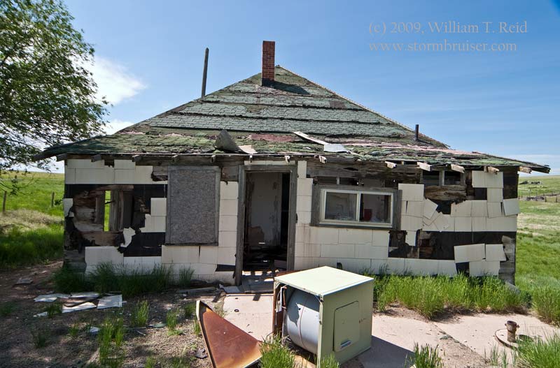
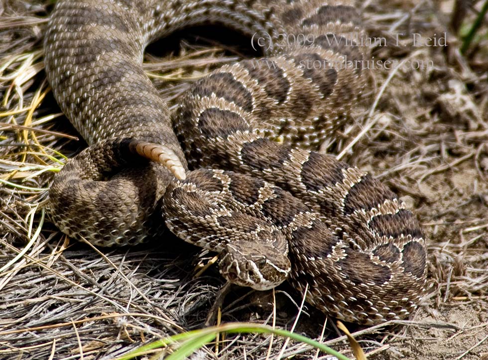
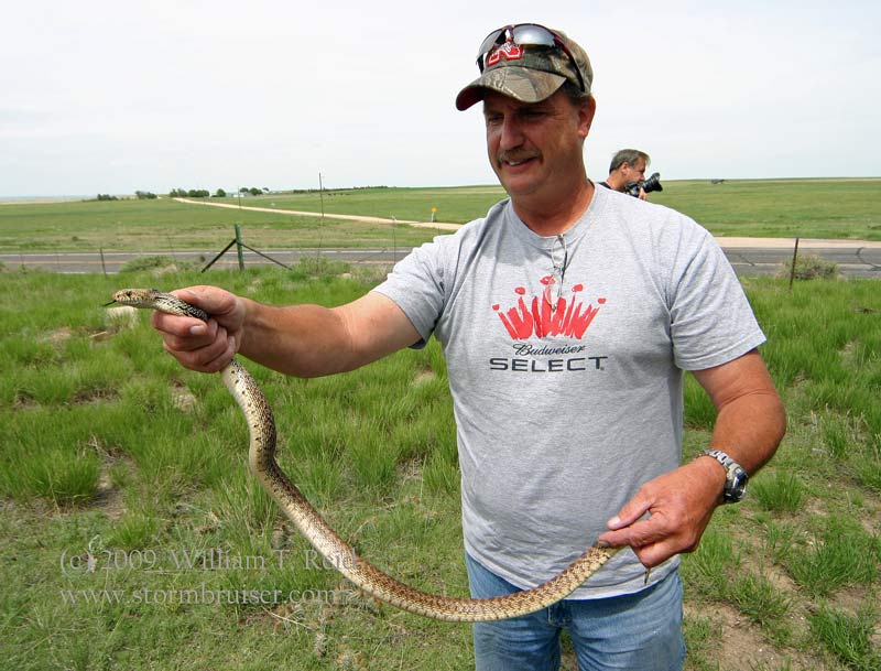
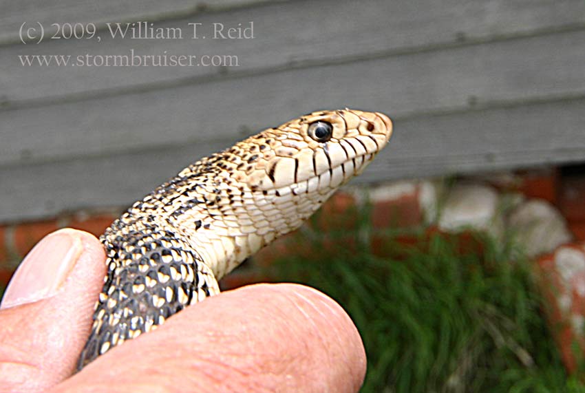
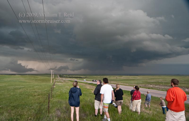
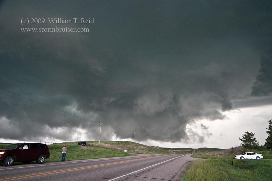
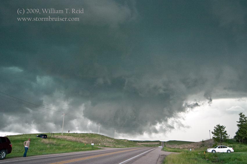
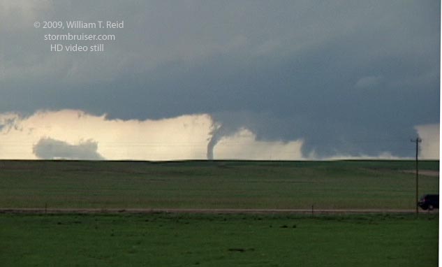
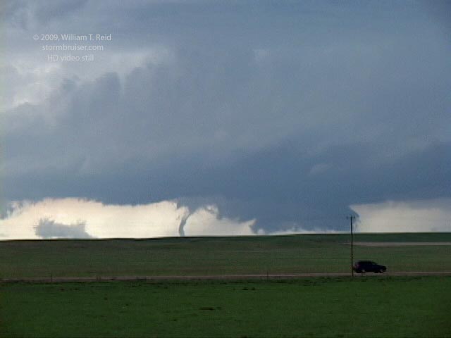
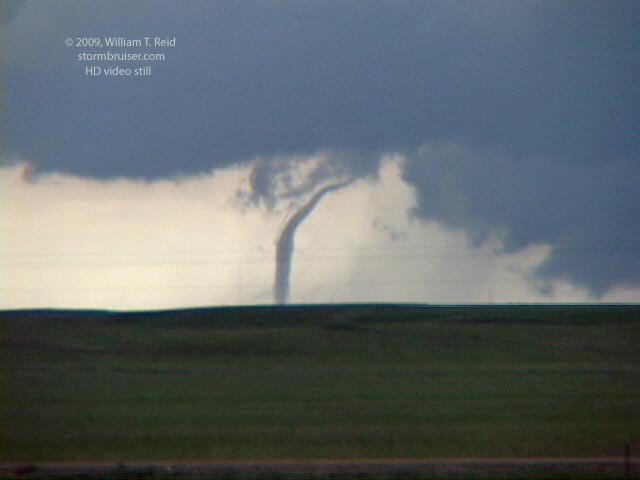
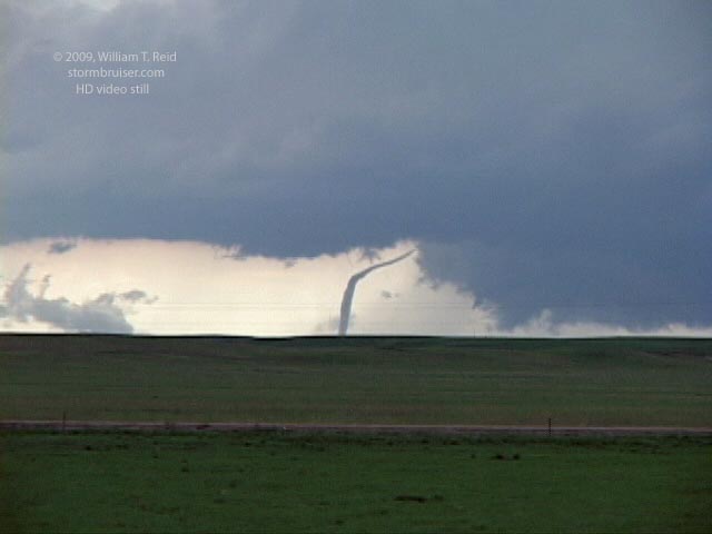
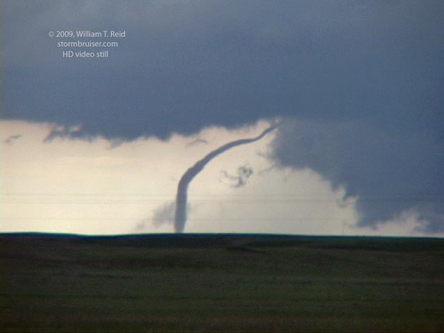
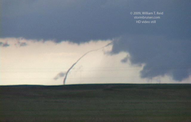
The outlook for the 5th appeared fairly promising on the High Plains, somewhere north of the Palmer Divide. We scooted north from Limon and stopped for a while at an abandoned house south of Last Chance (to the delight of a local rattler). During the afternoon we hung out near Raymer, CO (to the consternation of a gopher snake), thinking that storm initiation would be near or along the Cheyenne Ridge, just to the north. Storms did go up near the ridge, north of Cheyenne, and moved northeast. These cells struggled a bit early on, and we were somewhat reluctant to head north to intercept. But, the southern cell suddenly strengthened and it became obvious that we needed to blast north. We went north on 71 through Kimball, NE, and had a view of the cell to the west-northwest. The storm was still in Wyoming, about 25-30 miles away, and we could see some structure and a lowered area from time to time. I twitched nervously as I sat in the tour van and monitored the radar image. It showed a beautifully organized supercell with a large hook echo. It seemed that we were missing the show. Jon and Brian led us westward on an unpaved road in southern Banner County, about four miles south of Harrisburg. After a couple of miles our view of the storm improved dramatically, and we quickly saw a tornado develop! We stopped a couple of miles farther west, and stopped to watch the tornado for about five more minutes as it was blown out to the south side of the wall cloud during the rope stage. During this time I was shooting video with Brian’s spare camcorder, as my equipment was in storage in OKC. The stills below are of the storm shortly after the tornado as the storm approached Harrisburg, and then as it approached Dalton, NE.

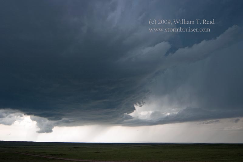
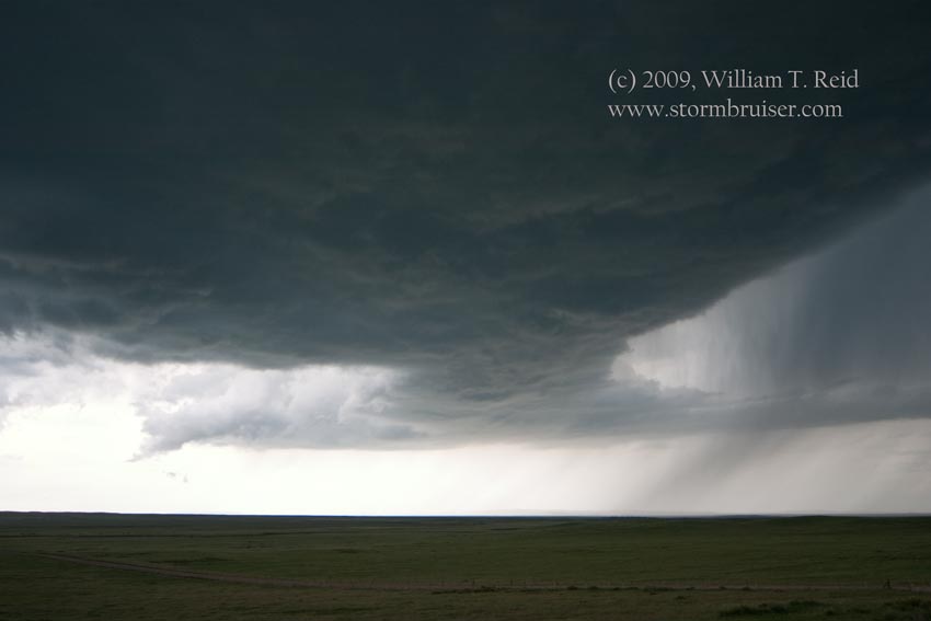
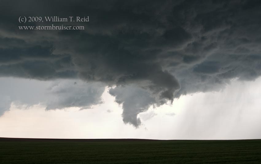
Some video stills of the LaGrange, WY tornado:
Leave a Reply
You must be logged in to post a comment.