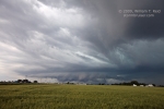
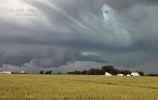
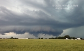
Guess what—we began this chase day in Lamar, Colorado! Eastern Colorado has been the hot spot this week with moist upslope flow beneath decent mid-level flow aloft. Another good severe weather setup was shaping up today, but this time for northeastern Colorado. We moseyed up towards Limon, but stopped first in Hugo for lunch. We caught a somewhat isolated but weak cell along I-76 around Roggen. It was high-based and it seemed reluctant to put on much of a show. We stayed ahead of it as it drifted east to Fort Morgan. Still, it was kind of a yawner as we stayed close to the storm’s updraft base. The storm may or may not have been severe-warned for hail, but I became a little impatient (and maybe a little disgusted at the lack of organization) and decided to head east a little. We drove the ten miles to Brush so I could get a view of this thing’s structure, and to try to figure out what to do next. Well, just as we are about to exit at Brush, a tornado warning is issued for our “Fort Morgan” storm! And, as we exit and look back west, we are treated to a nicely sculpted supercell! It seemed that this thing decided to get its act together in the blink of an eye, right when I elected to give it some space.
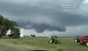
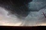
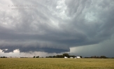
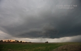
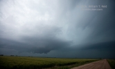
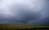
We reversed our field and approached the cell via U.S. 34, stopping a couple of miles east of Fort Morgan. The supercell loomed just west of the town. After maybe 10-15 minutes a pronounced clear slot and lowering developed on the forward flank, and a narrow funnel cloud teased the ground for a minute or two (fourth image below). This tornado did indeed touch down, but the funnel cloud dissipated rather quickly. We jumped back into the van to try to get closer, as the action area was maybe 4 to 5 miles away to our WNW. Another skinny tornado was observed for a minute while we navigated through Fort Morgan. We tried to go north on 52 to be close to the rotating wall cloud, but law enforcement was blocking the road to all traffic. I headed back east and north a little, to near Snyder. The storm had a good look to it again, but it refused to tornado. It was now near sunset, and the activity was lining out some. We went back west to Fort Morgan to check out a tail-end cell, but it was not severe. (A lengthier account for this day is pasted below the images.)
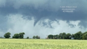
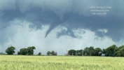
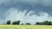
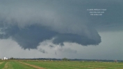
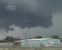
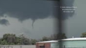
A few video stills…it is interesting that the second, really skinny tornado came from the area to the right of the prominent wall cloud (final four video stills):

 At our 10 a.m. forecast briefing, I told our group that we would play the Raton Mesa, where upslope flow and H5 flow appeared best. After a WalMart stop in Lamar, I saw Bob Henson’s post regarding the favorable prospects in NE CO, and looked at the new 15Z RUC. As mentioned in my late FCST post for this day, I decided to head north towards Weld County, as there appeared to be clearer skies, similar dew points compared to SE CO and NE NM, NE CO was along the axis of the strongest 250 mb winds, and the cap was weaker.
We waited at Roggen as a warned cell moved out of the Denver area and died. A new cell went up near Hudson and drifted slowly eastward. It pulsed a bit and looked weakly organized between Hudson and Fort Morgan. However, it was rather high-based, with a lot of precip. Other heavy showers were lined up to its NE along I-76 and cloud towers were abundant even to its east and southeast. Our cell was struggling, and I was concerned that a bigger and better show might evolve farther east. I elected to blast east through Fort Morgan to Brush, with some heavy rain during this time. We exited at Brush and looked around…the sky had changed dramatically in the past 15 minutes! The cloud towers had dissipated, and the line of rain that was extending northeast of the “Hudson” cell was now looking like a long inflow feature, feeding a newly banded and sculpted supercell to our due west! All it took for the Hudson (now Wiggins) cell to perk up was for us to briefly abandon it.
We went back west along U.S. 34, and stopped a mile shy of the eastern edge of Fort Morgan to set up the video. A couple of prominent lowerings hung beneath the wide laminar base, and soon the cell was tornado-warned as a funnel cloud had been reported. We stayed put, about 6 miles east of the cell, and observed a slender funnel cloud take shape near the north end of the base. The condensation funnel reached about 2/3 of the way to the ground and persisted for a couple of minutes. The funnel dissipated to some degree, and we moved west through Fort Morgan to get closer to the action area. Along the way, a skinnier funnel again emerged from the same wall cloud, to our WNW. This tornado-making phase had ceased when we tried to head north from Exit 80. The sheriff was blocking all traffic north.
The cell reorganized as was watched from Snyder (north of Brush), and it failed in the follow-up tornado attempt.
What is rather odd, especially compared to the summaries by others chasing on this day, was that surface inflow into the Fort Morgan storm was pathetic, at least where we were—-on its east and southeast side. Mosquitoes were a constant nuisance, as southeasterly inflow winds struggled to top 12 mph.
Somehow the upslope Colorado magic worked. As we were baby-sitting the lame Hudson storm for an hour or two and lamenting the situation, I was looking at the 0-1km SR helicity for our area. It barely registered, maybe a value of 50. I was thinking that our streak of Colorado supercell days was going to end at three, but a half hour later I was watching a nice supercell and tornado. Still, our chase was a non-action-packed stroll through the rose garden compared to the rock-and-roll fury in SE CO and the mega-CAPE storms in TX.



Leave a Reply
You must be logged in to post a comment.