This was another great chase day in eastern Colorado for Tour 5! My forecast (somewhat south of I-70 and the Palmer Divide) worked out, and storms quickly went from blah to supercells in southwestern Lincoln County. A lovely write-up penned two days after the chase is pasted below the images.
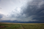
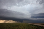
Image 9684/looking west from about 8 miles southwest of Punkin Center/distant cell due west, closer cell on right
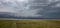
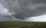
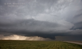
9683 and 86/same location, looking northwest at closer cell
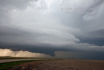
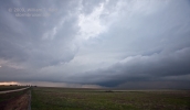
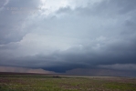
remaining images/along east-west road through Karval, looking north for the most part




At times on Sunday afternoon I felt like I had absolutely no idea what I was doing. I think we back-tracked three times. The messy convection early on in eastern CO was driving me nuts. Somehow, by sticking to my guns and by getting baled out by CO Magic again, we witnessed a couple of supercells from near Rush to Karval, CO, in Lincoln County.
My forecast area was south of I-70 and north of the Arkansas River. The theta-e axis and CAPE axis were forecast to lie E-W through this area, and mid-afternoon data supported the morning forecast charts. Mid and upper-level flow also looked to be quite a bit better in SE CO vs NE CO, but one look at afternoon data showed little difference here. Generally, I am drawn to the Palmer Divide on upslope days similar to this one, but by early afternoon I was seeing those better theta-e values on an E-W axis some 30-60 miles south of the Palmer. So, after lunch in Limon we headed southeast on 287.
Storms fired early in and around Baca County and caused great consternation. My mind was filled with questions. Was this the show of the day? Why was this happening so early? Are these cells elevated? Are they going to mess up my target area from Kit Carson to Punkin Center along Hwy 96? Did I leave the iron on?
We went as far southeast as Wild Horse. Let’s stop here and think about things. Hopefully this early stuff will go on its merry way and won’t do too much damage to my precious pristine SE CO environment. Dews at Lamar and La Junta are still in the low 60s. The surface low is still down there around the NM/CO border. The overall forecast hasn’t been turned upside-down yet. Besides, I can’t catch that stupid early convection anyway. It’s not even in the new tornado watch box. The Palmer Divide is in the box, and Steve H. likes the Palmer Divide now. After 15 minutes at Wild Horse we drove back NE on 287. Hmmmm……. I think the Palmer Divide just might be the right play today, as it is far removed from the stupid early convection. But we’ll stop here at this great high point just west of Boyero where I have a cell signal and I’ll look at more data, because I don’t want to keep driving back and forth like a dufus.
I looked at data by the big radio tower west of Boyero for maybe 20 minutes. It was probably around 3:30 p.m. MDT. Some goofy tornado warnings were up around Denver. Showers were developing along the foothills from Trinidad to Denver, the usual high-based junk, I surmised. Spotter network showed a zillion chasers clinging to the Palmer Divide like white on rice. The better air still seemed to be where I was, though. At this point I wanted/needed to do two things: drift west towards the developing foothill activity, and find the folks that were with me a place for a pit stop. There had been no such place in Wild Horse, and we needed to have a pit stop before things got serious. I decided to head from Boyero and northeast on 287 to Hugo for a pit stop. We went about ten miles. “Turn around, driver!” What am I thinking, going so close to the Palmer Divide when that is not my forecast target area? Sure, we need a pit stop, but I’m staying in my dang fool target area just in case a storm strays into it. We drove back past Boyero and turned west on 96 at Aroya. The sign said “next services 72 miles”. “Colorado Springs 93 miles.” GAD.
A line of storms developed NNE-SSW near the west end of the Palmer Divide to our NW as we drove west through Punkin Center. The tail-end cell was to our due west, near Colorado Spgs. That is good news! Surely this cell will move east through my target area and bring tears of joy to us all. There was no pit stop to stop our pits at in Punkin Center, so we continued west towards our unwarned cell. Nothing was open in Rush, population negative 200, but I knew there would be a pit stop place in Yoder, even though I didn’t recall any from my previous five visits there. There were no Pit Stop Palaces in Yoder, and now the purported cell of the day was raining on us and moving east and if we didn’t do a pit stop and if we did turn around now to stay with this storm then there would be NO PIT STOP EVER. That would not be acceptable, so I cringed as we continued west to Ellicott through the rain and long CGs from this high-based remnant mountain junk storm that would surely trigger tornadic nirvana to my east that I could never catch up with. Ellicott had a convenience store and we were in and out of there in fine fashion.
It was close to 5 p.m., I guess, and we scampered back east through the rain on 96 in order to get back in front of whatever might be worthy of getting in front of. Crazy stuff was happening. Heavy showers were quickly forming and moving in from the south. Strong winds were from the south. A long E-W line of heavy rain set up briefly right along 96. The NNE-SSW line to our north near the Palmer Divide looked to be breaking up a bit with cells looking more discrete…and they were to our northeast and moving east. I won’t EVER catch those and I ruined the chase by coming this far west, I thought! Why did I do this? We drove past Yoder and Rush and more showers popped up to our east — more junky, yucky garbage. Just keep going east and hope for a miracle, I figured.
We continued past Punkin Center, cleared the rain, and, like a flash, things changed — similar to the day before near Fort Morgan. The line of junk to our west was now looking more like two discrete cells on radar. We were under stratus clouds, but it looked clearer to the south. We went south on the road to Karval, then west beyond Karval and back to 71, and lo and behold, there were two unbelievably beautiful supercell updrafts in sight — one to our distant west, with a prominent and very low wall cloud; and one to our WNW, perhaps 7 miles WSW of Punkin Center. These were two of the prettiest and visually impressive rotating updrafts I have seen all season! And, they both had that look that they were serious about producing tornadoes! Rain was wrapping with an RFD cut not too far to our north, and I decided to drift back east to Karval to get a better look at the structure (once it became apparent that a tornado was not imminent). Great low-mid level striations with a huge and long white inflow band were prominent on the east cell. Did I say that the inflow band was both huge and long? Yes.
The rear cell seemed to weaken after its big wall cloud extravaganza, and, unfortunately, was likely seeding the forward cell. Both slowly croaked as we watched from a small hilltop just NE of Karval. We were delighted, though, to have witnessed the double supercells in the beautiful emptiness of southwestern Lincoln County—-even if they lasted less than one hour. This was a confounding and crazy Colorado chase day, and it is amazing to me that such a quick transition to supercells evolved and that I managed to get a good look at them.

Leave a Reply
You must be logged in to post a comment.