This day REALLY sticks in my craw. It was a day where I made a somewhat risky forecast decision after lunch, abandoned certain supercells as they were developing around Dodge City, and headed to the Kansas/Nebraska border, four hours away. The forecast and target area “switch” was a success, as we wound up on a fabulous, isolated storm as it developed north of Norman and east of Minden, Nebraska. The storm moved slowly east and we were RIGHT there, just south of the updraft base and wall cloud, south of Assumption (southwest of Hastings). We had done everything right, and were in great position for anything that might occur. Then, I kind of outsmarted myself, the storm threw me a curve ball, and we found ourselves too far east of the tornado when it developed. We could easily see the funnel cloud and occasional tornado, but we were farther than we should have been. The storm, or, I should say, the “tornadic mesocyclone” was nearly stationary, and a new meso (and some pesky precip) had pulled me east on the dirt roads in central Adams County. Bummer—-we could have easily been within a mile of a good-sized and slow-moving tornado, with only a few other chasers on this storm. It hurts to be so close, and yet so far, especially after making all of the right moves. A more detailed account, written for the chase community, is pasted below the images.
Click here to link to a spectacular time lapse sequence of the Assumption supercell and tornado(s) by chaser Walker Ashley. His view was much the same as ours for the development stage. Then, you can see our van and a follow vehicle pass Walker on our way north, and then east. Needless to say, I wish we had camped closer to Walker. From this clip you can see that the storm indeed moved little. Here are animations of reflectivity and storm-relative velocity, again provided by Walker Ashley. A small red square shows the location of Assumption (north-northwest of Roseland.
———
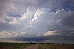
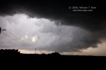
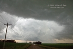
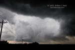
Image 9655/looking north at the developing updraft near Norman, NE, about 7:11 p.m. CDT
Image 9658/low updraft base organizing at 7:28 p.m., a few miles north of Norman, NE
Image 9660/12 minutes later, at 7:40 p.m., from near Holstein, NE, looking north
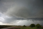
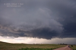
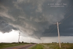
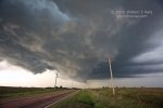
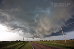
five images 9661 to 9669/looking NORTH at wall cloud and developing RFD cut from about two miles north of Holstein (five miles WSW of Assumption). Time: 7:51 to 7:56 p.m. CDT.
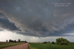
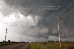
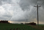
five images 9670 to 9675/looking due WEST at strongly occluded meso and large RFD cut (RFD/clear slot is just to our west, with the tornadic meso to the west of it). A few of these images show the active funnel cloud. Time: 8:12 to 8:18 p.m. CDT, from about 3.5 miles east of Assumption.
Final image/east of Ayr on 74 at 8:40 p.m., looking east at the backside of primary updraft (old tornadic meso was calved off and left to shrivel up to the west, near Assumption).

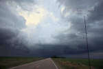
Doug Raflik and I started this Monday morning in Lamar, CO, and wound up on the stunning tornadic supercell at Assumption, NE, not too far southwest of Hastings.
Morning analysis indicated that we needed to move east into western KS somewhere (since we were disregarding the upslope play in E CO), in order to be northeast of the deepening surface low near the OK PH later in the day. The plan was to have lunch in GCK and to fine tune thereafter. A look at the data (and out the window) around 1 p.m. still showed the pesky SW surface winds in much of SW KS. These were progged to back nicely by late afternoon, and I figured that we would stick to the relatively simple and nearby target area in the vicinity of Dodge City, just northeast of the low. I was also noting the secondary E-W axis up in northern KS, and the good easterlies on its north side, but nothing was pulling me in that direction —- until Dave Gold’s CFDG post in the early afternoon. He noted the good environment for tornadoes somewhere along the NE/KS border. I considered that option intently and really liked what I saw. At the time the 6-9 hour forecast charts for the northern target area weren’t looking especially better than those for the southern target. However, the large swath of E-ESE winds with dews in the upper 60s just north of the KS border looked a whole lot better than what I was seeing in real time than the obs in SW KS. The CAPE/shear values were about the best I had seen all spring for the warm front area, and around 1:30 p.m. I elected to commit to the KS/NE border, maybe somewhere between Norton and Phillipsburg, I figured. Or hoped.
I headed north through Dighton and Gove, and tried not to look in the rear-view mirror. Giant storm towers were building just a county or two away to our south and SSW…and soon these were warned. I think that Doug and my tour guests were wondering what the heck was going on…what is this guy thinking? We pressed on northward through Grainfield and northeast to Phillipsburg. By this time, near 6 p.m., we were equidistant from three areas with tornado-warned storms, each about 100-150 miles away, to our west, south, and northwest. I said that we were doing a good job at keeping everyone safe from storms today. The huge anvil of the DDC-area storms was not too far to our south, and some towering cu were trying to break through the cap just south of Phillipsburg. I noted a decent-sized cu field just to our east which had the “gravity-wave” look on the satellite pic. Great—-except that the cap seems to be holding. A weak CB overhead died, and we continued east and then north to Franklin, NE, towards some new cumulus clouds. These also struggled against the cap. It was near 7 p.m., and finally an updraft just to our north began to push harder and harder, and yellows and reds showed up on the radar. “This is gonna be good,” I said! This cell was moving north at about 20 mph through eastern Kearney County. We stopped beneath its base at Norman, and this is when the storm stopped, too.
The storm stopped moving, but didn’t stop growing and organizing. The motion in and around the low cloud base above us was amazing! Soon, a wall cloud developed a short distance to the northeast, and the cell began to move to the east. We skirted east a few miles and then north a couple, and witnessed what was probably the most wicked-looking non-tornadic storm base that I have ever seen. The RFD cut was strong and the black wall cloud was SICK! I managed some tripodded video of this, and then we had to move east a little more to stay with it. I phoned NWS Hastings to let them know what was going on, and they issued a tornado warning minutes later.
Some shallow funnels came and went and the RFD continued to cut. Rain curtains came around the south side and hit us. We were just southeast of the action area, and I wanted to be east of the slow-moving updraft base. We were using dirt roads and I wanted to be out of the rain for more than a few minutes, so we stopped a few miles east of the wild barrel-shaped updraft base. This spot was east of Assumption by a few miles. A couple of minutes later, the spinning wall cloud issued a brief slender tornado, and then another one. Contrast was great, but these were a bit farther away than I would have liked. A fatter funnel took shape beneath the updraft base, still a few miles to our west. And, there was an area of precip to our north that was edging towards us. Rain and north winds hit us—this must have been due to a new meso area that was taking shape just to our southeast. I elected to move south a mile in order to get out of the rain, and I think it was during this time that the fat Assumption tornado developed. We looked west as we dropped south, and saw what looked like a wedge tornado, though we couldn’t see the bottom due to hills! We bolted back west on the next dirt road, but the tornado was not visible, perhaps due to precip. A couple of miles later we saw a ghostly white tornado in the rain to our WNW, as the updraft above it shriveled.
So, after we had moved north and then east (prior to the tornadic phase), it seemed like the tornadic meso stopped again or perhaps drifted back to the west a little during the final occlusion stages. At one point, the GR Level radar image showed an obvious hook echo with a ball at the end — what an insane storm! Thereafter the new meso moved to the ESE but showed little inclination to become truly tornadic. It was past sunset, anyway, and we remained on its west side through Pauline and Lawrence and viewed the structure.
I got some semi-decent video of the storm and tornadoes and some wide-angle stills, but no good tornado stills, unfortunately. I still have a month’s worth of storm images to weed through — my apologies for not posting pics here and for previous dates. I don’t have the time during the tours if I’m going to get enough sleep to keep going.
Anyway, the storm of June 15 at Assumption in Adams County, NE, is the highlight of the season for me — so far!
——
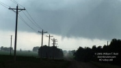
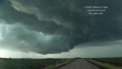
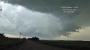
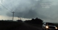
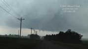
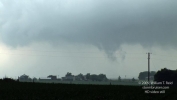
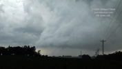
Late additions! Here are a handful of video stills…the first one is looking north at the Assumption cell about ten minutes prior to tornado development. The remainder are looking west during the tornadic phase.

Leave a Reply
You must be logged in to post a comment.