Short version:
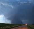
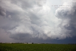
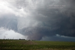
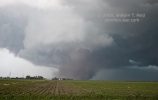
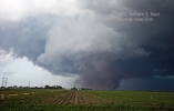
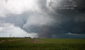
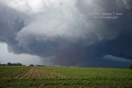
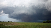
I finally managed a few good stills of a tornado this season—we caught the Phillips, NE, tornado (aka the “Aurora” tornado), between Grand island and Aurora. The tornado was along U.S. 34, about 3 miles north of I-80. The shots of the tornado below are looking north, a few miles south of the twister. We caught this storm north of Kearney, and witnessed a couple of rather brief tornadoes early on. The storm then went tornado-less for an hour or so as it approached Grand Island. Right after it passed through G.I., this rather large “Phillips” tornado spun up. It persisted for a good 15 minutes or so. A little later, we saw a weak tornado very close to Aurora. Near Aurora, we stopped and shot stills of the departing CB and its lightning.
Long version:
This was the second-to-last full chase day for Tour 5, which up to this point had been quite successful, with supercell intercepts on seven consecutive days. We had yet to be close to a photogenic tornado, and today offered a decent chance at that. Forecast parameters looked to be coming together in the vicinity of south-central Nebraska, so we headed south on U.S. 81 out of Yankton, SD. Shortly after lunchtime in Norfolk, we viewed a tremendous cumulonimbus to our due south. This storm was near the NE/KS state line and moving east. We continued south on 81 beyond I-80. A tornado was reported with the storm near Odell (south of Beatrice) about 2:20 p.m. CDT, but we gave up the chase around 2:30 p.m. near Hebron: the cell was moving away from us at a good clip, was moving away from the original target area, and it was still very early. I figured that playing catch-up would have been an effort in futility. I snapped a photo of the cell and we got some gas and goodies in Hebron.
It was close to 3 p.m., and the surface map suggested that we were a few counties too far east. The early afternoon cell had worked over the lower atmosphere along and east of U.S. 81, but undisturbed air resided towards Hastings and Kearney. We went west on 136 and north a bit, and wound up in the same spot (near Norman) where we watched the Assumption storm develop two days prior. Here we met up with Brian Morganti and Scott Weberpal. Storm towers soon went up not too far to our northwest, near Kearney. Perfect! The chase was on!
BIG storm towers were exploding north of U.S. 30 near Gibbon. It was a hassle to cross U.S. 30, as first our road was closed there, and then a long freight train intervened. Once we were on U.S. 30, I had to decide whether to charge west and north to the main cell, or stick around Gibbon to see what a second impressive updraft would do, just to our east. I nervously continued towards the young and established supercell that was a little northeast of Kearney. The big updraft near Gibbon (below, left, 6:04 p.m. CDT) wound up getting sucked into the Kearney cell (below, right, 6:25 p.m. CDT)!
The “Kearney” supercell strengthened and moved east through eastern Buffalo County. The action area moved to our north, but I was a bit reluctant to get too close as all we had to work with was the unpaved section road network. A couple of tornadoes quickly came and went a few miles to our north, some nine miles north of Gibbon, around 7 p.m. CDT. I captured the first one on video, and the second one occurred as we were repositioning to the east via U.S. 30. From Shelton, NE, we headed north and were afforded a good look at the cell’s structure, to our north-northwest (at 7:18 p.m.). The initial tornadic phase had ceased, however.
We approached the updraft base north of Shelton and then headed east into Hall County. A new action area wrapped up fairly quickly and a funnel cloud developed. It looked like the storm really wanted to produce! Precipitation curtains associated with the hook echo came around the south and southeast sides, but the tornado threat fizzled. This was north of Wood River by a few miles. The three shots below are looking west for the most part. The third one is a wide angle which shows an old occluded area in the distance (to the west), and a new one nearly overhead (at 7:53 p.m.).
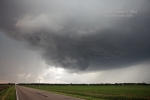
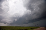
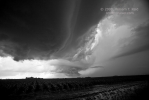
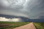
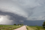
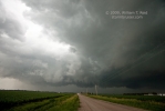
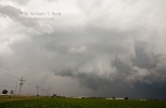
This brings us to the “Alda” stage. The supercell continued to move eastward rather slowly, and in doing so was approaching Highway 30 and the southwestern fringe of Grand Island. I wasn’t too happy that we were going to have to deal with a rather large city, but on the plus side we had a lot of paved roads at our disposal. The updraft base lowered some, and a wall cloud began to rotate very close to Alda. We were perhaps a mile and a half south of Alda, and in a great spot to watch tornado-making. Again, despite the classic RFD cut and strong, focused area of rotation, the storm could not put one down. The images below show just how close this thing was to tornado-ing near Alda. The view is to the north and north-northeast from 6:30 to 6:42 p.m. CDT.
Sunset was near, and the supercell was moving into Grand island. We stopped for a few minutes at U.S. 281, a mile north of I-80 (at W. Guenther Road), and watched the business end of the supercell hover above the south end of town, a few miles to our north-northeast. I wanted to get back in front of the storm again before it got too dark. Option #1 was to head north on 281 three miles and then east on Hwy 34. This would have taken me right beneath the wall cloud (and, as it turned out, one or two weak and brief tornadoes). That scenario, combined with the local and chaser traffic, did not appeal to me. The only other good option was to use I-80 and to blast east. We hurried south to the Interstate and made haste eastbound. After perhaps five miles we observed a brief but obvious tornado with the wall cloud to our north-northeast. Soon after, a wall of dirt kicked up quickly along the southern fringe of the wall cloud, and then a prominent funnel cloud showed itself. Finally, the storm was ready to put on a show! We exited at the Giltner Spur after twelve miles on I-80. This exit was fortuitous, as it placed us due south of the developing tornado. The tornado had started very close to Hwy 34, near Phillips, and was moving east, towards Aurora. (See the NWS track map.)
I had Doug stop on the first section road north of I-80, three miles south of Hwy 34 and 2.5 miles south of the tornado. The tour guests and I were treated to a great show! The condensation funnel was a “truncated cone”, and a very large swath of dust was kicked up and drawn towards the cloud base. This gave the tornado a large and very menacing appearance, but motions with the entity were not particularly extreme, at least from our vantage point. I set up the tripod and managed some decent HD video, including some power flashes. My stills wound up okay, though I had to crank up the ISO setting to 800. A wide-open aperture of 2.8 was incorporated for these tornado images, and shutter speeds were an uncomfortably slow 1/60 to 1/80 second (time of day—9:03 to 9:07 p.m. CDT).
Contrast of the tornado to our northeast was deteriorating, so we headed east along the dirt road to try for better contrast and to keep pace. Again, I was able to get some video footage of the tornado in progress as we blasted east, but no stills. Though the NWS track map shows a strengthening tornado as it moved east, it looked a little less impressive visually. I think we drove about four miles eastbound before stopping again, and there was enough light remaining for these shots, looking north, at 9:13 p.m.: 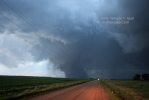
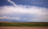
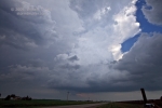
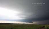
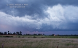
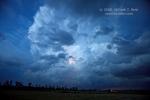
With darkness upon us and a very nice tornado “in the bag”, so to speak, we were fat and happy and allowed the storm to drift away from us. The updraft base continued to have that “wrapped-up” look which oftentimes results in tornadoes. We observed a suspicious plume of dust in the gloaming near Aurora, which some folks reported as a weak and brief tornado. Here are a couple of shots towards the east-northeast, from near Aurora:
We spent another 30-40 minutes photographing and enjoying the lightning show in the storm tower to our east, and then headed to the motel in Grand Island. (See the second entry for 6/17/09 for the nighttime lightning and storm tower images.) At a fast food joint along I-80 we traded war stories with Reed Timmer and crew, who graciously permitted our female guests to sit inside their tornado-intercept vehicle. It was somewhat appropriate, as we had chatted with Reed and compared forecast notes some seven hours earlier, in Hebron, while gassing up!





Leave a Reply
You must be logged in to post a comment.