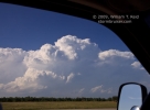
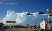
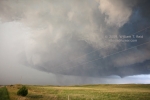
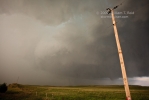
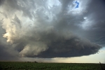
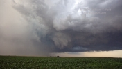
Today’s Logan County, NE, tornadic supercell was quite the treat, though it fell short in terms of easily-viewed tornadoes. I liked the high CAPE values which developed near North Platte during the afternoon, coincident with easterly surface flow with dews near 70F. Moisture convergence was good along the outflow boundary near I-80 by mid-afternoon. We started the day in Pierre, SD, lunched at Merriman, and dropped south to I-80 at Ogallala. Strong updrafts were going up north of North Platte as we rolled into town (first two images below, times 6:03 and 6:12 p.m. CDT). There were two strong updrafts initially. We went for the southwest one, near Tryon, which was tornado-warned. It was struggling greatly, though, as the Logan County storm blossomed. We hurried eastward on 92 to Stapleton, and new tornado warnings were issued based on sightings about 12 north of Stapleton.
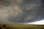
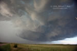
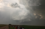
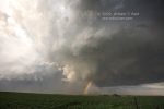
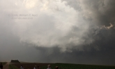
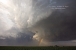
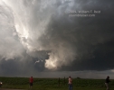
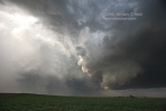
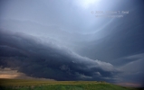
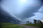
A major RFD-cut/wrapping meso process took place approximately 7 NNE of Stapleton. We watched from U.S. 83, just south of the updraft. Strong west winds associated with the RFD hit us, and then precipitation. The action area, to our NNE, became obscured by the wet RFD. We observed some suspicious and tight “rotating stuff” beneath the updraft base, but were unable to confirm or verify a tornado (see images 3-6 below, times 7:26 to 7:28 p.m. CDT). The storm was moving SSE, so we dropped back to the south to Stapleton in order to get in position again. Shortly after turning ESE on 57 from Stapleton, I viewed what looked to be, or could have been, a large tornado to the NNE. Unfortunately, the large feature became buried quickly in precipitation. I got no images of this! We stopped quickly between Stapleton and Gandy, and could hear the “whooshing” sound that sometimes accompanies a tornado. My video is inconclusive as far as whether a tornado was in progress or not, but this was about the time when the local fire department reported a large tornado. The nasty storm core chased us south of Gandy, and this north meso remained heavily wrapped in precip, from our perspective (images 7 and 9 below, times 7:52 and 7:53 p.m. CDT, looking NNE). A new meso just to our east tightened up rapidly, with strong rotation and wild up and down motions. We were being blasted by dusty RFD winds during this time frame as we watched the wall/wide funnel rotate above the fields a mile or so to the east (images 8 and 10-15 below, times 7:53 to 7:59 p.m. CDT). Again, rain wrapped around and forced us south. About 30 minutes later we were SSE of the meso, south of Arnold, but the cell was undercut severely by its own cool outflow (final two images, at 8:38 p.m. CDT).
There were about half a dozen different tornado reports, including one of a tornado up to one-half mile wide. A couple of the later ones seem dubious, as the cell was undercut, but the earlier reports of a large tornado are quite believable, given the general look of the cell. We were close at the right time, but a bit cursed by the wrapping precip and sketchy road network. Structure from inside the RFD was great during tornado time and afterward well south of Arnold.


Leave a Reply
You must be logged in to post a comment.