 The forecast target for this day was not particularly clear-cut when we departed Lexington, NE. There was, however, decent potential for another fabulous supercell as shear and instability were excellent somewhere between I-80 and I-90. Here is my account for the chase community written shortly after the chase, in Mitchell, SD…
—-
Chuck Doswell, Doug Raflik, Rob Petitt and I targeted the general area of central SD today, and wound up on the tornado-producing supercell which trekked southeastward from west of Huron to east of Mitchell. We managed to get a good look at a tornado near Fulton at dusk.
We began in Lexington, NE, and the NAM suggested maybe a chase up towards the north NE PH. The RUC strongly suggested that NE was out of play, and that we needed to get up into SD. With the better upper winds over SD and some backed surface flow (with plenty of 60-plus dews) by late morning over C and E SD, we headed north through Thedford and Valentine. After a 2 p.m. lunch in Valentine, we saw that a surface low was taking shape near Philip, SD. It appeared that Pierre would be a good staging area, and a decent cu field developed there during the mid-afternoon.
(I submitted this updated “forecast” to CFDG around 2:30 p.m.:
We just saw Roger and company in Murdo. With CAPE of 3000-plus and effective shear values of 50 knots in the middle of South Dakota, we could be in for another big chase day. A weak surface low appears to be between Philip and Rapid City, and a nice moisture convergence bullseye is not too far from Pierre. A field of shallow cu is just to our N and NE here east of Murdo, and extends to Pierre. If we can get a cell to go up near Pierre and then head ESE into the 67F and 70F dews near Huron and Mitchell…)
After killing some time in Vivian, we headed north and were in Pierre by 6 p.m. Some towering cu were around, but these struggled. The SPC meso-analysis page showed quite a bit of convective inhibition in central SD. There was no CIN a few counties to the east, and we could see some towering cu about 75 miles to the east. I elected to start driving east in case the area to the east developed strongly. We could always go back west if something good went up near Pierre. I liked where the persistent cu/cb was west of Huron, with the 68F-70F dew point air nearby on ESE winds. Dews near Pierre were closer to 62F.
Well, we kept driving east on 14, and the “Huron” cell slowly grew and grew. We were fully committed to it after about 40 minutes from Pierre. It became tornado-warned when we were about 30 miles NW of it, and it turned to the ESE. Needless to say, it took a while to get into position on its south and southeast side. We finally managed to do this near Forestburg, in Sanborn County. A strange-looking funnel loomed nearby as we skirted its southwest side. The storm turned harder to the right and chased us south on 37 towards Mitchell. We were in some RFD rain curtains on the SW side of a wet meso, and viewed a murky but solid funnel about halfway to the ground to the NE (back towards Artesian).
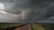
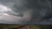
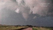
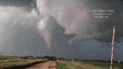
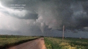
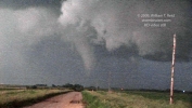
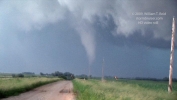
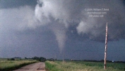
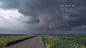
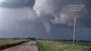
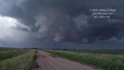
The sun had just set and this meso seemed to be fully involved with precip. We were glad to have gotten into position, but felt somewhat let down. The storm seemed to be having outflow issues, too. We drove about 6 more miles south and four miles east to get a look at the structure and the lightning as the cell moved off to our east and southeast. This was on Plano Road, I think, about six miles northwest of Fulton. Soon after stopping, around 9:45 p.m., the cell quickly organized on its western end, about 3-4 miles to our east. A cone-shaped tornado developed below a tight and sculpted updraft. It moved from left to right, to our due east, and lifted after about two or three minutes. I shot some semi-decent handheld vid in the low light. Thereafter, the supercell provided a continuous lightning display in the storm tower for us and the mosquitoes.
—-
Okay—that was my initial account. Here are a few more notes and comments for the images—
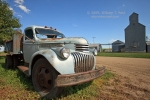
In Vivian, we found an old truck and some lovely accommodations at the Hilton. As late as 6:30 p.m., we were still waiting around in the sunshine (near Pierre) hoping for something to chase.
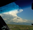
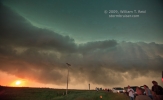
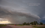
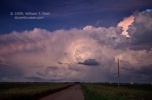
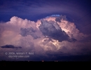
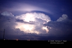
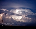
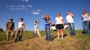
Shortly after I took this picture of the guests looking west, I saw new convection well to the east. We blasted east on U.S. 14, hoping that the activity would explode, but not until we got close! We were about 90 miles west to WNW of the building and isolated cumulus when we started at Pierre. Sixty miles later, at Miller, the storm strengthened significantly and was warned on. It was moving southeast and was a little west of Virgil, to our ESE. The first image below was shot at 8:06 p.m., shortly after we turned south from Wessington. A weak tornado was observed with the cell near Virgil at 8:07 p.m. The last image was taken at 8:35 p.m. CDT., shortly after we had cleared Wessington Springs and were heading east again. The storm is just north of Woonsocket at this point, and continuing to move southeast through Sanborn County.

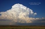
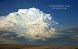
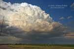
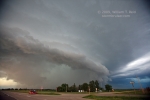
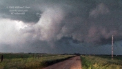
The first image below is looking east from near Lane, SD, along Hwy 34 at 8:41 p.m. CDT. We were finally under the updraft base three minutes later, and the clear slot associated with the RFD was not too far to the east, between Woonsocket and Forestburg. The third image below is a look at storm structure to the northwest and north, along Hwy 37, a few miles south of Hwy 34, at 9:02 p.m. The last two images were taken at 9:20 p.m., about 15 miles north of Mitchell, and looking northeast towards an active lowering. This is also looking towards the small community of Artesian, some five to six miles distant. Artesian was hit by two-inch hail at 9:10 p.m., and a rain-wrapped tornado was reported three miles south of the town at 9 p.m.

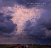
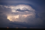
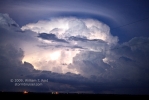
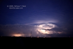
We observed the “3 N Fulton” tornado at about 9:45 p.m. (the video stills below cover a three-minute time frame) and stayed put to watch and photograph the light show in and around the CB. I wish I had noticed those wires at the time!






Leave a Reply
You must be logged in to post a comment.