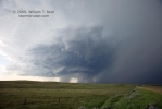
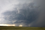
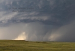
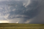
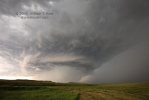
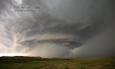
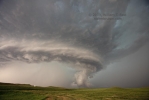
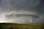
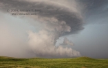
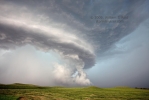
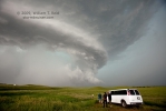
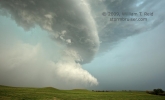
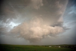
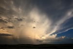
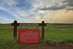
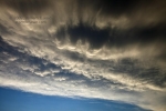
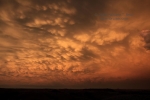
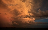
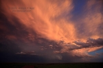
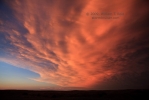
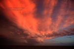
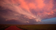
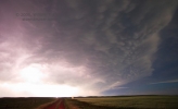
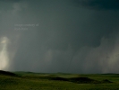
 A big day in Montana, and my first Montana tornado! We went north from Baker, MT, about 18 miles, and came upon a developing supercell with magnificent structure, Near the leading edge of the updraft base, a large funnel materialized inside of an area of precip to our NNW. A tornado touched down and persisted for a couple of minutes before being totally hidden by precip. The cell moved ESE and chased us down an unpaved road to Carlyle. On the way, a large lowering/wall cloud threatened to touch down, but apparently did not. We scooted south to Ollie and found a barn to hide in as the core moved over the tiny town. Nickel-size hail fell. At sunset we found a high spot near Marmarth, ND, to shoot an amazingly brilliant sky with plenty of mammatus—–many many more pics to come, eventually! I got good tripoded video of the supercell and tornado, and some wide-angle shots of the supercell with the tornado in the rain-wrap.
Thanks to Rob Petitt for sharing his zoomed image of the “Carlyle” tornado (above). The tornado was perhaps 6 to 8 miles WNW of the little town (just west of Hwy 7) at the time—6:10 p.m. MDT. We reported the event to NWS Glasgow about 90 minutes after the event, when we had a cell signal in Baker.
——
Updated longer version, with pictures!
My forecast for this chase day, written around noon MDT:
The target area is the Beach/Baker/Bowman/Belfield quadrilateral. Initiation will likely be in MT, closer to Glendive. A supercell would presumably dive southeastward into the southeasterly surface winds, which are progged to be blowing at 15-20 kts. This will be below a westerly 500 flow at 30-35 knots. The sore spot today is so-so moisture, with dew points generally near 60F. I suspect that the storm bases will be somewhat high, with only a very slight chance of a tornado.
As indicated above, I liked the area along the western ND border with MT, from about Baker to Beach. This worked out perfectly, as storms went up near Glendive and became tornado-warned (funnel cloud sightings and Doppler-indicated). The problem was that we were still motoring north through NW SD and SW ND (more than an hour away), when the “Hodges, MT” storm was providing all of this fun. We had stopped at Mount Rushmore briefly after leaving Chadron about 11 a.m. We pressed northward on U.S. 83, and from Bowman we went west to Baker. After a quick pit stop, we blasted north on 7, and were greeted by a brand new and impressively structured supercell. We stopped 18 miles north of Baker and set up, and not three minutes later, a skinny tornado was spawned beneath a large wall cloud which was somewhat obscured by precip. This tornadic cell was south of the originally tornado-warned storm, now near Wibaux. And, it was about as far from any Doppler radar as any place on the Plains. I tried to phone it in to NWS Glasgow, but had no cell service! (We reported the event later from Baker.)
The four images below were taken along Route 7, north of Baker, near the Wibaux/Fallon County line. The view is to the north-northwest, and time was about 6:08 to 6:10 p.m. MDT. The area of precipitation beneath the eastern/forward portion of the storm base partially obscures the wall cloud and its developing funnel/tornado.
Shortly after observing the tornado and watching it get more and more obscured by rain, we hurried north a couple of miles to get a closer look. I stopped at Carlyle Road, as we had a good look at the storm (still to our north-northwest), and a decent unpaved road to the east (to Carlyle). The nine images below were taken from 6:16 to 6:26 p.m. MDT. The tornadic area remained completely obscured. (Or almost completely obscured! The first and second images below faintly show what might be a tornado, buried in the precipitation core.) I estimate that the tornado which we observed from the previous stop occurred about three or four miles northwest of the intersection of Route 7 and Carlyle Rd. The images below show a new, quickly-forming appendage on the leading edge of the updraft base. A tail cloud materialized, and the photos suggest another interesting “lowering” could have been associated with a second tornado. We were unable to confirm or rule out another tornado, as the area was again quickly involved with precip.
Most of the above images are true 16mm wide-angle shots, in order to show as much storm structure as possible. The supercell was very close and moving southeastward, right at us. We blasted east on Carlyle Road, and stopped for a couple of minutes to watch the pronounced lowering to the north. It looked like it meant business (first image below), but overall rotation was not impressive. With the cell breathing down our necks, I thought that we were in a bad spot as the road network ran out to the east. Seven miles east of Route 7, we turned south off of Carlyle Road and headed to Ollie. Again, this was an excellent gravel road, but I wasn’t looking forward to getting cored in this area. We made it to Ollie after five miles, just as nickel hail began to fall. Were baseball-sized hailstones seconds away?! I saw a rancher drive his pick-up truck into his ranch driveway, and I had Rob follow him. The nice fellow pointed us into his barn! We were safe! The storm seemed to lose steam for some reason, and we were treated to only marble-sized hail for the most part from Kirk Stark’s barn. Mr. Stark came over to chat with us as we waited out the core.
The only way back to pavement was west from Ollie to Hwy 7, so getting back in position on the storm was not going to happen. After dropping back south to Baker, we tried to continue south but were thwarted by very muddy conditions. Instead, we headed east to the Dakota Lodge in Lemmon for the night, with a photo stop at sunset just west of Marmarth.

