

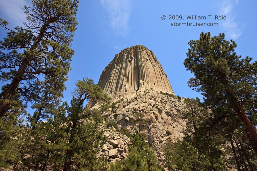
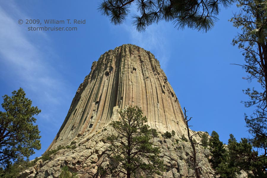
 My target area for today was generally Crook County, WY, which is in the northeastern corner of the state. Severe chances appeared to be good, thanks to adequate instability and vertical wind shear. Tornado prospects, like the day prior, were minimal. Since we had stayed in Belle Fourche, SD, our drive after the weather briefing to the target area was minimal, as Crook County was just ten minutes away! This allowed us to kill some time midday at beautiful Devils Tower.
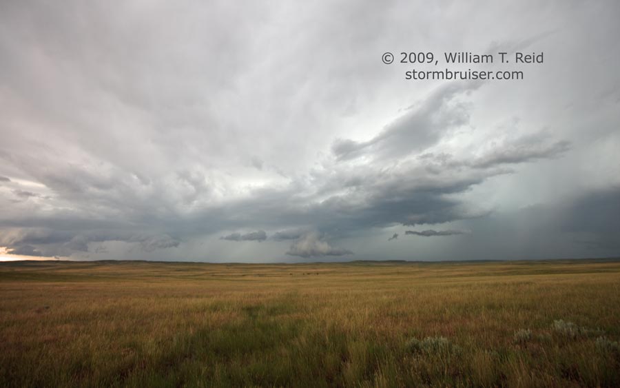
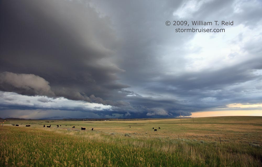
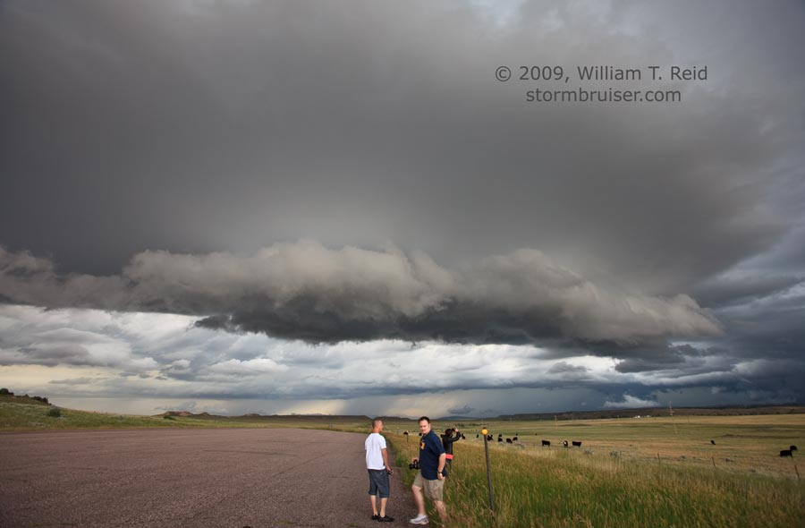
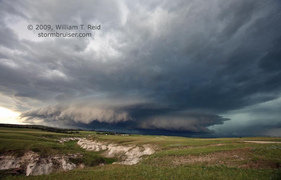
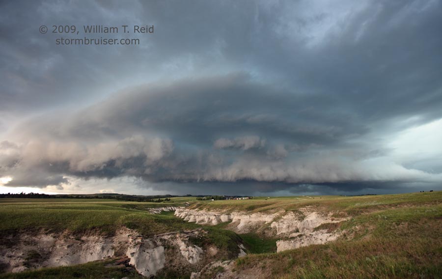
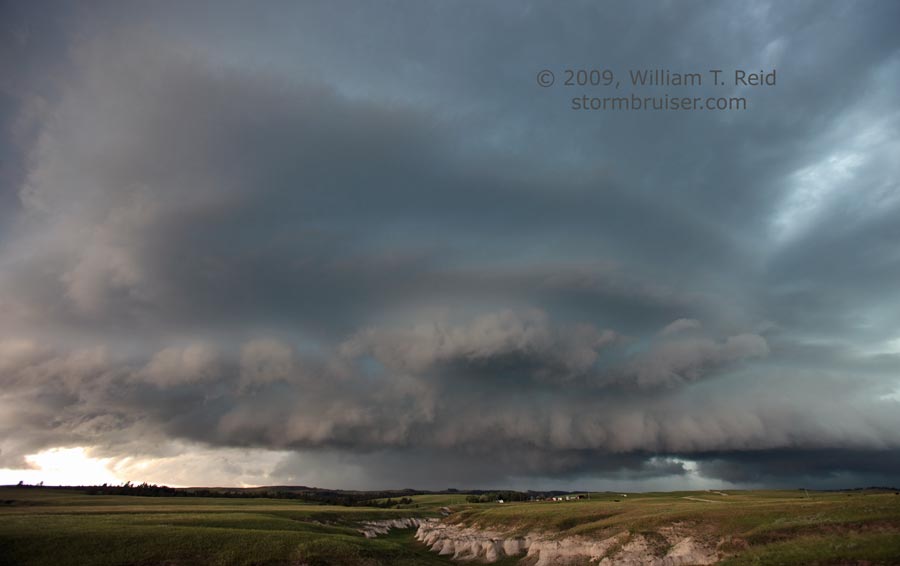
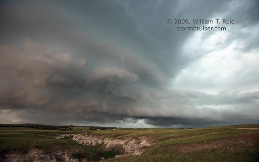
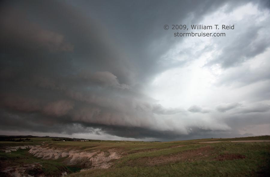
My target area verified, as Alva, a small town in Crook County that we had passed through early on, was hammered by quarter-sized hail and “very strong” winds at 5 p.m. However, after our midday meal near Devils Tower, we were lured southward towards strong storms moving out of southern Campbell County. A rather unimpressive and linear-looking complex gave us a decent CG show near Clareton, in Weston County. The southern end of this complex showed some promise and was moving east-southeast, so we blasted east to Newcastle and then south on U.S. 85 in order to get in front of something worthwhile. We were rewarded somewhere between Redbird and Hat Creek, I think, as a nicely sculpted HP supercell approached U.S. 85. I found some interesting eastern Wyoming range land for a nice foreground.
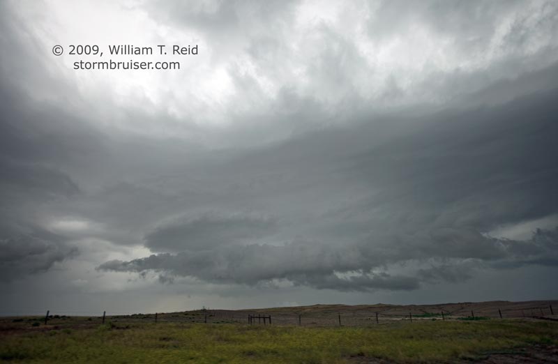
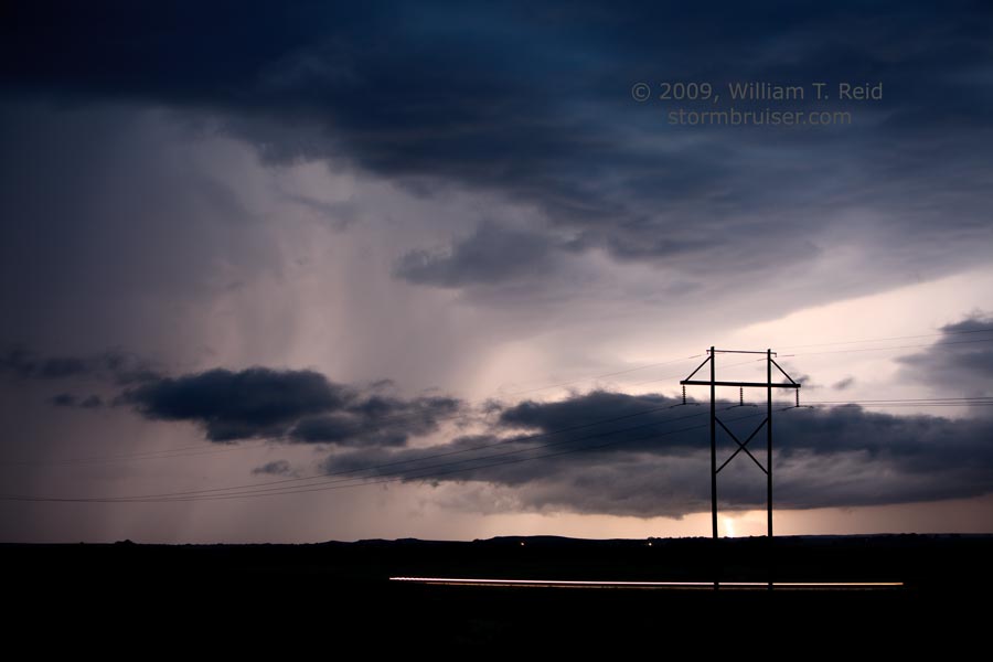
The supercell looked nasty and well-organized, but dominated by outflow. I wasn’t interested in tasting its precip core, so we had to hustle south to Lusk and then east on U.S. 20 to stay ahead of it. SPC’s “storm reports” indicates an “unconfirmed tornado” with our cell seven miles northeast of Lusk at 8 p.m. MDT. We weren’t too far away, but didn’t see it. The storm was dropping at least 1.75″ hail on open range land, and then started to lose steam as it crossed into Nebraska. A number of other cells developed just after sunset, and our supercell croaked. We arrived in Chadron for the night safe and sound.
Leave a Reply
You must be logged in to post a comment.