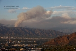
The wildfires in the mountains north of Los Angeles had been going for several days, and I finally had an afternoon and evening free this Monday to try to get some shots. The “Station” fire, in the San Gabriel Mountains near La Canada, La Crescenta, and Mount Wilson continued to rage on Monday afternoon. On the previous two afternoons, this fire had created impressive pyrocumulus clouds above the mountains as viewed from the San Fernando Valley (WSW of the fire). As I headed east on the Ventura Freeway around 5 p.m., I was looking to find a relatively close high point which would give me a good look at the convection above the fire. On the drive the pyrocumulus looked pretty good, and I snapped a couple of shots from Encino when the traffic on the 101 slowed. I decided to head north on the 405 towards the northern part of the San Fernando Valley, as I thought the view from that area might be a little better. But, as I neared the 118 Freeway in Granada Hills, the pyrocumulus cloud above the fire became obscured by smoke.
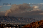
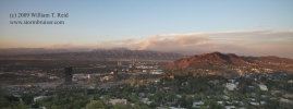
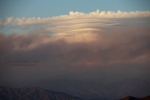
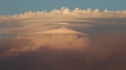
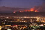
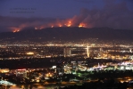
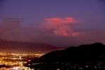
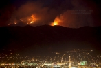
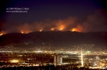
I called my friend Charlie B., who said the best overall views of the fire seemed to be from more distant locations. So, I went back south to the Santa Monica Mountains, a few miles south of the Ventura Freeway. With a suggestion from Charlie I found a high point above the Universal City area, with a great view of the San Gabriel Mountains to the north and northeast. It was about an hour before sunset, and the nice pyrocumulus cloud had dissipated for the most part, unfortunately. This was to the east-northeast, in the direction of Mount Wilson. However, a nice lenticular cloud formed at the top of the large smoke plume. Closer to me, to the northeast, several smaller “spot” fires burned in the San Gabriels. Some of these may have been backfires, intentionally set by firefighters. Regardless, the fires provided some interesting photography opportunities at sunset and dusk.
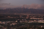
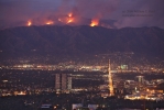
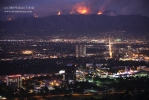
So, except for the first image, these were all taken above Studio City and Universal City, looking northeast (for the most part) above North Hollywood and Burbank. The major thoroughfare that stretches into the distance is Olive Ave., through Burbank.
Note: This Wednesday evening (Sept 2) I did a live phone interview with The Weather Channel, and they were nice enough to show my photos below! Thanks Weather Channel! Since my site will likely be viewed by some new folks, I need to note that the “comments” and “web site sign up” options on this web site are not activated. If you would like to say “hi”, you can reach me by e-mail at
bill@stormbruiser.com
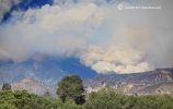
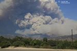
At the bottom I have added several excellent images of the “Station” fire by Charles Bustamante, as viewed from the San Fernando area. The final image is a cumulonimbus over the Coachella Valley on September 5.









Leave a Reply
You must be logged in to post a comment.