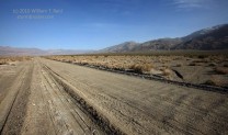
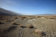
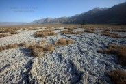
 The best thing about Saline Valley is its nothingness. Well, that’s not really true—this basin has everything a large desert basin should have. It has brilliant surrounding mountains, deep canyons, abandoned stuff, sand dunes, a playa, a coyote, and springs—there are plenty of very interesting spots to explore. But what makes this place so special is its miles and miles of desolate starkness…or stark desolation, or barren barrenness, and/or empty vastness. Remoteness and somewhat difficult access make the drive into the Saline Valley a real adventure. The only roads into the basin are dirt, or mud, or sand, or sharp rocks. The main entrances at the north and south ends are at elevations of 7200 and 6000 feet, respectively, and are typically covered in snow in winter. The basin bottom is near 1000 feet, meaning summer afternoon temperatures are often 110F to 120F. If you are lucky enough to find yourself in the middle of Saline Valley, chances are you will either feel you are in heaven, or hell. There is no in-between. The Saline Valley is kind of like Death Valley’s forgotten ugly sister. But, for many, the Saline Valley is more attractive, more inviting, and more of an experience than Death Valley. The reason is easy —- it’s the nothingness.
I had been to the Saline Valley about four times, but not for some ten years or so. I was glad to be going back! Brian and Nancy and I had had a busy morning of photography in the Owens Valley below Mount Whitney, and after lunch in Lone Pine we set our sights on the Saline Valley, on the other side of the Inyo Mountains to the east. The Death Valley National Park web site said that the roads into Saline Valley were closed due to snow, but I found that hard to believe as the weather had been dry and mild for a week or two, it was nearly mid-March, and there was little or no snow visible on the mountain slopes at elevations from 6000 to 7000 feet. Our plan was to venture as far as we could before getting in trouble.
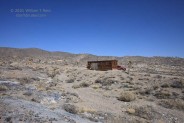
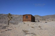
Sand blew across the road near Swansea and Keeler along the eastern fringe of Owens Lake. Even though the lake had some water on it, plenty of white dust was getting kicked up. There was also a curious pall of dust moving through parts of Owens Valley well north of the “dry” lake. Those strong winds that we had observed on the peaks around Mount Whitney earlier were mixing down some. We caught 190 east and jumped onto the first road northeast that heads to Saline Valley. It is paved in some places, but the pavement is deteriorating badly. I wonder when this road was originally paved. By the time we connect with Saline Valley Road, the surface is dirt and well graded. There is a “road closed” sign set up to keep the unwary from venturing any farther, and we press on! Our first stop is at a cabin called “boxcar cabin“. We aren’t in Saline Valley yet, but are on an elevated plateau which sits astride the Owens, Saline, and Panamint valleys. We looked inside the cabin and found it to be a place where anyone could kickback, spend the night, or take shelter. Someone cared enough to make the place livable again! If you feel like visiting, you will have to find it yourself, and please bring some extra sodas for the next visitors.
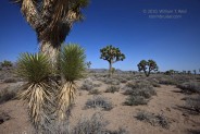
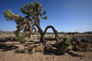
A bit farther up the road we found ourselves in a Joshua Tree forest. Brian was on a mission to find the Mother of all Joshua Trees. I don’t know if he found it or not, but I found some decent specimens.
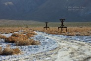
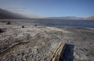
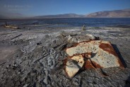
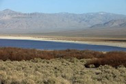
There were a few folks on motorcycles/dirt bikes on our road, but we otherwise saw no one else as we reached the overlook on the south end of Saline Valley, at 6000 feet. There were some patches of snow on the road in the shady spots, and some boulders on the road next to steep slopes, but Brian’s SUV toyed with the obstacles. We made our way down pretty Grapevine Canyon and finally made it onto the flats, where the road straightens out. The first part is on a rocky alluvial fan, and the road is a little rocky and rough. Later, near the basin bottom, the road surface is smoother and sandier, and occasionally like a washboard. We passed a make-shift campsite along the way, and then stopped along the old abandoned salt tram towers. A side road heads along the towers to the playa, which happened to be quite wet! The Saline Valley was sporting a good-sized lake late this winter! I lugged my camera to the shore, and in spots the salty ground was extremely mushy and my shoes sank an inch or two into the muck. The sun was low, and it was a good time to shoot!
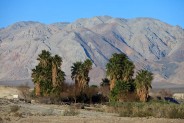
After poking around the shoreline and tram towers for a bit, we continued north along Saline Valley Road, past the sand dunes, and then turned northeast onto the road to the springs. The springs are one of the few places in the basin where you can expect to see people. The area has palm trees, large tubs for bathing in the warm to hot spring waters, and camping sites. It’s a nice place to visit, but there were a bunch of people around, and we didn’t need that noise! It was also cool and windy, with some blowing dust. We made a quick tour of the area and headed back to Lone Pine the way we came. Near the Joshua Tree forest we stopped again to admire and photograph the very dark night sky and, you guessed it, the Zodiacal Light!








Leave a Reply
You must be logged in to post a comment.