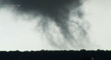
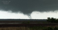
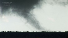
I bit the bullet and played the high risk area of eastern Arkansas. Heck—we were already in St. Louis, so why not?! Tornadic supercells were raking Mississippi around midday as we made our way into the northeastern corner of AR. A couple of storm towers went up in the vicinity of Fair Oaks by mid-afternoon, and the bases were nearly scraping the ground. Low level wind shear was very strong, and we observed strange “plumes” of condensation beneath a storm base. These were in contact with the ground surface…were they tornadoes? Well, there was definitely no violent rotation associated with the phenomena, so I would have to say that these were not tornadoes. Relative humidity was so high that any convergence beneath the storm base seemed to result in condensation. Here are a few video stills of the tornado-lookalike, or weak tornado, looking southeast at 5:17 p.m. CDT from near Penrose (the storm was very close to the triple-point of Cross, Woodruff, and St. Francis counties, northwest of Forrest City).
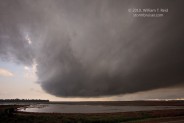
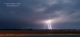
Anyway, though the low-levels looked impressive on occasion, the towers above were not. We abandoned the Fair Oaks area and headed west and then south to Haven, in time to intercept a strong supercell with frequent CGs and some good low-level structure. It waited until nighttime, though, to go into tornado mode, near Fair Oaks!


Leave a Reply
You must be logged in to post a comment.