Today’s atmospheric setup showed huge potential for nasty tornadic supercells in OK, and the potential was realized during the afternoon and evening! A tornado outbreak occurred over Oklahoma, with a handful of EF3 and EF4s. Fortunately for our tour group, it was arrival day and we were based in Oklahoma City. We did a quick orientation around noon and headed north towards north-central OK. Surface low pressure, dry line convergence, and mostly clear skies were over northwest Oklahoma, and development was expected there. However, the flow aloft was very strong from the southwest, and storm motions would be uncomfortably fast. We waited beneath a broken stratus deck around Enid for a while, and a strong cell went up to our northwest, between Woodward and Alva. We had time to head north to intercept it, but I was concerned that it would trek northeastward and wind up in the murk north of the warm front, along the OK/KS border. As it turned out, that cell grabbed the warm front, moved ENE, and produced tornadoes around Wakita and Medford. As this was transpiring, a new, large updraft materialized to our WSW and was moving in our direction. It was unlikely to produce a tornado right off of the bat, I surmised, so we headed east towards I-35 (along 64/412) in order to give the storm time to mature. We wound up stopping east of Red Rock, OK, by about six miles, near roads 15 and 177 (between Ponca City and Stillwater).
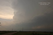
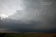
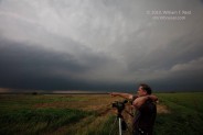
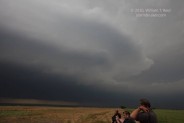
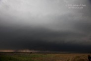
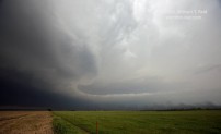
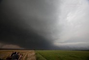
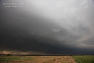
Our location provided a great view of the approaching supercell. The first two views below are to the west, at about 4:40 and 4:50 p.m. CDT, and the image of the nicely tilted updraft was at 4:53 p.m. The storm was moving to the ENE at about 45 mph, so it was not long before the storm base was to our northwest by a few miles.
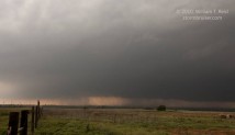
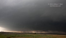
The images below were taken between 4:55 and 5:00 p.m. CDT.
The views to the north (especially 1445, 1449 and 1453) show the front end of the updraft base and the nicely structured area adjacent to the updraft/low-level inflow region. The views to the northwest (1447, 1450, and 1454) show the low updraft base and areas of precip. These precipitation curtains were near the RFD and were moving rapidly. On at least one occasion, an area wrapped up tightly enough to kick up some surface material. Inflow into this beast was intense, averaging perhaps close to 40 mph for a minute or two at our location. To our east was a sand and gravel operation, and the inflow winds were picking up copious amounts of dust and sand from that locale (see the lower-right side of images 1453 and 1456). It was quite a rush to be so close to such an immense and dynamic entity!
The storm moved off to our northeast and we were left with some west winds and light rain — and with a somewhat empty feeling. Where was the big tornado we were hoping for? Well, the storm did go on to produce a significant tornado or two shortly afterward, but there was no way for us to view it due to the fast storm motion, and particularly because of the poor road network to our east and northeast (in and around the Arkansas River).
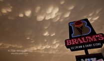
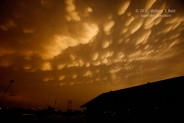
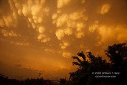
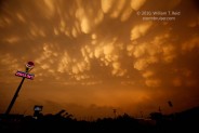
With a few hours of daylight remaining, we had a chance to intercept another supercell to our south, a little south of I-40. This cell produced a tornado east of Norman and again from near Tecumseh to Cromwell. I elected to blast east to Tulsa and then south to Henryetta on U.S. 75, and despite making good time, we still wound up behind the storm, too late. We inadvertently wound up heading south on the Indian Nation Turnpike and had to drive several miles in order to come back north again. The toll booths had been abandoned due to the tornado threat. Mammatus filled the sky at sunset at Henryetta and we enjoyed the view from the Braum’s parking lot.





Leave a Reply
You must be logged in to post a comment.