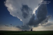
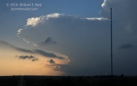
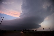
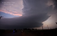
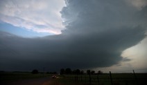
The atmosphere over the southern Plains was much more relaxed compared to yesterday! A strong cap and weak boundaries were above western OK. With decent CAPE and shear/vorticity along a lifting warm front, there was a chance of a supercell, and we found one near sunset southwest of Woodward. Our group killed time during the afternoon along I-40 near Foss, and were then lured a little southwest towards Sentinel as an updraft broke through the cap. Shortly after positioning east of the “storm”, it bought the farm. We drifted north and were near Canton when strong convection was observed well to the west. It took nearly an hour to get to the pretty, but somewhat skinny, sculpted supercell in Woodward County west of Sharon. A brief tornado was observed with the cell prior to our arrival, but the storm structure was more impressive than the tornado on this chase, I suspect!
William T. Reid






Leave a Reply
You must be logged in to post a comment.