Stormbruiser.com

William T. Reid

  • About
  • Video Links
  • Climate
  • Categories
    • Astronomy
    • Aurora/Northern Lights
    • Artsy
    • Airports (LAX and VNY)
    • Animal Day
    • Beach
    • BEST and MOST POPULAR
    • Chase Season Summary
    • Chasers and friends
    • Cumulonimbus
    • Death Valley
    • Desert
    • Desert/Mountains
    • Elevated photography
    • Eyesores
    • Fire
    • Flooding
    • Hurricane
    • Landscapes
    • Lightning
    • Local: Conejo Valley/San Fernando Valley
    • Mid and High Clouds
    • Nighttime photography
    • Old Stuff
    • Rainbows/Optical Phenomena
    • San Nicolas Island
    • Storm Video Sales
    • Stormy Skies
    • Stupid Bugs
    • Sunsets and Storms
    • Supercells
    • The City
    • Tornadoes
    • Unusual Clouds
    • Vegetation
    • Wind and Dust
    • Winter Weather
  • Contact
You are here: Home / 2010 / May 15 and 16, 2010 Marathon, TX convection

May 15 and 16, 2010 Marathon, TX convection

May 16, 2010 By Bill Leave a Comment

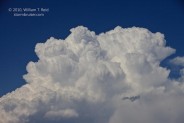
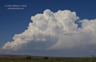
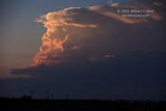
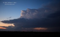
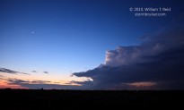
On both the 15th and 16th we were in Fort Stockton for lunch, and from there we headed southwest towards Alpine on U.S. 67.  We wound up with marginally strong cells in the vicinity of Marathon, and I have little in the way of interesting photographs to share.  On the 16th we abandoned a dud storm between Marathon and Fort Stockton, and raced northward to catch a small supercell that was north of Andrews.  As we neared, it sputtered, and I was unable to catch any of the impressive (but extremely infrequent) lightning flashes that it emitted at dusk.  All of these images are from the 16th.

Filed Under: 2010, Cumulonimbus, Sunsets and Storms

Leave a Reply

You must be logged in to post a comment.

Search

May 2010
S M T W T F S
 1
2345678
9101112131415
16171819202122
23242526272829
3031  
« Apr   Jun »

Categories

Archives

Copyright © 2025 stormbruiser.com · Log in