High risk!
High risk in OK!
High risk in OK in May!
High risk in OK in May near OKC!
High risk in OK in May near OKC with tornadic HP supercells moving quickly through less-than-ideal road networks clogged with thousands of chasers some of whom are insane idiotic imbeciles with flashing lights and whatnot!
This is what chasing is all about!
Western OK was where all of the fun would be today. We began in Borger, TX, and fidgeted around Weatherford, OK, during the mid-afternoon. A storm went up to the WNW near the TX/OK border, but it was in somewhat dry air and we waited a bit for something closer, as the nearby cu were somewhat agitated. We drifted north and viewed an impressive storm tower to the northeast, near Hennessey. We might have been able to attach ourselves to this one, but it would be moving away from us, and the low-level environment to its northeast was suspect. It looked like our best play would be to get in front of the storm out west, now tornado-warned! Well, about the time we reached the Canadian River northwest of Watonga, both storms had produced tornadoes—and we were still too far away to see much. It was going to be that kind of day.
A little northwest of Oakwood, a low stratus deck was just to our north, and the supercell to our west was sucking on this cool air. Its tornado phase was over, for now. It was moving eastbound at an unfriendly pace, perhaps 40 mph. Our group stayed with it along 33 through Watonga to Kingfisher, with a stop or two to shoot structure to the north. The storm lost its cool outflowish look and became a tornado candidate as it neared Dover. We managed to get in front of the beast a little south of Dover, and shortly after stopping we viewed a fairly significant cone tornado to our west! I shot video, but got zero stills of the entity, which quickly became rain-wrapped. UGH.
There was little time to spare—the HP cell was bearing down on us quickly. We jumped on the road which went east to Crescent, and then south back to highway 33, west of Guthrie. The storm had a green and nasty look, and only God (and Roger Hill) knew what was lurking inside its maw. Unfortunately, the chaser zoo gates had been thrown open, and everyone and their monkey’s uncles and their uncle’s monkeys were on highway 33 in front of the storm. Not good. I was afraid that the storm might mow down chasers stuck in traffic along the highway. We managed to crawl along and barely stay ahead of the cell, and when we reached Guthrie the traffic had thinned considerably, thankfully. We stayed in front of the storm a little east of Guthrie, but there was little to see as it had become a messy HP. We got rooms in Chandler, where the fine folks at a restaurant next to the Econolodge were nice enough to stay open to feed us.
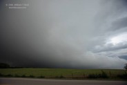
Here is a video still of the supercell west of Loyal, and then looking west from near Dover of the tornado, before it became rain-wrapped.


Leave a Reply
You must be logged in to post a comment.