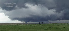
 A great tornado chase today! Our chase tour (with Brian Morganti and Chris Gullikson) started out of OKC two days prior, and we were quite bummed at being unable to chase the big event in northeastern SD that day (May 22). On the 23rd we chased storm cells which were moving northward through NW KS. In the last light of dusk we spotted a decent-sized tornado north of Goodland. I was so impressed with the look of the storms on this day that I shot zero stills.
The chase outlook for the 24th appeared to be pretty good (okay—very, very good!), as a strong, negative-tilt short-wave trough would be moving east-southeastward towards the western Dakotas and western Nebraska. The forecast wind profiles were very impressive for the afternoon hours! Low-level moisture was not a problem at all in advance of the system, and it appeared that tornadic supercells would be a very good bet—but they would be very fast moving. This system gave us an opportunity to “make up” for missing the big SD tornadic supercell on the 22nd. I did not want to mess up.
Forecast models on the 23rd indicated a surface low in the vicinity of Rapid City by midday on the 24th, with a warm front lifting northward through the state. More importantly, surface winds were forecast to be nicely backed near the warm front. Forecast conditions didn’t look too shabby for Nebraska, either, but surface winds were not as backed, and the poor road network in northwest NE around the Sand Hills made the decision to target SD an easy one. There was one small hitch, though —– we were in NW KS near GLD at dusk on the 23rd, and models were breaking out convection in western SD by early afternoon on the 24th. Another hitch was the potentially fast storm motions from south to north. It would be very frustrating indeed if we made the long drive only to wind up futilely out of position behind a tornadic storm. I booked rooms two hours north of Goodland, in Imperial, NE. This decision wound up being very important.
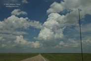
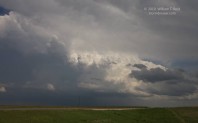
After a relatively short night at the Imperial Inn, we were on Hwy 61 northbound by 7:00 a.m. MDT on the 24th. The chase prospects in western SD, east to northeast of the surface low near the Badlands, remained excellent. SPC had a 15 percent hatched tornado area covering much of western SD. By about noon MDT our group had reached Kadoka on I-90, and as we continued north on Hwy 73 we found ourselves in a rapidly developing cu field. We were very near the warm front, dew point was an impressive 67F at Philip, and winds were from the southeast at 15-20 mph. A healthy updraft was just to our north and moving north to NNE (image 2055 below at 12:16 p.m. MDT). Gad—it wasn’t even noon sun-time locally, and it was showtime already! We had reached the target area just in time. A second updraft (or two) was developing not too far to our west as we headed north from Philip. When we reached Hwy 34, where 73 jogs to the west, the “north” storm was just to our east and appeared fairly healthy (image 2056 at 12:41 p.m.). There was no way to easily stay with it, though, as it moved fairly quickly into the Cheyenne River Indian Reservation and towards the community of Cherry Creek. Highway 73/34 went west a little and then northwest, and would serve handily to intercept the storm that was looking better to our southwest (image 2059, 12:41 p.m.).
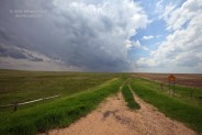
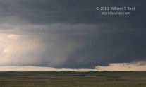
We crossed the Cheyenne River and continued northwest towards Howes on 73. Shortly after 1 p.m. MDT, we stopped just short of Howes along Hwy 73. The cell that we were watching was to our south-southwest now, and was exhibiting some decent organization. The three images below are looking south-southwest from 1:11 to 1:14 p.m. The lowest portion of a sculpted updraft base was in view to the south or south-southwest, and an area of forward-flank precip was northeast of that—-to our west-southwest. The storm was moving north, or a little west of due north. A “clear slot” associated with the RFD is apparent on our side of the very low storm base/wall cloud.
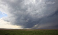
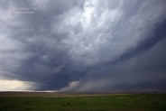
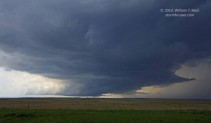
I had my camcorder set up and pointed SSW at the updraft base at 1:08 p.m., and ten minutes later it was still pointed in the same direction. The storm was approaching somewhat quickly, but it was very nice that we were not dealing with something that was racing along at 50 or 60 mph. I would estimate the storm motion at 35 to 40 mph. As the leading edge of the updraft base neared, I became somewhat less impressed with the look of the storm. I was still a bit concerned about fast storm motion, and since our cell was not tornadic yet, I thought it would be a good idea to move west a little, to Howes, where we could head north if necessary in order to stay ahead of stuff. At 1:18 p.m. I told the group that “we’re gonna drift farther west”, and I turned off the camcorder. Moments later, Chris Gullikson pointed out that a tornado was forming! My tape was quickly running again! At 1:19 p.m. MDT a tornado was in progress well to our south or SSW, perhaps seven miles distant. The contrast was excellent, however, and there was no longer a reason to reposition! (NWS RAP indicates that the first tornado began at 1:24 p.m., but it was actually five or six minutes prior.) The three images below were at 1:12, 1:16, and 1:20 p.m. MDT, looking SSW, from our position about a half mile east of Howes.
The tornado moved from left to right from our perspective. It looked like it was moving NNW. It appeared to clear a ridge in the distance, and was in open, low-rolling rangeland to our southwest after several minutes. The six images below were taken with the 70-200mm zoom lens, from 1:20 to 1:23 p.m. MDT.
The tornado neared as it moved north, and was perhaps five miles to our southwest. The motion near the ground was fast and impressive, and condensation quickly came and went, occasionally revealing multiple suction spots. The images below were from about 1:25 to 1:29 p.m., again with the 70-200mm zoom. With such a low storm base, the tornado on occasion attained near “wedge-like” status. Given local time of close to high noon, lighting was quite a bit different than for most tornadic supercells. It was remarkable that the contrast was magnificent, that the RFD remained precip-free, and that our view of the tornado remained absolutely unobstructed.
With the storm and its spectacular structure on display to our west-southwest, I grabbed my Canon 5D with the 16-35mm zoom for a handful of wide-angle shots. These were from 1:27 to 1:31 p.m MDT. In pic 2073, the tiny community of Howes can be seen on the extreme right.
The large tornado moved towards our west, and a second skinny tornado appeared for a minute or two to our WNW. The images below were shot from 1:30 to 1:32 p.m.
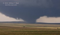
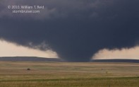
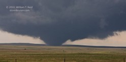
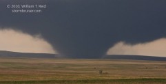
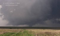
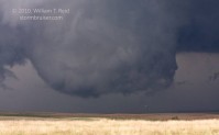
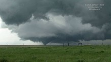
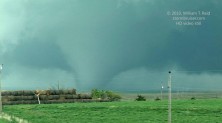
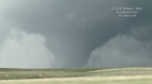
It was about the time of the skinny tornado (1:31 p.m.) that the large tornado crossed Hwy 34, approximately four miles west of Howes. This is where Antelope Rd. crosses, just two miles east of Plainview. It was time for us to move quickly. We were in the vans and headed the short distance to Howes by 1:33 p.m., and the tornado was very large and north of Hwy 34 by about a mile already. We turned right at Howes on Hwy 73, and this road was just about perfect to keep pace with the tornadic storm to our west. A couple of chasers had passed by us earlier and went west of Howes to get a good look at the tornado. There were no other chasers in sight as we motored north out of Howes! I suspect that the early show messed up a bunch of chase plans this day. From 1:33 to 1:45 p.m. (at least!) the tornado was very large and very impressive — a beast! It remained some five miles or so to our west as we paralleled it along Hwy 73. It was planted solidly, a fat stovepipe to fat cone and back, and it was during this stage that it was likely strongest. I shot video through Chris’ driver’s side window, but we were battling some interfering low hills on occasion. We caught up, and with the tornado a little south of due west, we stopped again. This was from 1:40 to 1:43 p.m., about six miles north of Howes. The tornado was not quite as massive as minutes earlier. The second image shows a new meso on the northern edge of the updraft base area (to our WNW). Occasional small and brief tornadoes were observed from this strong circulation, but the main show continued to be the southern meso.
We continued north on 73 again, passing Old Marcos Rd. at 1:45 p.m. and Cherry Creek a minute later. The large tornado went into Jeckyll and Hyde mode. It was a massive cone for a couple of minutes, and then dissipated almost entirely. Moments later it was a large, fat drillbit, but this phase was momentary. While the old tornadic meso produced intermittent touchdowns, the new meso on the north side continued to tease (9766 below). The images below were taken from 2:00 p.m. to 2:05 p.m., along Hwy 73 about 12 miles south of Faith. The large tornado was still a good five miles or so west of Hwy 73. It was a large stovepipe and slow-moving at this point, and then it quickly dissipated and vanished. This was near 2:05 p.m., and was likely the very final iteration of this storm’s initial tornadic mesocyclone. The NWS survey map shows this first tornado ending right here, at 1:57 p.m. (the correct time is 2:05 p.m. MDT). The duration of the tornado was 45 minutes, though there were phases towards the end in which there may have been intermittent contact with the ground. The meso continued to drift a little farther to the west and precip increased with the circulation, making it more difficult to observe any tornadoes that might be with this tornado cyclone.
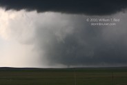
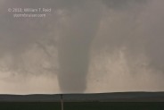
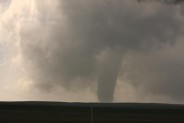
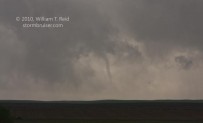
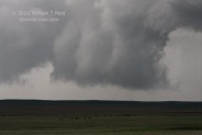
We were back in the vans and heading north towards Faith by 2:10 p.m. The northern, or leading edge, of the supercell’s updraft base exhibited strong rotation at cloud base but appeared unable to produce a tornado. We reached Faith at 2:20 p.m., and jogged west three miles in order to continue north on 73. The action area appeared to be just north of the 212/73 junction west of Faith, and the NWS survey shows that a tornado occurred just southwest and west of Faith. The storm was becoming HP in character and we were unable to see this tornado, despite being quite close. Whereas Hwy 73 had been an excellent route from which to view the storm to this point, it now found itself right along the path of the new tornado cyclone. We drove north on 73 some six to eight miles, I think. Visibility was poor and we were in occasional heavy rain. I was fairly certain that we were trailing the potentially tornadic area, but it was becoming increasingly dicey to continue the chase. I chose to turn around and to head back to Faith for a break. The storm did indeed produce an additional long-track tornado (occasionally more than one at a time), soon after we abandoned the chase. This one was from 2:34 to 3:35 p.m. MDT, according to the NWS, and the path length was about 42 miles. Tornado damage occurred at several places, first just east of Hwy 73, and then just west of 73, north of Hwy 20. At least one chaser managed to get close to this tornado, but he was battling rain and poor visibility.
Wow—what a rush! During the previous hour or two I had witnessed one of the most photogenic large tornadoes in my chase career! South Dakota is truly a magical chase state. So, what now?? Numerous storms were well to our south and southwest in southwest SD and western NE. This looked awfully messy and much of it was going linear. It was not even 3 p.m. yet, so we set our sights on a cell that was in the vicinity of Pierre and moving north. From Faith we blasted east on 212 and crossed the Missouri River into Potter County. Our target storm was to our south-southeast, and we maneuvered east to U.S. 83 (west of Gettysburg) to set up. Well, lo and behold, our cell was a supercell, and a beautifully structured one at that! And believe it or not, it looked like a small funnel cloud or tornado was dangling beneath the large updraft base to our south! This was at 4:37 MDT…well, now it was 5:37 CDT, since we had just crossed into the Central Time Zone. The “tornado” to our south was rather distant, and we were unable to confirm ground contact. It didn’t last more than a minute or two. The first image below was at 5:37 p.m. CDT, and the following seven were from 5:41 to 5:47 p.m. All of these were looking south as the updraft approached. When the cell reached Hwy 212, it was as if it had entered the Mojave Desert. The updraft croaked quickly . We were several miles northwest of Gettysburg and looking west when I snapped the last of the nine images below. A few minutes later this storm updraft was essentially a nonentity.
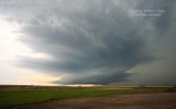
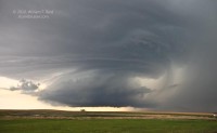
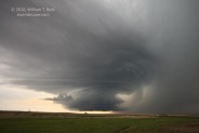
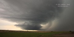
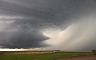
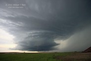
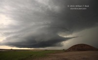
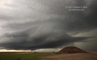
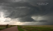
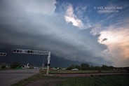
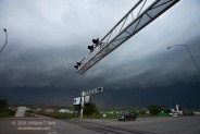
There were still a few hours of daylight remaining, but the storm system had morphed into a large derecho-like mess, blasting east down I-90 and vicinity. It looked like the line would affect Pierre, so we went south on 83 to the capital. On the Fort Pierre side of the Missouri, we stopped to watch the shelf cloud pass overhead. There was some wind and rain, but nothing Pierre could not handle. It was pizza time for our bunch!
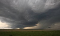
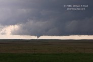
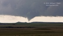
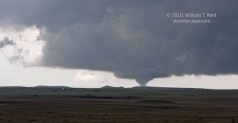
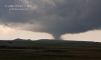
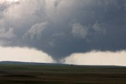
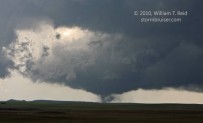
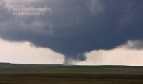
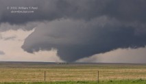
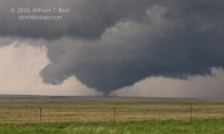
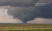
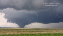
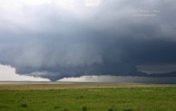
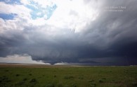
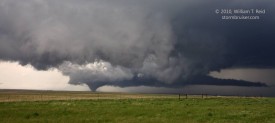
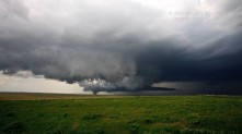
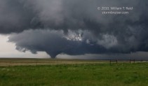
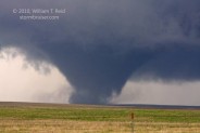
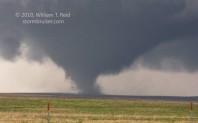
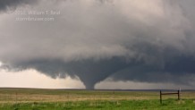
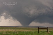
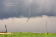
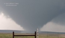
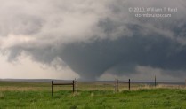
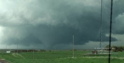
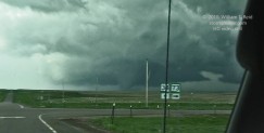
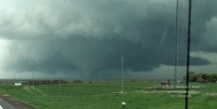
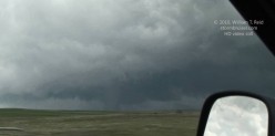
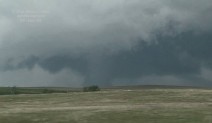
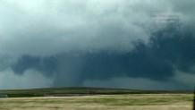
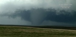
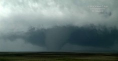
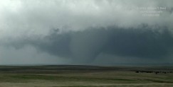
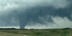
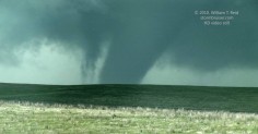
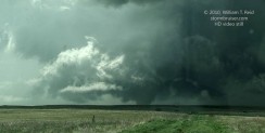
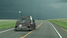
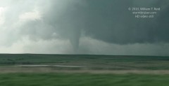
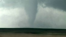
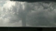
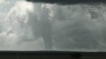
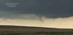
Below are numerous HD video stills, some enhanced greatly. These are primarily during the north-of-Howes phase while we were in motion. Our guest Marco Hoogers got some great shots (click here), as did Kate Gerlach (click here); and finally, click here for youtube video of the Howes-to-Faith tornado by Chris Gullikson.



Leave a Reply
You must be logged in to post a comment.