This was a somewhat odd chase day. We began in Murdo, SD, and had a long drive to make in order to get to the target area in extreme western KS—a little south of I-70. The setup for strong supercells and tornadoes was not especially pronounced (marginal upper flow, so-so dew points), but many of the storms that did form along and near the KS/CO border produced numerous tornadoes. What may well have been the “storm of the day” was a beast of a tornadic supercell which found itself practically free of storm chasers. So, how did our group do? Well, we basically wound up flailing around—
—too late for the landspout and tornado-fest near Towner, CO (understandable since this was unreachable in time)
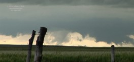
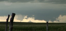
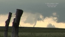
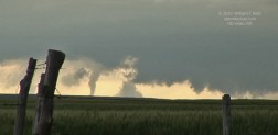
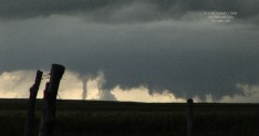
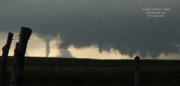
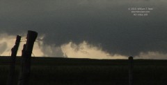
—chose poorly between storms north of Leoti and west of Leoti. We went north of Leoti to extreme southern Logan County, where our activity became a strung-out mess while the cell north of Tribune tornadoed. Fortunately, we could see this tornado from 20 miles away (see video stills below).
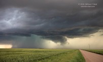
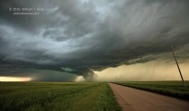
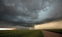
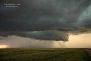
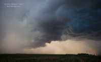
—chose poorly again north of Leoti when a new storm blossomed not too far to our northeast, while the Tribune-area supercell slowly approached. My decision (after much agonizing!) was to stay put along KS 25 near the Wichita/Logan county line in order to observe the approaching cell. This supercell to our west had good structure, but was no longer interested in tornado-making, as it was running over rain-cooled low-level northerly outflow.
The new cell that I elected not to chase trekked from southern Logan County and into southern Gove County and beyond into the night hours. There were reports of a large, rain-wrapped tornado in Gove County, six miles northeast of Monument Rocks at 0114Z. Multiple tornado reports from the same supercell were later made from Trego County and Ellis County. The radar representation on this storm was fantastic around sunset time as it marched through southern Gove County. The supercell was in a very poor road network, however, and I have yet to see any images of the storm or its tornadoes! Show me the pictures of this beast! Most chasers on this day were clustered around storms near the dry line, along the KS/CO border, and were unable to reach the Gove cell. The storm was riding along a warm front and into east winds. This area had not been highlighted by SPC. Yes, I am miffed that I did not blast east on the unpaved road network to chase this storm when we had the opportunity. We would have been one of the lone chase teams on one of the meanest storms of the spring! If this storm had been swarming with chasers and had been 15 miles farther south or north, then today it would be very well known.
Below I am pasting my forecast post, written midday while heading south through Nebraska, and the write-up that Brian and I whipped up for the chase community shortly after the chase.
——-
my midday forecast thoughts:
Our group just had lunch in North Platte. My thoughts this morning were to head to Sterling or Brush and to dive south. I was hoping that some decent moisture could make it to the Palmer Divide by 7 p.m. or so for a nicely sculpted supercell. It appears now that the E-W tongue of good air will remain near U.S. 50 (Lamar-La Junta) —- according to the RUC. Current conditions are somewhat contradictory, as dews at LAA and LHX have fallen to the low 50s, and dews are coming up along I-70 (GLD/ITR/LIC) —- into the mid 50s at GLD.
The RUC is bullish on precip in NW and NC KS by 00Z, with a tongue of decent CAPE into the Stockton area. So, I am waffling between E CO and northern KS currently. The KS target is much easier for us, CAPE values are above 1000 and effective shear is enough for supercells. The 19Z surface map suggests a nice stalled-out E-W boundary running E-W between HYS and HLC. Moist easterlies are blowing through NW and NC KS, and there is some weak convection there now.
So, instead of heading west to Sterling, we’ll drop south to the boundary near Colby and play the KS option…but still leave the I-70/Palmer Divide option open in CO if I start seeing some near-50 dews at LIC.
——–
chase summary by Brian Morganti and myself:
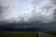
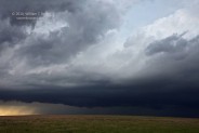
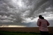
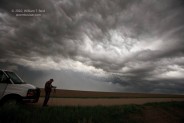
Bill Reid, Chris Gullikson, and I dove south out of Murdo, SD mid-morning and were looking at eastern Colorado as our target area. After lunch in North Platte we continued south into northwest KS and several storms went up along the KS/CO border. The closer storm took on a supercell shape on radar and was slowly approaching Sharon Springs as we approached from Oakley. However, what appeared to be a left-moving supercell crashed into our target cell from the south. The end result was a new storm which produced a handful of landspouts and perhaps a large tornado near Towner, CO, just west of the KS border. Unfortunately this was some 25 miles even farther to our southwest and we missed the show. We then headed south to Leoti and learned from Matt C. that the slow-moving tornadic cell, that was now to our west, was undercut by cold outflow. A new strong updraft was becoming more discrete back to the NNW so we headed back north into southern Logan County. An RFD appeared to cut into the base to our west but the overall look remained rather strung out and undercut. Soon we were shivering in cold outflow winds as new storm towers blew up just to our east. A newly tornado-warned cell was now visible to our WSW and sported a large lowering. We observed an elephant trunk tornado from this storm base which lasted for two minutes, but it was at least 20 miles distant near the town of Tribune. We then moved south a few miles to near the Logan-Wichita County line and found ourselves between two good storms. The new one to our ENE had a good look at low levels and was likely moving into good unspoiled air, but the only way to quickly get into position was to use an unpaved road into northern Scott County. The recently tornadic cell to our WSW was now approaching our position and had good structure and a persistent wall cloud. It was decision time—which storm should we target!? We were ready to blast east towards the cell moving towards the Monument Rocks but we took one more look at radar and saw a nice hook on the one approaching from our WSW. We stuck with this approaching cell as it was an easy intercept. We had a good view into the notch area and took some nice structure shots but it seemed that the storm was becoming undercut again and tornado chances were slim. As we dropped south to get out of the way, the cell threw some small hail on us, and we started to learn of significant tornadoes with the eastern cell in southern Gove County. We wish we had gone east when we had the chance.
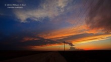
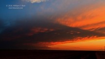
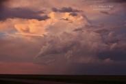
The HD stills below are of the “Tribune” tornado, approximately 20 miles to our WSW from KS 25 near the Logan/Wichita county line around 5:50 p.m. MDT. More images by guest Marco Hoogers here.

Leave a Reply
You must be logged in to post a comment.