video of Campo Tornado on youtube
The Campo tornado chase posts are in two parts on Stormbruiser. Part One covers the preliminaries from about 3 p.m. to 6 p.m. MDT, when we observed a nearly stationary tornadic supercell in Baca County, CO. This is Part Two: the main event and thereafter into the evening.
In Part One you’ll find a brief setup. Let’s include a little more here. Dallas Raines and Kirstie Johnson and I were loosely tagging along with Brian Morganti and the Tempest Tours group today. We began the day in Enid, OK, and targeted extreme southeast Colorado. The upper winds were weak, seemingly a little too weak around the 500 mb level to expect a top-notch supercell. The forecast flow at 700 mb was not too shabby, maybe 20-25 knots from the SSW. If we could get some southeasterlies at the surface, I figured that low-level shear could be sufficient for an interesting show. Moisture and instability were quite good for this High Plains area, with dews near 60F. Forecast charts showed a good slug of precip by 00Z near the CO/KS/OK triple-point. It appeared to be the obvious target area, and SPC agreed, as they circled our region with a slight risk. Still, they weren’t too keen on tornado prospects, with just a 2 percent outline around Baca County and vicinity.
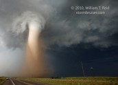
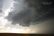
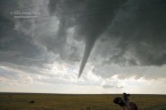
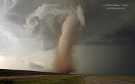
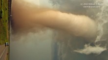
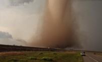
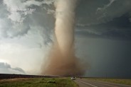
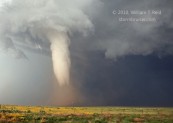
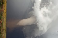
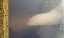
See Part One for the chase account up to 6 p.m. It was very close to 6 p.m. MDT when we entered Campo from the west and turned to the south on U.S. 287/385. This Baca County supercell had been in progress for four hours at least, but it had not produced a tornado in the previous two-and-one-half hours. Low-level rotation in the updraft base continued quite hard. I knew that the cell might indeed produce another tornado, but I certainly was not expecting one. I really had no expectations! I think that having expectations often leads to frustration, and since I usually have a positive outlook, I expect good things to happen. It was “6 o’clock Magic Time” now. My thoughts as I headed south a couple of miles from Campo were: “Let’s get a tad south of this thing, get out of the car and take a look!” There were a couple of prominent lowered areas nearby. One was just to the north, and another one just to the northwest. We were just east of the updraft’s clear slot/RFD cut. Motion and occasional tight rotation in the base continued to be impressive, but this had been the case for the previous 90 minutes. I shot a wide angle (18mm) still image to the northwest (2378, first image below) at 6:04 p.m. MDT. The wall cloud and the cloud-eroded area associated with the RFD are prominent. I put my camera down and grabbed the camcorder. Dallas was very excited, as the “action area” was quite close once again! Less than a minute later, a slender funnel cloud was quickly making its way earthward from the wall cloud to our northwest. Dallas was beside himself as the thing got closer and closer to the ground! “It’s right there! It’s right there!!” Kirstie and I were silent and in semi-shock! I was shooting video as the funnel descended about halfway, and then I gave the camcorder to Dallas —- I REALLY needed to get some good stills of this! Dallas is the TV meteorologist for Channel 7 in L.A., so he is accustomed to being on camera, not holding the camera! But, he did an excellent job filming while I shot a bunch of wide-angle stills. And, his narrative is priceless! I took about a dozen photographs with the 5D and the 16-35mm zoom. I needed just about all of the 16mm in order to get the entire funnel cloud in the frame. According to my camera, all of the tornado/funnel stills in the group below were at 6:08 p.m. MDT. ISO setting was 320, aperture was 5.0, and shutter speeds were from 1/1000 to 1/1600. I cropped a couple of the images, and turned some 90 degrees because monitors sometimes aren’t tornado friendly.
The funnel was firmly planted on the ground, perhaps a mile away to our west or west-northwest. We were slightly more than two miles south of Campo, a little beyond the curve where 287 turns to the southeast. I had Dallas hand the camcorder back to me and I videoed for another minute at most. The tornado was not translating right or left—it was headed right for us! I yelled “we gotta go!” I needed a little breathing room. It was great being so close, but it’s easier to get quality tornado video and stills when you aren’t worried about getting hit by the thing.
Dallas took off southeastward on 287, and Kirstie and I followed moments later. The tornado seemed to be right on our heels, though it was probably still a half mile or so behind us. Kirstie shot video out the passenger-side window, and we passed a group of chasers who continued to sit there gawking! I could not believe that they were not scrambling to their vehicles to escape!
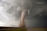
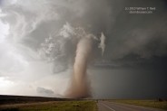
A very strong RFD wind from the west began to throw loose debris across the road. We went about two miles, stopping close to where 287 heads due south again. The tornado was still to our northwest, but at a comfortable distance. Dallas was nowhere to be seen—he went south a little farther and later said that the strong winds spooked him, thinking that the tornado was a lot closer than it was. The time was 6:12 p.m. MDT. I exited into the wind and clicked away like a crazy person!

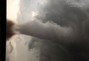

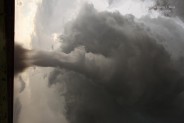


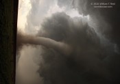

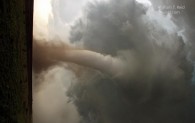
The images above were taken from 6:12 to 6:13 p.m., according to the camera’s time stamp. I think we can assume that it is accurate plus or minus one minute. The settings remained the same—ISO 320, f5, 1/1000 to 1/1600″, 16mm to 35mm focal lengths. Even though the tornado was a comfortable distance to our north-northwest, maybe a little under two miles away, we were getting blasted by strong RFD winds and I wasn’t feeling entirely safe. Kirstie and I sped south for about 40 seconds and stopped again. We were still in the strong RFD wind, but the anxiety level was acceptable. The shots below were taken from 6:14 to 6:16 p.m. MDT, about one-half mile south of where 287 turns to due south.
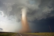
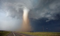
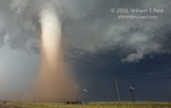
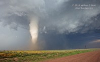
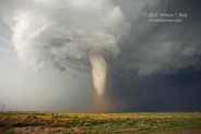
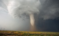
The tornado was amazing, the light and contrast were perfect. Kirstie and I stood on the east side of the X-terra to stay out of the wind and took turns shooting video and stills. After a minute or two, one-half inch to one-inch diameter hailstones were whipping past us at high speed. The tornado drifted a little east of 287, to our north-northeast, a little less than a mile distant. The strong winds persisted and the hail was getting heavier, so I elected to get back into the vehicle. I was resigned to bail south another couple of miles in order to find less hostile conditions. However, after only ten or twenty seconds, we came upon Baca County Road C! Wow—this was an excellent graded section road and would allow us to stay close to the tornado. The road was unpaved, but there was more hail than rain, so I wasn’t too worried about sliding around. (Mike Umscheid’s Campo post contains excellent radar graphics, and shows where the tornado paralleled 287 along its northwest-southeast segment, and later crossed Road C, about two miles north of the CO/OK border.) We scooted perhaps a half mile east, and the tornado was just to our northeast! I rolled down the driver’s side window, tried to ignore the occasional hailstone to the head and arm, and shot additional stills and video. The condensation funnel was wrapped in dust and dirt at low levels, but these cleared enough at the surface to reveal a wicked, whirling multi-vortex structure. The images below were taken from 6:17 to 6:21 p.m. MDT with the Canon 5D and attached 16-35mm zoom lens.
As the images above suggest, the hail was becoming quite intense just behind the tornado. Some stones were a little larger than one inch, and I was concerned that the side windows might not withstand the battering. I wound up with a bleeding thumb and a ding or two on the noggin. Regardless, I was not going to let a little hail end the chase at that point. The tornado was nearly due east, so we dashed east again down the empty road to get another close look. The four images below were taken at 6:25 p.m. MDT. The tornado narrowly missed, or perhaps “skirted”, the nearby farmstead, on the south side of Road C and a mile east of 287.

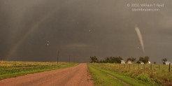
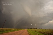

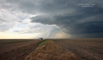
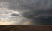
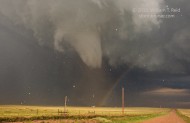
Kirstie and I headed east another mile or so one more time. Sunshine filled the foreground and a double rainbow framed the tornado…just another day at the office!
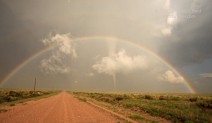
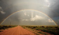
These two images were at 6:30 p.m. MDT—the tornado refused to quit some 22 minutes after initiation. I had to get out of the vehicle and crouch in front of the X-terra to shoot the incredible scene, suffering just one hailstone impact to the neck. It was worth it!
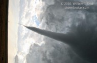
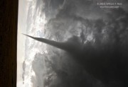
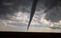
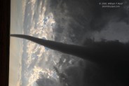
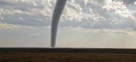
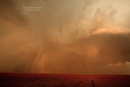
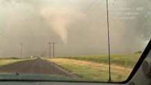
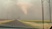
The tornado continued to the east-southeast. It had appeared somewhat intermittent in the past five minutes approximately, and was decidedly in a dissipating stage. Road C to the east appeared to be awash in a sea of hail and other precip types, so it was time to let the storm go…at least temporarily. I had two things to do now. I wanted to find Dallas, and I wanted to get back into position on the storm. At least two hours of daylight remained. Kirstie and I retreated to 287 and headed southbound. Dallas and his vehicle were nowhere to be seen, and we had no luck reaching him on the cell phone. Oh well…Dallas would be on his own for a while! (We later learned that Dallas had gone back north on 287 a little bit, north of Road C, to look for us and to inspect for damage.) As we crossed the state line into the OK Panhandle, I contemplated the road options. The next paved road eastbound was not until Boise City, but that was much farther south than I wanted to go. We went about 12 miles south of the CO/OK border (six miles north of Boise City) to Road 130 and blasted east again. After another five miles or so, the storm was to our north-northeast and was sporting another (or was it the same??) tornado! We stopped seven miles east of U.S. 287 at north-south Road 350. A slanting and elongated tornado was almost due north, perhaps six miles distant. The images below were taken from 6:59 to 7:03 p.m. MDT. About thirty minutes had elapsed since leaving the “Campo” tornado. The tornado now to our north was likely a new tornado from the same supercell.
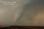

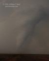

The tornado roped out and dissipated soon after the final image. I estimate that this tornado was near or just south of the Cimarron River, approximately 10 to 12 miles northwest of Keyes, OK. Of course, this is in Cimarron County, OK, and the tornado was in progress around 8 p.m. local time (CDT).
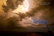
The rear end of the supercell drifted north and northeast of Keyes. We stayed close to this very agitated area. The RFD was very wet with heavy hail curtains. If a new tornado was forming, we were not in a particularly good position to view it. Kirstie and I wound up some 6 to 8 miles ENE of Keyes on U.S. 56, and found some 2.5 inch hailstones on the road. U.S. 56 continued ENE, and the storm was headed ESE, so we had to scoot south a few miles before heading east again. We stopped briefly for a few more stills of the back end of the CB, and then found a paved road east. This was a road which connected Keyes and Eva. We came up close to the backside of the cell again and witnessed another prominent funnel cloud! It appeared to be hovering very close to Eva and its grain elevators—to our east-southeast. As we neared Eva, the funnel dissipated or became absorbed by the heavy RFD hail core, just east of Eva.
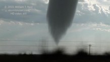
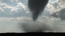
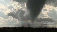
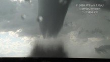
Apparently a tornado was reported close to Eva with the storm, so this was the third tornado witnessed since 6 p.m., and at least the fifth one for the day…not bad for a marginal day! SPC’s “Storm Reports” indicates a rain-wrapped tornado 4 WNW of Eva at 8:51 p.m. CDT. The video stills here of the “Eva tornado” were from 8:45 to 8:47 p.m., from one to two miles WNW of Eva, looking east.
It was near sunset and time to let the storm go for good. I reached Dallas by phone and met him back at Keyes. It was good to see Dallas again! He was all smiles, and kept saying how he could not believe what he had just seen! Dallas wound up watching the Campo tornado just a little ways south of Road C on 287 on a small rise. He missed the ones that we saw in Oklahoma, but that did not matter. Our group headed to Boise City for a celebration dinner with the Tempest group at Subway.
I have driven through Campo, Colorado, perhaps dozens of times through the years. The weather was always tranquil there. I was always trying to get somewhere else. There was never any reason to stop in Campo. There was never any need to stop in Campo. No longer. I suspect I’ll be smiling all of the way through Baca County next time, and the time after that, and the time after that. I suspect that I’ll be stopping in Campo for no reason.
———————————————————-
Below is pasted my original write-up for May 31:
This was Dallas’ final chase day of his whirlwind 4-day chase weekend. He was eager to witness his first good tornado, and he was more optimistic about seeing a tornado than I was. Kirstie and Dallas and I left Enid around 10 a.m. and made it to Guymon for lunch around 1:30 p.m. We gassed up at Boise City with the Tempest group and then made a bee-line for a tornado-warned cell in western Baca County. Someone had seen a funnel cloud with the new storm there already! When we got into our vehicles in Boise City, I kiddingly said to Dallas, “Let’s go see the tornado!”
Our cell put down a nice tornado for a minute or so when we were east of the cell along 287. We were several miles south of Springfield, and the cell was some 10-13 miles to our west. We scooted west a few miles on a dirt road, and the nicely organized cell managed to put down a couple more tornadoes at the same time! After these events, the storm was practically stationary for perhaps 60 minutes. It sported a wall cloud, but made no serious effort to tornado. Our group got a lot closer to the cell during this time frame, and then the cell started to spin strongly at low levels again. We looked up into the corkscrew wall cloud area and heard a hail roar and a whooshing sound, which is sometimes heard during a tornado. A beefy funnel extended about 2/3 of the way to the ground, but did not touch down apparently. We were REALLY close, and the cell was moving south at 3 mph, but the storm was in major “tease” mode. Dang.
We dropped south to Road J, I think, and headed east towards Campo. We stopped several times with numerous other chase groups, and viewed amazingly wrapped-up wall clouds/updrafts and occasional funnel clouds. The action area seemed to jump quickly eastward, and we trekked into Campo and south a few miles. Again, the action area was nearly overhead, and it seemed ready to go to town…but we had seen this scenario before, over and over again.
But this time was different. A funnel cloud quickly descended just to our northwest, and just west of U.S. 287. The funnel touched the ground less than a mile away, and a debris whirl rose up. The thing was moving towards us, too! We had a minute to watch, and then moved south fast! The tornado was strengthening quickly, and was moving towards the road. I could not understand why some folks stood there watching as it neared them — were they in a trance?
I must have dropped south a mile or so and then stopped and looked back north. The tornado was magnificent! See the photos! I shot a bunch of stills with the 16-35mm wide-angle, and Kirstie helped me to shoot video, too. The RFD was wicked and scared Dallas off farther to the south another mile. Kirstie and I stooped low to the ground on the road, on the east side of my SUV, to stay out of the wind and rain and hail. We could look almost straight up and see the rapidly rotating funnel at cloud base — what a sight! Since I usually chase with the tour group, I tend to stay back a mile or more from tornadoes, but this was my chance to get some closer shots, and I took full advantage! I had no data or GPS onboard, and elected to jump onto an unpaved road eastbound that the tornado was near. We were getting slammed by one-to-two-inch hail and strong winds, and I managed several more minutes of stills and pretty close video, with fast suction-spot vortices whirling around at the surface. Finally, a rainbow appeared and framed the tornado a little. I had to get out and get some stills of that — and paid for it with a big hail stone to the back of the neck.
That was definitely the main show. We continued south into the OK Panhandle and east again before getting into Boise City. We saw another tornado for several minutes to our north, and later, just before sunset, saw another brief one well east of Keyes to our immediate east. When the storm decided to start making tornadoes again, it didn’t waste any time! I got lots of stills and video of all of the tornadoes, but the stills provided below are all of the Campo tornado. Thanks to everyone in our group today and other chasers on the storm for a great, safe chase.







Leave a Reply
You must be logged in to post a comment.