Memorial Day 2010 was a big day for chasers in Baca County, CO. A supercell went up early in the afternoon, spit out a couple of tornadoes, dawdled for hours west of Campo, and finally produced a beautiful tornado just south of Campo late in the afternoon. I was fortunate enough to be on the storm early on and later be quite close to the Campo tornado, and I managed to get some decent stills and video.
Since I have a lot to share, I am breaking this chase day into two parts. This first post will cover developments right up until the main event — the “Campo” tornado. See Part Two for the really good stuff!
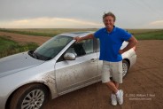
Our little chase team was comprised of myself, Dallas Raines, and Kirstie Johnson. Kirstie and I were in my X-terra, and Dallas followed in a rental sedan. He had flown out from L.A. to Denver for a chase trip several days prior, and today would be his final day to chase. Our group had no data while mobile—no radar, no satellite, surface obs, etc.—but we did have NOAA wx radio and a cell phone. We began the day in Enid and headed west on Hwy 412. Forecast models indicated an isolated storm in extreme southeastern Colorado by late afternoon, and instability and shear appeared to be good enough for severe weather. Tornado prospects did not look particularly good, as flow at mid-and upper levels was on the weak side. SPC was not keen on tornado chances—the 13Z and 16Z outlooks drew a 2 percent line around the OK Panhandle, including Baca County, CO. Of course, it was May, and a supercell on the High Plains in May is one which needs to be chased. Dallas was excited about the possibility of seeing a tornado. I had my usual “we’ll see what happens” approach!
Hwy 412 worked well to get us near the target zone. It bisected SPC’s slight risk area, so there was no need to wander north or south initially. We stopped in Boise City around 2 p.m. MDT with Brian and the Tempest group for a pit stop, and a decent cell had already developed in western Baca County. As we departed the convenience store, I said to Dallas: “Let’s go see the tornado!” My quip was quite prophetic. On our approach to the storm along U.S. 287/385 from the CO/OK border, it became wonderfully obvious that the Baca County storm was already a well-organized supercell. I figured that the storm was moving slowly to the east, and I wanted to be east of the updraft base. I led our two-vehicle group north from Campo toward Springfield, with the storm updraft in view some 15 miles or so to the WNW. And, lo and behold, a tornado started to do its thing as we reached about halfway between the two towns. The tornado was rather distant, about six miles south-southwest of Pritchett, and 15 miles to our west. Time was 3 p.m. MDT.
The tornado appeared to be somewhat intermittent. It struggled to firmly plant itself against the landscape, but there was the occasional dust swirl beneath a persistent and long-lasting funnel cloud. A second funnel (or perhaps tornado) developed south of the primary tornado, on the anti-cyclonic side of the RFD cut. We stopped along the highway for a few minutes to get some video and stills, and then headed west on Road W to get a closer look. After about four miles we stopped again, and by that time, around 3:18 p.m. MDT, precipitation curtains had enveloped the tornadic circulation. The first tornado event of the day had come and gone, but the first quarter had just ended and plenty of time remained.
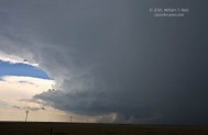
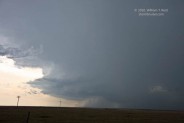
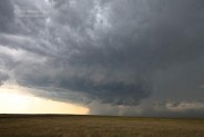
We were in some light anvil rain east of the HP-ish cell, so we repositioned to the south a few miles on an unpaved section road, probably County Rd 20. We stopped again at Rd 17 and Rd Q, southwest of the nicely sculpted updraft base. I kept expecting the storm to move east, at least a little, but it was drifting south at 5 mph!
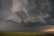
Images 2318 to 2326 above were taken from about 3:50 to 3:55 p.m. MDT. The supercell’s RFD continued to be quite wet, giving the updraft base an HP look from time to time. The storm seemed disinterested in tornado generation during this time frame. Lightning activity increased nearby and light rain became moderate in intensity, so again we were chased a little farther south. I figured that we may as well be south of the updraft base if the storm was moving to the south, so we went south a few miles to Rd M, and then west four miles to Rd 13. The last image above (2330) is looking north from M and 13 at 4:25 p.m. MDT. The RFD/wall cloud area was looking less wet, so we scooted north a couple of miles to get a closer look.
The images above were taken from about 4:40 to 4:55 p.m. MDT. We were less than a half mile south of a tight and strongly-rotating low-level circulation. This was a prominent and well-formed wall cloud and funnel cloud, pointed right at us! From our perspective it was not entirely obvious, however. We did realize, though, that the storm was very close to putting a tornado down quite close to us. Dallas was ecstatic and nervous as we peered up into the wild rotation. These images are true 16mm wide-angle shots, so the action area does not look as close as it really was! An occasional hail stone fell and would chase us south one or two hundred yards, and then west winds kicked up and we experienced the “atomized rain” which chasers have documented near tornadoes. We also heard a hail roar, and later the “whooshing/waterfall” sound sometimes heard near tornadoes! What a rush! The only thing missing was an actual circulation on the ground. It was perplexing (and a little frustrating) that the storm was unable to produce right then and there, a little north of M and 13 around 5 p.m. (Mike Umscheid’s posts for this event include some excellent shots of the storm and the funnel cloud at this time from the ESE. Note that Mike’s times are CDT, whereas I am using MDT. See pics 14 to 18 at the bottom of Mike’s page linked above.)
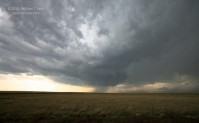
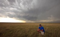
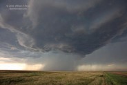
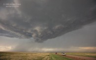
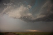
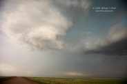
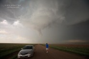
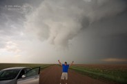
The lowering just to our north fizzled out. We found ourselves at the rear end of the updraft base, and it was now making a move to the east-southeast. After drifting to the south for about three hours, the storm was moving! Dallas and Kirstie and I went back south on Road 13, past Road M, and then east on Road J. After a few miles we stopped again. Along this stretch of usually empty Road J were numerous chasers, but there was plenty of room and traffic flowed relatively freely. The five images below were taken from 5:20 to 5:40 p.m. MDT along Road J, some 8 to 10 miles due west of Campo. The view is primarily to the northeast for the first three, and you can see Road J heading east in the final two. Rotation was occasionally very strong in the wall cloud which loomed nearby. Near 5:40 p.m. it appeared that the focused area of low-level rotation shifted southeastward quickly. The final image below shows a lowered area just slightly south of Road J. We needed to scoot east to Campo—fast! Most of the other chasers had the same idea, and a large caravan made its way to Campo. We motored beneath the updraft base and turned south on 287/385. The second quarter was over, intermission would last two seconds, and now it was showtime!






Leave a Reply
You must be logged in to post a comment.