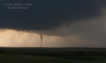
 A very rewarding chase was had in northeastern Colorado, courtesy of a magnificent supercell that tracked east-northeastward right over Last Chance and through Washington County.
We began in Kimball, NE, and waited a long time in Kimball and a little west of there as the cap held strongly into mid-afternoon. Upper-level winds over the region were excellent and from the southwest as a disturbance moved into the western U.S. A weak front had cleared Colorado during the morning, resulting in weak and moist upslope flow on the High Plains. This flow would strengthen and back to southeast by late in the afternoon as the disturbance aloft approached the Rocky Mountains. Around lunchtime I posted the following to CFDG:
Sitting in Kimball and looking at the latest RUC. Its forecast CAPE and forecast theta-e axis is telling me to head down south to near U.S. 36 (Last Chance) or I-70 (Palmer Divide/Limon). It breaks out precip but keeps it close to the foothills all day—-except for a Weld County-area storm around sunset. The NAM laughs at the cap and breaks out a bunch of precip over NE CO. So, I’m leaning towards dropping south to Brush for starters.
This day featured very warm air at 700 mb, so chasers were worried about the strong cap. Low-level moisture was excellent over northeast CO, with dews in the mid-60s at AKO midday. So, given the above, why were we still lingering near and west of Kimball along I-80 and the Cheyenne Ridge later into the afternoon? Well, I thought that the best chance of having any convection at all, given the strong cap, would be over the highest elevation areas. I was a little reluctant to drift very far from the somewhat elevated Cheyenne Ridge. If something went up down south towards U.S. 36 in CO, then it should be an easy intercept…but a 90-minute drive. In the meantime, we explored an old home near Bushnell.
A junky cell (or two) went up near Cheyenne and we watched it approach from Pine Bluffs, WY. Fortunately, these “storms” were so pathetic that they did not draw us farther west along I-80. Finally, some storms went up where I wanted them to — in northeast Colorado near Denver. This area had better air, CAPE was higher, and E-W U.S. 36 was along the axis of highest theta-e values. I had my eye on two cells near Denver, but another (much closer) cell blew up about 30 SW of Kimball. We headed east to Kimball on I-80 and dove south towards Brush on 71. We passed in front of the smallish Weld County cell that was approaching Kimball. It sported a nice wall cloud and appeared to be a tornado-producing candidate. I knew there was a chance that we could miss a nice tornado with this cell, but I continued south without stopping. I was intent on getting to the southern activity.
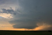
Fortunately (for us!), the Weld County cell sputtered. Two supercells were in progress to our southwest as we reached Brush. Most chasers were on the stronger northern cell, west of Hoyt (SSW of Fort Morgan). The southern cell would soon be raining on the northern cell, though, so we continued south to Last Chance. We placed ourselves a few miles west of Last Chance in front of the southern/tail-end cell. The cell’s nicely sculpted updraft was moving east to ENE from I-70 near Deer Trail. The time was 7 p.m. MDT.
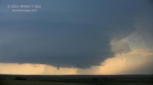
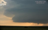
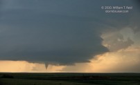
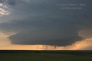
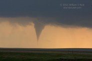
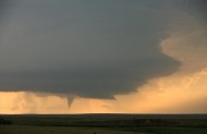
Not more than ten minutes after stopping, a tornado developed beneath the storm base —- what timing; what a gorgeous sight! The tornado formed at about 7:07 MDT, and was about 13 miles to our WSW, in Adams County. It hesitated for several minutes, hanging halfway from cloud base to empty Colorado landscape. By 7:11 MDT the funnel was in full contract with the ground, and a minute or two later it was gone.
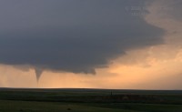
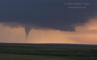
Despite the fabulous contrast and position with respect to the storm, I had the bright idea that we should reposition during the tornado interlude. I guess I was a little nervous about the hail threat, and I was thinking that it would be a little safer and advantageous to be along Hwy 71 in case the storm moved more to the east. Well, as we were piling our stuff and ourselves into the vans, a second tornado quickly developed from the same area as the first one. Forget the repositioning! The images below were taken from 7:18 p.m. to rope-out stage at 7:26 p.m. MDT.
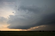
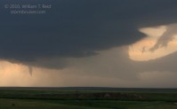
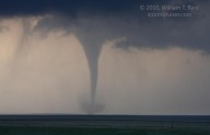
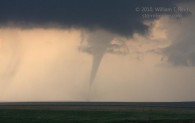
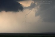
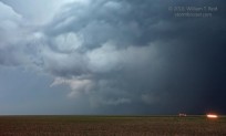
After rope-out, we motored east of Last Chance a mile or two to peek at the structure, and later stopped a little west of Lindon. The updraft passed overhead, the RFD hit us with strong westerly winds, and the “action area” associated with the strongest low-level circulation was not too far to the north.
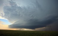
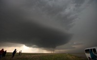
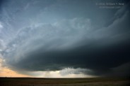
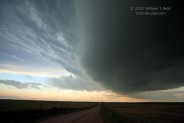


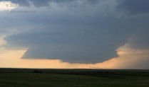
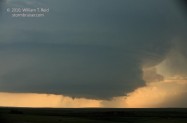
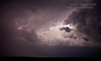
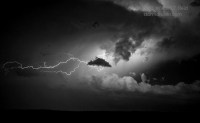
By dusk, the storm was several miles north of Anton, and it appeared to wrap up again and to produce another tornado around 8:33 p.m. MDT. By this time the updraft was a tremendous mothership/spaceship, but we were a bit too close to the updraft base to get decent structure images. We stayed with the cell towards Yuma County and enjoyed the lightning in the updraft. The cell weakened considerably as it continued east of 385, and we headed to the Imperial Inn for the night. Additional images of today’s Last Chance tornado (and other chases during Tours 6 and 7) are on Tempest guest Tom Trott’s web site.




Leave a Reply
You must be logged in to post a comment.