A nearly stationary supercell, replete with a handful of highly visible and fairly long-lived tornadoes, developed just a couple of counties away from our starting point of Imperial, NE, and an easy 90-minute drive from our lunch stop in Goodland! The beautiful, isolated tornadic storm was in Decatur County, KS, near Jennings (southeast of Oberlin), and there were practically no chasers on it! I had a hunch that a good storm might go up in northwest Kansas as I checked forecast maps and surface observations on this Friday morning. I just wish that I had had a hunch during lunch that my hunch was good.
We wound up chasing the Palmer Divide/Limon area of eastern Colorado. Storm development there was very likely, whereas the strong cap and somewhat weak forcing over northwest Kansas made storm development an unknown quantity—-favoring zero development. Tornado chances appeared to be decent in both areas (given a storm), so we, like nearly every other storm chaser in the region, opted for the near-certain play to the west. We intercepted a robust supercell west-southwest of Limon, and tracked it eastward along I-70 past Limon and Arriba. The supercell had cool outflow issues and trouble spinning up tornadoes. There apparently were one or two, but these were brief and/or rain-wrapped and I never saw one. Below is pasted my account penned shortly after the chase.
—————————
I was considering the NW KS play on Friday because
a—-we started the day in Imperial and had lunch in Goodland, so we were already there…
and
b—-this group needed to be back to OKC by about 2 or 3 p.m. on Saturday.
So, it was by fate to some degree that we wound up chasing the Limon supercell. If someone in our tour group had booked a flight out of OKC around 2 p.m. Saturday, then the Palmer Divide target would have been too far west to consider. As it was, the earliest flight out was at 4 p.m. Saturday, just enough time to play the Limon area and get 7 hours of sleep overnight.
We finished up lunch in GLD around 2 p.m. MDT. A flat cu field surrounded us, and I was hoping that a storm would develop in NW KS. This would make for an easier drive back to OKC. Storms were developing in the foothills west of DEN and COS, and it was fairly obvious that a good storm would be rolling east along the Palmer Divide in the vicinity of Limon by late afternoon. We did a pit stop in Stratton, and I looked back to the east for any hint of a storm tower—there was none. This tour was only a four-day tour, which makes it very difficult to target the high-risk/high reward target area. You gotta show the group a storm!
As we rolled into Limon a strong cell was to our WSW, near Peyton. We headed WSW on 24 and stopped just north of Ramah and watched the storm approach. It had a somewhat cold, green, HP/outflowish look, with a sizable wall cloud. An RFD cut in strongly and the north-side meso tightened up. There was some rotation in the wall cloud, but not a lot. The base was very low to the ground already, and there was a report of a tornado. The 26 eyes in our group did not see a tornado. The wind shifted to cold and westerly as the wall cloud area approached to within about two miles, and the forward-flank RFD surge was almost upon us. We headed back east towards Matheson to view the storm structure, knowing that this undercut cell had little or no tornado chance for the time being.
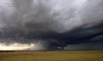
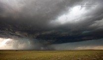
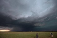
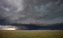
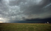
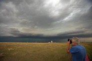
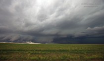
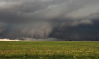
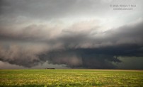
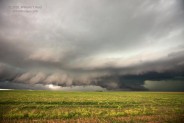
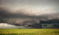
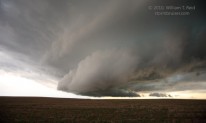
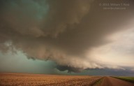
New storm towers blew up quickly in the Limon vicinity and were incorporated into the supercell. The thing went through some re-organization, it seemed, while we watched from Genoa. A very low storm base and action area loomed back to the west, near Limon, so we made use of a dirt road westward on the north side of I-70, stopping after about four miles. From here we had an amazing view of the notch area and the ground-hugging base, which stretched from our southwest to northwest. Numerous low-level whirls and “psuedo-tornadoes”, as Roger called them, danced above the prairie. Still, none of these evolved into violent surface-based rotation. (The images below are labeled “Arriba”, but we were actually closer to Genoa. In the first two, the Genoa grain elevator and Matt Crowther are visible to the northwest. The remainder were snapped a few miles WNW of Genoa.)
We moved east with the storm and soon the wrapping precip associated with a new hook-echo region developed around us. As we bailed out eastward, the action area became obscured, and we did not see the brief tornado that was reported near Arriba. By this time it was about sunset and we had to get to the motel in Wakeeney. To our east, 160 miles away, was the new updraft bomb in NW KS.
UGH.

Leave a Reply
You must be logged in to post a comment.