This was Day 2 of the short 4-day “mini-tour” out of OKC, and our group was in Lubbock. SPC showed a slight risk for severe over much of eastern NM and western TX as moist surface upslope flow was beneath marginal mid-level winds. The threat for severe weather would shift north of I-80 beginning tomorrow—and I would worry about tomorrow tomorrow. BIG mistake! I failed to adequately weigh the pros and cons between chasing locally or making the big drive north, and this cost us the fabulous tornadic supercell near Dupree, SD, on June 16.
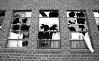
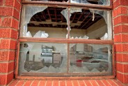
Of course, for a short tour such as the current one, it is difficult to “blow off” a nearby severe storm risk and to use that day (day 2) to position for the next day (day 3), knowing that the day after that (day 4) would likely be another non-chase day, used to make our way back to the base city. So, I targeted the TX/NM border to the west of Lubbock on June 15. We stopped at a place called “Bula” in southeastern Bailey County to poke around Bula School. The school closed for good in 1975, and later burned down!
Tornado chances were not especially good, and minimal “forcing” and “strong inhibition” caused SPC to drop the slight risk for the entire area at 20Z. Still, there were indications by mid-afternoon that a decent storm could take shape IF the strong cap could be breached. I posted the following to chase group CFDG:
Looks like a surface mesolow is taking shape around Andrews County, TX. A clump of cu and a radar echo is evident near Hobbs. Decent ESE flow with dews near 66F are feeding into this area. With SB CAPE near 4000 and effective bulk shear near 30-35 knots, it could be a good show. We are at Bronco and diving south.
The remainder of the day is a complete blur! Well, some of it, such as what happened between the time that we reached Hobbs and later when watching the LP storm near Tatum? Fortunately, Brian Morganti effectively covered this part of the chase in his brief account, written later on the same day! I’m sure Brian won’t mind if I paste that right here:
We hung out around the Hobbs, NM area for a good part of the afternoon watching towering Cu struggle against the warm temperatures aloft. About an hour and a half before sunset one tower to our west finally developed an anvil and looked good—but only for a few minutes before it split. The left split went north and quickly died. The right split remained nearly stationary for the next hour or so and briefly gave us some nice LP’ish looking storm structure near sunset. We played around under its small hail shaft before heading west towards a more potent cell that was moving north from the Carlsbad area. We weren’t really targeting that storm, but it gave us a nice light show on our way north to Portales for the night.
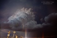
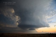
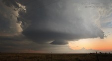
It is all starting to come back to me now! Here are some pics of the pretty, though smallish, low-precipitation “supercell” between Hobbs and Tatum—

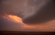
The little cell struggled and struggled, but persisted. Shortly after sunset, the updraft perked up quite a bit. We drove north beneath the front edge of the updraft base and emerged just to the northeast of the base, on U.S. 380 between Bronco and Tatum.
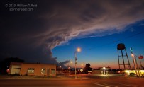
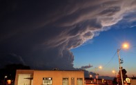
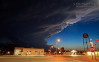
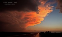
With light diminishing, no lightning to photograph (yet), the prospects of a long drive the next day, and with a hungry and weary crew, we abandoned the LP supercell and drove west into Tatum for some food. I setup my camera and tripod in the parking lot of the convenience store at Tatum’s main intersection. The “Carlsbad” storm was looking pretty to the west in the soft light of dusk. This was a “left-mover” that was heading north, with the updraft on the north side of the storm. The final shot of the four below is of our little LP cell, looking east. There were sporadic (very sporadic!), brilliant lightning bolts by this time from both cells, but I was not lucky enough to catch any with the camera. When the gang emerged from the store, we headed north to Portales for the night.


Leave a Reply
You must be logged in to post a comment.