This was not exactly your typical chase day.
There was no in-depth forecasting or chase strategy consternation. The “chase” began as soon as the noon tour orientation had concluded. We drove north from Denver towards the better risk region, and were watching a tornado a few hours later.
It did not involve an extended, exciting period of tornado chasing, though it did involve an exciting period of driving very quickly away from the storm and tornado!
It did not involve a chase into the evening hours watching a pretty storm and some lightning, as the window for strong storms had closed well before sunset.
And, it did not involve a bunch of fun phone calls to my friends and family to tell them that I had witnessed a splendid tornado —- but it did involve a bunch of calls to automotive glass replacement companies!
There was a moderate risk of severe weather today, extending from northeastern WY all of the way east into western IA. A ten percent tornado area was drawn for much of eastern NE. On the Plains of eastern WY was moist upslope flow beneath strong WSW flow aloft—a great setup for supercells and perhaps tornadoes. As we headed north on I-25 after the tour orientation, convection was occurring west of I-25 north of Cheyenne and moving east. There was adequate sunshine in the area from Cheyenne to Chugwater and vicinity, but near the Nebraska border, a cool and cloudy low-level airmass persisted. Would the stratus and fog burn off? Would storms have enough time to develop before moving over the cool air?
My drivers on this tour were Chad Cowan, Kinney Adams and Chris Gullikson; and Chuck Doswell was the guest “lecturer”. As we reached U.S. 85 just north of Cheyenne (about 2:45 p.m. MDT), we could see a healthy updraft with an over-shooting top to our north-northeast. We went northeast on 85 to try to intercept the storm near Torrington, but as we neared, it was apparent that the updraft would soon find itself above the fog and stratus. This would effectively minimize its tornado potential. And besides, who wants to chase beneath a stable low cloud deck?! The look of its base was unimpressive and strung out, so we blew it off. Fortunately (and we were very fortunate indeed!), a second strong storm had developed in the wake of, and perhaps on the boundary left behind by, the Torrington supercell. And, there was a very convenient road to the west, Route 313, at our disposal. The trailing storm was organizing quickly as we charged westward towards Chugwater. Plenty of sunshine and moist and mild air to its southeast helped to sustain it. The low-level shear was outstanding, and radar indicated strong rotation and a developing hook-echo. After about 20 miles on 313, and perhaps six miles short of Chugwater, some intervening low cloudiness cleared, the updraft and very low storm base was in view, and a tornado was developing! This was at about 3:56 p.m. MDT.
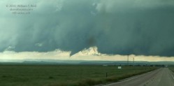
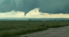
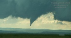
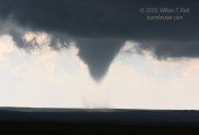
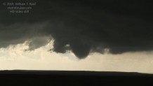
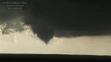
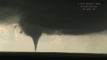
These images are video stills. The tornado apparently did make brief contact with the ground. By the time we stopped moments later, the funnel had dissipated for the most part, and I took this shot at 4 p.m. MDT.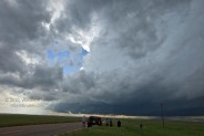
The storm updraft was to our west and west-southwest, and this initial tornado had occurred perhaps a mile or so south of 313. I elected to get closer to the updraft base, as I figured that it would be fun to be closer to the next tornado should one develop. We continued a few miles farther west and stopped a couple of miles southeast of Chugwater, right where Road 313 turns sharply to the north. This put us beneath the base, with the action area not too far at all to our southwest. There was obvious rotation in the low clouds in that direction, but some reluctance on the storm’s part to produce again. We seemed to be in a safe spot, as the wall cloud area with the rotation was not moving towards our east-west road. After several minutes, a muted “roar” was noted, and then some loud “clanks” were heard not too far to the north. BIG HAIL! We managed to get out of that spot quickly, but not before seeing a few golfball-sized stones strike the earth.
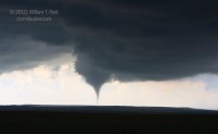
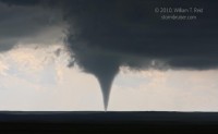
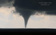
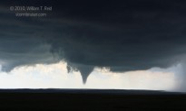
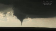
We fled back to the east several miles, passing Silver Lining Tours and Brian and Keith, who were leading a private tour for Tempest. Shortly after stopping again, perhaps five miles east of Chugwater, the storm dropped a second tornado! This happened at about 4:20 p.m. MDT, and the brief (30-second?) event did not give me enough time to photograph or video it. There was no tornado in progress when I tripodded my camcorder at 4:23 p.m., but one minute later the tornado had returned to its full glory to our southwest.
The images above were taken during a 2-minute period. At 4:25 p.m., giant hail was again falling nearby, and we had to move FAST! And this time, the stones were easily baseball to softball in size, and even larger. These were the largest hailstones that I had ever seen in my 20 years of chasing, and I was in no mood to stick around to watch. The tornado to our southwest was dissipating and beginning a rope-out stage, and we were again blasting east in a desperate attempt to minimize damage to the vehicles and to get to a safe area. The large van that Chad and I were in took several direct hits, by baseballs at least. I was holding a large gazateer up against the windshield—would that help any if a four-inch hailstone smacked it? Who knows?! Luckily, the windshield survived. Kinney and Chris were a little ahead of us as we blasted east on 313, and Kinney’s windshield was trashed. The windshield on Chris’ minivan was unscathed, but both vehicles took some big hits to the bodies. Brian and Keith were a little west of us, and they lingered at their viewing spot some sixty seconds or so longer, despite the large hail! They fared much worse, losing the windshield, a side window, and an outside mirror. The van’s body suffered greatly before they found a convenient garage to pull into. My group was able to continue east to U.S. 85 and then south a ways to a high point, in order to observe the supercell again, now to our west-northwest. We were ecstatic about the tornado, but also somewhat shell-shocked from the subsequent beating. Fortunately, except for a couple of minor cuts due to glass, everyone with us was uninjured.
At this point, near the Laramie/Goshen county line, we had a great view of the supercell structure. No additional tornadoes were noted, and the storm weakened as it approached the cooler low-level air near the WY/NE border. The day’s chase was over already, just a few hours after we had left the motel in Denver! I had to get on the phone to find rooms for the night and to set up an appointment in Cheyenne the next morning to replace one of our windshields. Roger Edwards stopped by and found me at work in Kinney’s unfortunate vehicle. I didn’t appear too happy about the course of events!
I was upset that our tour vehicles were damaged and that our guests had been very vulnerable to hail that was large enough to injure, and worse! But, we did react very quickly when the first big stone or two crashed nearby. We were lucky to get out of there without worse damage. Of course, I shouldn’t be too hard on myself, as hail is a part of chasing. I am typically very conservative while chasing when it comes to hail threat, and in this instance I just didn’t see it coming.
The road network on this chase offered zero decent alternatives to Route 313. The initial supercell moved generally east-northeast from near Chugwater to the Torrington area. As we approached the trailing supercell, the base was to our due west, and my thinking was that we were generally okay with regard to hail. I figured that any big hail would be primarily north of 313, and that our cell would roughly move along the same course as the previous storm. This was not what happened! Of course, when the first tornado occurred south of 313 and when we had our first taste of hail near Chugwater, that was a big clue that hail could soon be an issue along 313. After stopping a few minutes later and a few miles farther east, the next “main event” tornado immediately took place, and my concern with hail was put on the back burner. Two minutes later and we were under siege.
With the tornado to our southwest by a few miles, we were in the right spot for hail—no question about that! My thinking that the storm would move east-northeast and carry its hail threat north of 313 was wrong. The supercell made the customary “turn to the right” during its tornado phase, so it was heading to the east or perhaps even slightly south of due east. And, finally, I suspect that we just happened to be in the wrong place at the wrong time as the cell’s three-to-five inch stones descended around our location right then and there. I would not have been surprised by golfball-size or even tennis-ball size, but softball-size and greater?! That is just unreal and scary! It took our group nearly six or seven minutes of blasting east before we were clear of the big hail. The lesson of the day—-well, no lesson. Stuff happens.

Leave a Reply
You must be logged in to post a comment.