This chase day had the potential for some very significant severe weather, as strong instability and shear were in place over southern Minnesota. We managed to get on a tail-end supercell near Redwood Falls, and observed a rapidly rotating wall cloud just north of Sleepy Eye in western Brown County. The storm failed to produce a tornado at that point, and quickly turned HP and somewhat elongated. We dropped south of the ESE-moving cell, and were unable to see the heavily precip-wrapped tornadoes which occurred in the vicinity of New Ulm and Mankato. The radar display showed a very tight couplet suggesting a tornado, but it was too dangerous to dive into the storm to look for a tornado!
The long version is below:
Here is a brief forecast post that I made late morning…
—-
I suspect that the best chance for tornadoes should be where the strong SSWerly 850 flow is slamming into the weak east flow in the vicinity of Watertown, SD around 21Z. Current surface map shows the lowest pressure at Chamberlain, with a nice SE wind at Huron. The shear and instability and temp/dew point spreads all look very good for tornadic supercells today.
We are heading east on U.S. 12 from Selby, and I will feel comfortable once I reach Watertown in three or four hours.
—-
…and here is my chase summary written a couple of days after the chase:
Our group began this day in Mobridge, SD, with a target of east-central SD in mind. The best air appeared to be along an E-W axis which was situated between Watertown and Brookings, SD, and extended east into sw MN. CAPE values were very high and effective bulk shear was excellent, with about 50-kt flow from the west at 500 mb. Surface winds, though, were not backed very much in vicinity of the E-W theta-e axis that I was interested in.
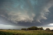
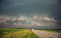
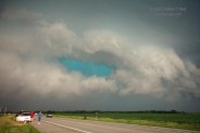
We arrived at Watertown near 2:30 p.m., and soon a beefy tower was going up to the east. It was moving ENE somewhat quickly and was not quite near the area that I wanted it to be near…but it was close. I elected to head south towards Brookings. If this new storm was going to be the main show, the only way we would ever catch it would be if it slowed considerably and it turned sharply southeastward. We exited I-29 at hwy 30 and moved east into MN towards Marshall. The original cell looked pretty good on radar and visually to our NE some 50-60 miles, but it continued eastward. Fortunately, new strong towers blew up just 20 miles or so to our east when we were near Marshall. We got into position south of a new supercell in eastern Redwood County, near Morgan. The storm base was very large. The base had a somewhat stable look to it early on, but now it was looking more ragged, and a clear slot and lowered area began to emerge. In the Morgan area, the cell looked to be very serious about going into tornado mode. The storm took a sharp turn towards the east-southeast and chased us to just north of the town of Sleepy Eye, in Brown County. A wall cloud rotated rapidly just to our NW, and then N, and then NE. We were expecting a significant funnel cloud or tornado to develop, but none did.
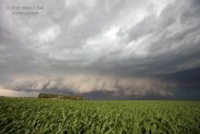
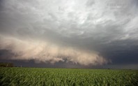
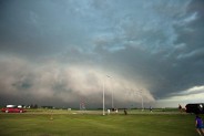
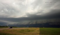
To stay close to the action area we headed S to Sleepy Eye and east to near Essig. Bands of heavy precip began to rotate around the “tornadic” circulation to our NE. We were hit by perhaps 40-50 mph winds from the NNW for a couple of miles before we could escape to the south. The storm was nearing New Ulm, and we stopped to watch from near Searles. Our view now was of a greenish, precip-filled HP beast. The action area looked quite wrapped up to our north, but anything inside was hidden by rain. That wound up being the last hurrah for easily visible tornado prospects. We continued to near Good Thunder and Amboy and stopped for some HP storm structure shots, and then bailed south and west along I-90.
We grabbed dinner at Jackson, and were treated to an eerie display of continuous in-cloud lightning and continuous thunder rumbling during moderate rain. On our way to the Sioux City motel, we crossed part of the damage path due to the Sibley, IA, tornado. Power lines were down and the road had a little vegetation debris on it.

Leave a Reply
You must be logged in to post a comment.