This was our third day in Saskatchewan, and our persistence in Canada’s best province paid off. Severe weather parameters were forecast to be fairly decent towards our west-southwest, in southwestern SK, later in the afternoon. Around noon-time not much of Western Civilization was privy to my innermost thoughts with regard to the chase forecast:
Happy Canada Day! There is no way in Moose Jaw that I’m going to be able to find 7 rooms for this group at sunset—10:30 p.m.! Yea!
We are starting out in Wolseley, which is on Hwy 1 east of Regina in SK. The Pac NW trough is finally edging eastward enough to give us a very good shot at a supercell intercept. We have been capped out for the most part on our first two days here in southern SK. The 12Z NAM/WRF and the 15Z RUC have their own un-matching ideas. I looked first at the NAM, and it showed a nice area of surface convergence beneath adequate 500 flow in western ND. The RUC downplays this area and suggests that we should head west back towards Swift Current. 850 flow is strong and backed nicely by 00Z in the Swift Current area, and the 500 flow is much faster compared to western ND. Central MT has a CAPE bomb and may light up big time, but the sw SK area has the better low-level shear with good CAPE and sunshine. The HRRR suggests a beefy supercell or two in the vicinity of Swift Current by 23Z.
We are heading west to Moose Jaw and Swift Current.
Our first stop on this chase day was, again, at the A & W fast food place by Moose Jaw. I was afraid to exit the main highway and to look for another place for lunch. I found that prices for burgers and fries and a root beer in Canada were nearly double that which I would have expected to pay in the USA. I really loved chasing in SK, but a few things, like the high prices for food, the lack of soda fountains in the convenience stores, and metric system signs, bugged me. But, back to the chase at hand. We stuck to our forecast and killed time in southwestern SK during the afternoon at a tiny town by the name of “Admiral”. This place is south of Swift Current and west of Cadillac. Our group enjoyed exploring the area, and though we were in Admiral for an hour or more, we saw no one else. This place is EMPTY. Supposedly, a couple of dozen folks call Admiral home. They must have all been in Swift Current for Canada Day.
From Admiral we drifted west and south to Shaunavon, another tiny farm town. It was close to 6 p.m. CST/MDT, and there was one lone gas station open to fill our tanks and to grab a few goodies. A nearby cumulus field was showing some promise—we would just need to be patient. Or, we could blast to a beast of a tornado-warned cell some 80 miles to our southwest, near Havre. I was tempted, but I stuck to my guns.
My chase summary post to CFDG does a good job describing the remainder of the chase:
We considered blasting towards that, but storm towers were finally building nearby, in our target area. We positioned ourselves just south of the largest storm base, north of Shaunavon. This was around 01Z. It took a little time, but the storm gradually attained supercell status and began to spin hard at mid-levels, according to the Glasgow radar. We watched a heavy precip core develop north of the base, which led to a large and low wall cloud. We got east of the WC west of Neville on route 4. Cloud motions were very nice, but there was no strong and persistent low-level rotation. Cool west winds hit us before I would have liked, too, so there may have been some outflow issues. We scooted east on 43 a few miles and looked back west and northwest again. A very impressive and large “barrel” was practically scraping the surface. It looked for all the world like a very large tornado, but there was only weak rotation with it. VERY WEIRD. We were chased eastward on 43 thru Pambrun, and the supercell became HP in character. New mesos on the leading edge teased us with ephemeral strong rotation and prominent bowl-shaped lowerings, but we never did witness a full-fledged tornado. Radar showed a strong velocity couplet and low-level structure was pretty with inflow bands and a laminar look, but mid-levels were largely obscured by a persistent strato-cu deck. We got ESE of the cell a little before sunset (03Z) south of Hodgeville. The storm seemed to try to wrap up one more time at low levels as it weakened. Light rain from new weak storms to our south was falling, and this led to further weakening. It had been a fun 2 or 3 hours, but the show was over. We found rooms in nearby Gravelbourg.
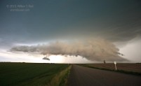
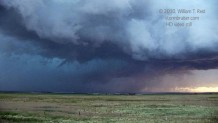
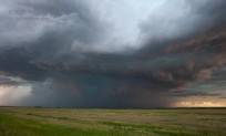
Now let’s look at some storm images from today. This first one below is the wall cloud and updraft base of the supercell. We were stopped on Hwy 4 at Hwy 43, south of Swift Current and west of Neville and looking west. I think that the base was slightly undercut by rain-cooled outflow at this point. The lowest levels were not exhibiting strong and organized rotation. It was also quite dark, even though there was another full hour or more remaining before sunset (around 0145Z/7:45 p.m. CST). My camera settings for this 16mm wide angle shot were ISO 640, f3.5 at 1/30 sec.
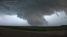
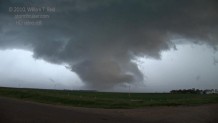
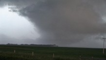
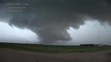
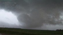
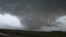
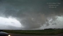
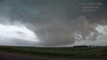
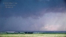
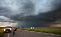
The cell was moving east at about 30 mph and it chased us down 43 past Neville to about Pambrun. The RFD developed strongly and was kicking up dust to our due west, and the action area tightened up and it looked for all the world like a large tornado was in progress to our WNW. The following HD video still images were during a 2-minute timeframe around 0155Z/7:55 p.m. CST.
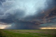
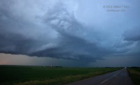
Though the feature looked much like a tornado, I did not observe strong rotation or any debris or dust beneath the “funnel cloud”. The supercell continued eastward, and Hwy 43 stayed with the storm nicely to its south. East of Pambrun, near Vanguard, an RFD/clear slot was evident and a bowl-shaped funnel cloud persisted. For a minute or two, some dust or debris was kicked up beneath a funnel cloud and there may have been a legitimate tornado (third image below). Light levels were low and contrast was so-so.
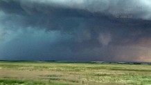
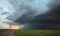
The cell turned HP and became less organized as it continued towards Hodgeville and Hwy 19. The final image above is looking north along 19, south of Hodgeville. Weaker, elevated convection was spreading northeastward to our south, and we rolled into Gravelbourg, where a couple of motels had rooms for us, thankfully.







Leave a Reply
You must be logged in to post a comment.