Raymore is a little town about 60 miles north of Regina, Saskatchewan. On July 2, 2010, a strong, long-track tornado (rated F3) did considerable damage just north of Raymore. The tornado continued to the east-northeast and was on the ground for about 30 miles! A google search of the “Raymore SK tornado” will yield quite a few hits, and a video clip of the twister is here. For our chase group, the day was somewhat disappointing, in that we were afforded only a fleeting glimpse of the tornado from a distance. What could have been an amazing chase day, with an incredible tornado intercept, wound up being a long and somewhat frustrating day, but one with plenty of memorable moments and great photo ops. So, despite the disappointment of what-could-have-been, my forecast was good and I saw my first Canada tornado. Here is how it happened.
The previous day had been a long one, and we ended the day in Gravelbourg. Heck, it doesn’t get dark up here in Saskatchewan until after 0330Z, or 10:30 p.m. MDT/11:30 p.m. CDT! (Saskatchewan observes CST during the summer, which is the same as MDT.) The chase day just keeps on going and going in early July. The good news for our group was that the target area was not very far away again. We were able to sleep in to about 9 a.m. CST, and had plenty of time to enjoy a nice brunch in town. I made a quick forecast post around noon:
I agree with Pat that the upper winds and dynamics appear to favor Canada over the U.S. today. We are in Gravelbourg, and currently there seems to be little reason to rush off to anywhere else. 15Z RUC doesn’t exactly have a “go here” arrow, but I think we might want to be near or a little north of Moose Jaw by 22Z. CAPE and shear look excellent for a supercell again today.
“Pat” is Patrick McCarthey, a severe weather meteorologist with Environment Canada. Pat thought that the best chase prospects were north of the international border in southern SK, with the best shear/CAPE combo near a surface trough from Saskatoon to Regina to Estevan. The best plan would be to be patient and to wait around Moose Jaw or Regina. I should have written my little forecast blurb on a piece of paper and taped it to the dashboard.
After brunch we drifted east from Gravelbourg to Mossbank. It was sunny and warm and humid, and we stopped in town. I was generally thinking about heading to Moose Jaw, but I didn’t have a really good reason to go anywhere. I don’t like to be driving somewhere without a good reason! While the guests were poking around a museum, I was in the van checking the data. A strong storm was already in progress, well to our west-southwest. It was coming out of extreme southeastern Alberta and moving towards — you guessed it — Gravelbourg! I was not particularly pleased with this, as convection this early in the day (it was barely past noon!) usually means a junky chase day. Should we head back west to intercept the cell? I had to. If it started to produce tornadoes while I was twiddling my thumbs in Moose Jaw or Mossbank, then I would be miffed. We began our way back west, and I posted the following to CFDG:
Strong convection has commenced along the cold front in sw SK and is moving ENE. A tail-end cell is approaching the area where we chased a supercell yesterday, near Cadillac. I see no reason NOT to blast towards this cell now. We left Gravelbourg earlier and went 20 miles east to Mossbank. Now we are going back west on 43 thru Gravelbourg to intercept the tail-end Charlie cell. Hopefully it won’t be undercut by the cold front—-I suspect that it will be.
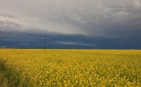
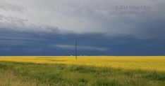
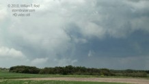
We stopped just short of Highway 19, next to a yellow canola field. The cell was already in view to the west! It was moving rapidly to the ENE — about 40 mph. This is not what I wanted.
There was some interesting mid-level banding, but the cell did not (yet) look like a well-organized supercell and a tornado-making candidate. It was heading more to the northeast, towards Hodgeville, so we went north on 19 to get a closer look.
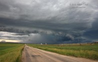
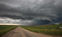
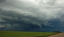
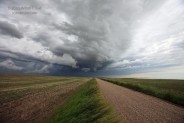
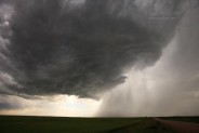
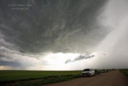
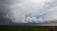
These images are looking west to WNW, across Hodgeville, on road 363 about a mile east of Hodgeville. The cell had decent organization at low levels and was definitely a supercell. It appeared to be a little on the HP side and might have been undercut a little by rain-cooled outflow. I posted the following at 2 p.m. CST:
The supercell se of Swift Current appears (visually) to be east of the cold front and is ingesting good surface-based air. We stopped for a few minutes near Hodgeville and viewed good structure — cell is HP and has a front-end meso and occasional beefy lowerings It is booking it to the ENE so we need to blast east.
We stayed with the storm for a little bit along 363, which jogs a little north, east of Hodgeville. These images were shot near Kelstern and Shamrock:
There is a bug splat on the windshield right where a tornado would be in that first image — DO NOT BE FOOLED! As the supercell marched northeastward at 40 mph or so, we continued east on 363 to Courval. I was thinking that it would be next to impossible to get back in position on the supercell again, given the e-w/n-s road network. New storm towers were going up in our vicinity, anyway. This was good! We could kiss off the long-track, undercut, fast-moving supercell, and attach ourselves to a new one which hopefully would be easier to chase. This developing storm was strengthening just southwest of Courval:
This new cell looked quite healthy for a little while. We continued on 363 into Moose Jaw, and were greeted by some thunder and rain. But, our little cell was no more — the updraft had dissipated and only an anvil remained! Unbelievable! We made our way through Moose Jaw and jumped onto Hwy 1 eastbound to Regina. The only game in town (or in province) now was the original big supercell, well to our north. Tornado watches and/or warnings were associated with the storm. We had to try to get back on the storm again. We had spent about 15 to 20 minutes stopped along 363, and that time lost would be crucial.
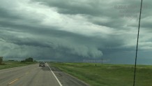
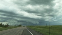
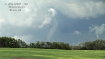
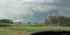
The supercell would soon be trekking over Last Mountain Lake, also known as “Long” Lake. It is a very long lake, with no east-west road crossings for about 60 miles! The only way we were going to get close to this big southern Saskatchewan supercell would be to blast east to Regina and then north on Hwy 6, east of the lake. This was a long way to go, but as we persevered, the supercell remained strong and the tornado warnings with it continued. There appeared to be a decent chance that we could get back on the storm. I think it had slowed down a little, so maybe it was rotating more strongly and maybe it was indeed in a better environment for producing tornadoes. It was, after all, now in my forecast target area! We made pretty good time, but had to go around the east side of Regina and then back west a little before jumping on Hwy 6 north. On our way north from Regina, the cell was to our north-northwest, and we could see the storm tower. I didn’t have a good radar image of the storm, though, and I was unable to get decent reports as to whether there was a tornado with the storm or not. As far as I knew, the storm was still HP with outflow issues and non-tornadic, as it had been three hours earlier near Hodgeville! We had to make a pit stop some 30 miles north of Regina, and spent close to ten minutes there. Unfortunately, I did not have the group in “urgent” mode, and we dilly-dallied a little. We got back on 6 and headed north. It looked like we would still be able to get close to the storm near Raymore. Near the small town of Serath, highway 6 jogs to the west a couple of miles before continuing north. (I wish it had jogged east!) Shortly after completing this jog, perhaps 8 miles or so south of Raymore, a tornado came into view to our north-northeast! I got some so-so zoomed-in video of it through the breaks in the trees —- what are trees doing way up north here on the plains of Saskatchewan, anyway?! Didn’t the glaciers scour away the soil and the trees and everything? Well, I had mixed emotions. It was great seeing a full-fledged tornado with the supercell that we had been on four hours ago, but I was kicking myself for the time we had lost in the interim. Still, it was quite an accomplishment to have even seen the tornado, given the parent storm’s fast motion, diagonal to the road network. The tornado seemed to disappear or dissipate in some precip, and the number of trees seemed to increase, making it difficult to observe the action area. We turned east on 15, just south of Raymore, and were unable to confirm whether the storm (to our northeast) still carried a tornado or not. Highway 15 did not cooperate, as it jogged decidedly to the ESE while the supercell continued to the NE or ENE. I wasn’t about to try out an unpaved road to catch an HP cell, so we had to go 30 miles ESE to Laross before another paved north option was available. By the time we were close to the cell again, near Bankend, the storm had weakened and was not tornadic. That was a LOT of hard driving (by Chad!) for just a lousy one-minute glimpse of a distant tornado. And, of course, if-only this and if-only that and on and on—-if we had only been at Raymore ten minutes prior. Here are some images from video of the Raymnore, SK, tornado as we are driving north:
The structure shots are looking due north down the road, so this is right about the time that the tornado was near Raymore. I think that this was just prior to the west “jog”. After the jog, we are headed north again, just a few minutes later. The skinny tornado is to our NNE, and appears to be in a dissipating stage.
We went north a bit more to Hwy 16 at Elfros. This is a major “Trans-Canada” Highway which connects Saskatoon and Yorkton. And, this was as far north as I had ever been in my life: the latitude of Elfros is 51 degrees 44.5 minutes N. (The previous record for me had been set on June 30, when I was in nearby Willowbrook, latitude 51 deg 13 minutes N.) It was a little surreal for me up in this area. The vegetation was strange and nothing was familiar. Several beefy towers were in the vicinity and were moving northeast. Naturally, the road we were on went east-southeast. There was still plenty of daylight remaining, but chasing a storm in this region today was essentially futile. Fortunately, additional storms were forming to our southwest and moving in our direction. We could stop, relax, set up the tripods and cameras and enjoy the surroundings!
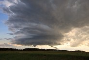
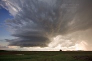
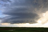
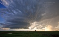
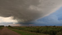
A goofy town by the name of Foam Lake came into view, and we drifted south several miles on 310. At last we had a chance to get out and walk around. And, we enjoyed nearly a full second of the great outdoors before we were enveloped by trillions of blood-sucking flying insects. Well, I suppose it wasn’t as bad as I make it sound, but the mosquitoes situation was horrid. A smallish but very pretty supercell approached from the southwest. There appeared to be no serious tornado threat, but there was a wall cloud and a prominent RFD cut. The storm structure was excellent, and I tried to take some images in between my frantic hand-waving to ward off the bugs. I had repellent on, a wind breaker and long pants. If the mosquitoes were going for my hemoglobin, they would have to get it off my face or through the clothes.
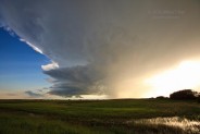
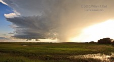
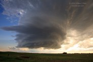
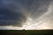
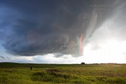
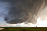
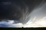
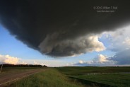
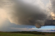
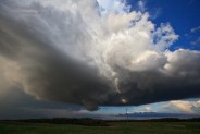
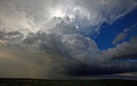
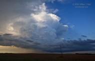
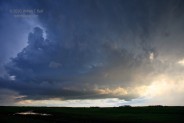
The bulk of the images above feature the nicely structured and small supercell south of Foam Lake. The base of the cell passed overhead (at 7:40 p.m. CST), as did the clear slot and a shallow lowering or wall cloud. Image 0850 is looking south as the base crossed the road, and the following five images are of the same cell on our east side. I don’t think that any hail fell where we were, but we could hear a “hail roar” just to our north as the cell passed. We went north a couple of miles and found some one-inch hailstones. A second cell followed on the heels of the lead cell, south of Foam Lake, but it was weaker and less organized (final two images above). It was close to 8:40 p.m. CST, and even more storms were going up to our south and southwest. Good—it was time to head south, terminate the chase and to find food and lodging.
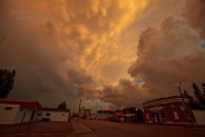
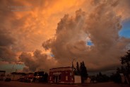
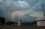
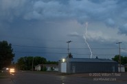
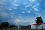
Prior to sunset, around 9:10 p.m. CST, we sat down for a meal in Ituna. I don’t think that tuna was on the menu, but I ordered something and went back outside to shoot the sky. The mammatus over the town at sunset was fabulous, and I caught a few CGs looking east-southeast which were not entirely uninteresting.
Our weary group checked into the hotel in Regina around 1 a.m.
In summary, this was quite the severe weather day for Saskatchewan. F3 tornadoes are definitely on the rare side here, and it is a shame that we were just a little late to get into position on the supercell near Raymore. This long-track storm lasted for at least six or seven hours and went nearly border-to-border across the province.



Leave a Reply
You must be logged in to post a comment.