 This appeared to be shaping up as a decent chase day after several down days on the Plains. We began in Cozad, NE (between North Platte and Kearney), and the chase target area was not clear cut. The 1630Z outlook by SPC outlined a large part of the central and northern Plains, and even the dry line down into KS and OK was open for consideration. The cap was strong along the dry line, however. Morning model runs appeared to be favoring the eastern one-third of NE for strong mid-late afternoon convection, and instability and shear looked very good there. But, again, the cap was quite formidable in that area. My late morning forecast thinking was as follows:
—-
I am not happy. We are in Cozad, NE, and easily able to reach just about any part of today’s risk area in NE and SD. The 13Z RUC and the latest HRRR are not showing storms in what would seem to be the obvious place —- northeast of the low from Cherry County and into the Badlands. Instead, these two models initiate big cells in eastern NE. The 12Z NAM does show convection in the Badlands sometime between 00Z and 06Z, and a big storm near GRI. So, three models have something big going up in E NE. CAPE and surface winds and 500 wind are not bad at all around GRI.
I dunno…I am hesitant now to head north to Valentine as I thought I would be doing. We will hang tight here in Cozad, I guess, and see how current conditions are shaping up around noon and then decide.
—-
So, despite my reservations, I put some trust in the models and drifted east from Cozad and towards the middle of eastern NE. I was afraid of the strong cap over NE, and kept my eye on the area near the surface low near Valentine and Winner. We had lunch at the McDonalds in Kearney, and then continued a little farther east and northeast to Central City. Here is my CFDG nowcast post made around 2:30 p.m.:
—-
Yep—the RUC and HRRR now suggest that the big storms will be up towards Yankton. I look at the current analysis and see a nice theta-e ridge to the west of there, from Grand Island to Ainsworth. I am having a difficult time grasping why the models have been initiating storms well to the east of the theta-e tongue.
Well, I looked again at the 18Z RUC and it does indeed show convection just north of Ainsworth by 21Z—-so that fits better with my normal thought processes! We just left Grand Island and will head north out of Central City. No way are we getting a sunburn today.
—-
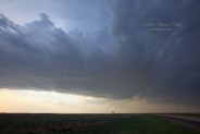
Models were starting to latch onto the magnitude of the strong cap over NE, and were shifting the late afternoon convection towards the NE/SD border. We headed north from Central City, NE, mid-afternoon when it appeared that the E NE play was too risky due to the strong cap. We headed NW from O’Niell and watched a cumulonimbus go up and croak to our south, then continued towards Winner. Some cells near Valentine were tempting but a lone storm north of Winner looked better, so we placed ourselves just south of the relatively high updraft base. This was just north of the White River, about 7 miles south of Presho and I-90. The base featured an RFD cut and mini wall cloud/lowering. While I was making room reservations inside the van, Roger Hill’s group observed a “skinny” tornado. One person in our group managed a shot of the funnel. It must have been quite brief!
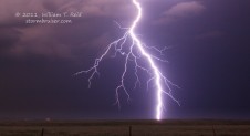
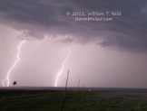
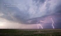
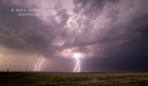
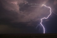
The supercell seemed to redevelop a little to the south, right on top of U.S. highway 183. A big RFD cut ensued and a persistent rotating wall cloud/cinnamon swirl look entertained us, and there was a brief funnel cloud which came down 1/10 of the way to the ground. So, no tornado with that attempt, but there was a nasty/amazing CG barrage right out of the updraft base. We scooted south of the White River a little in order to get safe and to allow us to get out and shoot the lightning.
The precipitation predictions by the models today were of absolutely no help. The HRRR failed miserably, and the RUC and NAM were almost as bad. I decided that our best chance at seeing something would be on the theta-e/CAPE/moisture axis towards the SD/NE border where 700 mb temps were a little cooler (a little less than 10C). This area had weakish mid and upper flow, but that’s how it goes. It was a relief to get on a very nice supercell on this chase day. There were zero reports of severe weather in NE and KS, while someone reported a 1.75″ hailstone eight miles south of Presho. Our home for the night was Murdo.









Leave a Reply
You must be logged in to post a comment.