Two great chase days Sunday and Monday, May 8 and 9! On Sunday, we wound up on a splendid supercell just south of Presho, SD (north of Winner). Here is the chase summary I wrote afterward:
—–
Fun stationary supercell south of Presho, SD, this Mother’s Day.
We headed north from Central City, NE, mid-afternoon when it appeared that the E NE play was too risky due to the strong cap. We headed NW from O’Niell and watched a cumulonimbus go up and croak to our south, then continued towards Winner. Some cells near Valentine were tempting but a lone storm north of Winner looked better, so we placed ourselves just south of the relatively high updraft base. The base featured an RFD cut and mini wall cloud/lowering. While I was making room reservations inside the van, Roger Hill’s group observed the “skinny” tornado. One person in our group managed a shot of the funnel. It must have been quite brief!
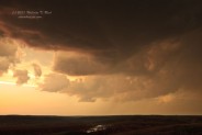
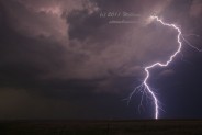
The supercell seemed to redevelop a little to the south, right on top of the N-S road. A big RFD cut ensued and a persistent rotating wall cloud/cinnamon swirl look entertained us, and there was a brief funnel cloud which came down 1/10 of the way to the ground. So, no tornado with that attempt, but there was a nasty/amazing CG barrage right out of the updraft base.
We scooted south to get safe and to allow us to get out and shoot the lightning.
The precipitation predictions by the models today were of absolutely no help. The HRRR failed miserably, and the RUC and NAM were almost as bad. I decided that our best chance at seeing something would be on the theta-e/CAPE/moisture axis towards the SD/NE border where 700 mb temps were a littel cooler (a little less than 10C). This area had weakish mid and upper flow, but that’s how it goes.
—-
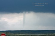
And, today, I had to decide between chasing the extreme northwest Nebraska Panhandle area versus the I-90 corridor between about Rapid City and Murdo. We started the day in Murdo and drifted west to Wall, had lunch and then briefly checked out the Badlands. At about 3:30 p.m. I commited to the northern NE PH option, and we met up with a strong cell with a spectacularly impressive updraft southwest of Harrison, NE. Unfortunately, intervening low clouds frequently blocked the view of the updraft tower, which was to our south. The cell moved to the northeast, and as it approached U.S. 20 a few miles east of Harrison, a huge RFD cut was apparent, and a slender tornado touched down to our south. It persisted for 2 or 3 minutes and dissipated. We were chased east on 20 by the precip core. The cell looked ready to produce again, with a nice pregnant base and wrap-around precip curtains just to our southwest. We were able to watch this get close, but then were chased again east through the hilly/canyon/bluffy area between Harrison and Fort Robinson. During these few minutes “the public” reported another tornado to the NWS, ten miles east of Harrison. We did not observe this event, which was behind us and behind the higher terrain (assuming it is a legitimate report). The storm continued in primarily HP mode towards Crawford and north of Chadron, and we let it go. On our way to Alliance, we waited for another strong supercell to clear the highway, and found tennis ball and baseball-sized hailstones in the grass about 15 miles south of Chadron. I reported both the Harrison tornado and hail observations to the NWS in Cheyenne.
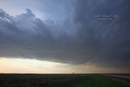
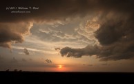
Some pics from Sunday and Monday below—the supercell base south of Presho, looking north (about the time of the tornado report with the cell), mammatus in the back-sheared anvil of the Presho cell, looking through the RFD cut, a rotating wall cloud with the Presho cell, nice CG bolt with the Presho cell, and two images of the Harrison tornado from Monday:


Leave a Reply
You must be logged in to post a comment.