 It had been ten days since a decent, long-lived supercell had been observed. Chase prospects finally appeared good on this day, somewhere in and around the middle of Kansas. I was leading the Tour 3 folks with Chris G. and Chad C., and this chase began in Pratt. Healthy CBs were already going up around Pratt around lunch time, and I was concerned that the early convection would once again lead to a junky chase day due to too many storms. My forecast thinking around noon:
—-
We will play the warm front just northeast of the triple point surface low. The Pawnee County area just west of Great Bend might be a good place to hang out (we are near Pratt currently). There does appear to be a fairly wide-ranging area today to choose from and, at the moment, I can’t find an arrow that says “go here”. So, we’ll stick to Storm Chasing 101 basics and find some sunshine on the backed winds near the surface low. The models appear to break out storms rather early, which I dread.
—-
About an hour later, I wrote a NOW-post regarding the convection around Pratt:
—-
We are just east of Pratt. Some strong towers to our SE and E are anviling out some, but then are getting shredded apart by the shear. We will sit tight —- hoping for something to approach from the SW and latching onto the nearby warm front.
—-
It seemed like we went back and forth through Pratt a dozen times as I contemplated the healthy updrafts along U.S. 54 and eastward towards Wichita. Fortunately, I blew these off and stuck to my guns, which were pointed more towards the area a little west and north of Pratt. Surface ob trends and the warm front pulled us north from Pratt towards Great Bend…and this looks like a good place to paste my original write-up for the day…
—-
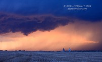
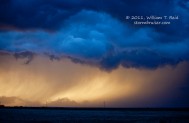
The chase went pretty much according to plan today, for once. We (Chris Gullikson, Chad Cowan and I) began in Pratt and targeted the area just northeast of the triple point/dry line bulge which was west of Pratt midday. There was plenty of sunshine and it looked like the atmosphere was going to go into storm-making mode by noon, but it held off, fortunately. One concern today was that a storm would form in the good air along the NW-SE oriented CAPE axis and then quickly move NE into the cool murk north of warm front. At 2 p.m. the wind at DDC shifted to SW. Wind at Great Bend was SE and moist, so that was the impetus to get us moving north from Pratt. We continued just past Great Bend, and a healthy CB developed right in front of us. We stayed with it towards Russell and it matured into a supercell, though somewhat of a messy HP supercell. We were behind it a little on its west side as we reached Russell, and then jumped on I-70 eastbound. After a couple of brief stops to allow a hail core to pass, we made it through to the north and then the northeast side of an elongated updraft base with a couple of action areas. Near Dorrance, an area tightened up some and we saw dust get kicked up beneath it. It was dark and nasty looking and the base was quite low to our west —- we were a little north of the warm front, and east winds were strong. Someone reported a tornado with the storm a little north of I-70 —- our group did not see one for certain (though Chris’ video shows a power flash). The cell seemed to move more to the NE and more slowly now, and we managed to get in front of it at Sylvan Grove. Inflow winds from the NE gusted to near 50 mph, and rain curtains swirled around beneath the large base to our SW. It chased us a little east of Sylvan Grove as the sirens wailed, and we stopped after going about a mile east on 18. Here, the winds were dead calm, and an area of strong low level rotation was developing just south of the road. I thought we were going to get a tornado at close range at this point, but it couldn’t pull it off (though, again, a tornado was reported with the storm by a spotter).
We went north of Lincoln a little for one last look. The cell seemed messier and less organized, and the air was murkier, and it seemed that tornado prospects were slim. So, we blew it off in order to get south to a tail-end cell near Great Bend, but this cell weakened. A couple of cells went up on the retreating dry line near Dodge City, so we went SW and stopped at Rozel for a very pretty sculpted (though elongated) storm at sunset. As the light faded it looked like the storm base was issuing some funnels to our N, and then a tornado warning was issued. We blasted north on 183 to get a closer look, but the cell quickly disorganized.
This was a fairly satisfying chase as the forecast worked out and we managed to stay with a fast-moving supercell from formation to maturity.
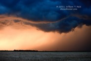
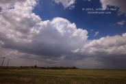
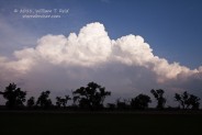
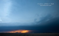
Here is a look to the north of the developing CB with pileous cap, between Great Bend and Russell. Below is a view of the low supercell base to the west, from Dorrance, and then towards the southwest, from Sylvan Grove.
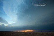
Later, we were WSW of Great Bend, near Rozel, east of a dry line supercell.






Leave a Reply
You must be logged in to post a comment.